Area Overview for PE9 2TF
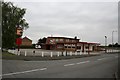
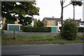
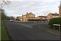
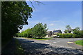
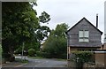
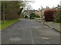
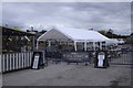
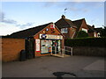
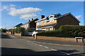
Photos of PE9 2TF

Area Information
Living in PE9 2TF offers a settled residential experience within a compact 1.5 hectare cluster. This postcode covers a small area where 1,357 residents call home, creating a distinct neighbourhood feel. You will find a population density of 89,496 people per square kilometre here, which indicates a concentrated community layout rather than sprawling development. The location sits comfortably in England, providing a stable environment for those seeking a specific postcode area covering a small residential cluster. Daily life revolves around a close-knit setting where neighbours are likely to know each other well due to the focused nature of the land use. Residents enjoy a quiet existence away from high-density urban pressures, benefiting from a defined boundary that separates this zone from wider traffic flows. The geography supports a calm routine, making it an ideal choice for individuals who prioritise proximity and community cohesion over expansive green spaces. Being part of this specific cluster means you have direct access to local services while maintaining a sense of seclusion that larger towns cannot replicate.
- Area Type
- Postcode
- Area Size
- 1.5 hectares
- Population
- 1357
- Population Density
- 4199 people/km²
The property market in PE9 2TF is overwhelmingly defined by ownership rather than renting. Data shows that 84% of homes here are owner-occupied, creating a stable environment for buyers who view the area as a permanent home. Nearly all available accommodation falls into the category of Houses, meaning you will find distinct structures rather than flats or high-density living arrangements. This scarcity of rental stock indicates that the local market is driven by purchasers who value stability and equity building over short-term leasing. When you look for homes in PE9 2TF, you are entering a market where price reflects long-term tenure and asset value. The narrow focus on Houses limits options for those specifically seeking flats or other dwelling types, reinforcing the traditional suburban character of the postcode area covering a small residential cluster. Buyers here typically seek security and a place to put down roots, rather than the flexibility found in faster-moving rental sectors of larger cities.
House Prices in PE9 2TF
Showing 49 properties
| Address | Type | Beds | Baths | Last Sale Price | Last Sale Date | |
|---|---|---|---|---|---|---|
| 49 Caithness Road, Stamford, PE9 2TF | Detached | 3 | 1 | £425,000 | Aug 2024 | |
| 46 Caithness Road, Stamford, PE9 2TF | Semi-detached | 3 | 1 | £317,500 | May 2024 | |
| 50 Caithness Road, Stamford, PE9 2TF | Semi-detached | 2 | 1 | £235,000 | Nov 2023 | |
| 32 Caithness Road, Stamford, PE9 2TF | Semi-detached | 3 | 1 | £257,500 | Oct 2023 | |
| 33 Caithness Road, Stamford, PE9 2TF | house | - | - | £305,000 | Apr 2023 | |
| 69 Caithness Road, Stamford, PE9 2TF | house | 3 | - | £280,000 | Sep 2021 | |
| 67 Caithness Road, Stamford, PE9 2TF | Semi-detached | 3 | 1 | £262,000 | May 2020 | |
| 63 Caithness Road, Stamford, PE9 2TF | Semi-detached | 3 | 1 | £255,000 | Feb 2020 | |
| 31 Caithness Road, Stamford, PE9 2TF | house | - | - | £265,000 | Jan 2020 | |
| 52 Caithness Road, Stamford, PE9 2TF | Semi-detached | 2 | 1 | £202,000 | Jul 2019 |
Energy Efficiency in PE9 2TF
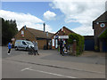
Residents of PE9 2TF enjoy convenient access to major retail and transport hubs without needing to travel far. Within practical reach, you will find Waitrose Stamford, Tesco Stamford, and M&S Stamford SF, providing ample choice for groceries and daily shopping. Luton station and other major rail links are not listed, but Stamford Railway Station is a key rail amenity nearby, offering direct connections. For drivers, the area provides easy access to Stamford SF, ensuring flexibility for those who prefer personal vehicles. Transport options include a dedicated Bus Interchange and RAF Wittering, highlighting the strategic position of this residential zone. These amenities mean you can handle your weekly shop or catch a train with minimal effort. The presence of five notable retail venues and specific transport points creates a functional lifestyle where essential services are always at hand.
Amenities
Schools
Families considering schools near PE9 2TF have access to specific local options. The Malcolm Sargent Primary School is a prominent institution in the neighbourhood, rated as Good by Ofsted. This rating reflects steady educational performance and reliable oversight. You will also find the Malcolm Sargent Primary School listed as a primary institution within the vicinity. Having two entries for this school in the local register suggests it is a central fixture for the community's educational needs. As a primary school, it caters to children from the earliest years of their formal education up to the age of eleven. The presence of a Good-rated institution on the doorstep provides reassurance for parents moving into PE9 2TF. While secondary schools are not listed in the immediate data, the local primary sector offers a solid foundation for younger children.
| Rank | School | Type | Entry gender | Ages |
|---|
Explore more schools in this area
Go to Schools tabDemographics
The community in PE9 2TF skews towards established adulthood, with a median age of 47 years. You will find that Adults aged between 30 and 64 years represent the most common age range, suggesting a neighbourhood populated by those in their prime working or semi-retirement years. This pattern often correlates with stable households looking for long-term settlements rather than temporary rentals. Homeownership stands at an impressive 84%, indicating that the majority of residents have purchased their properties and intend to stay. The accommodation type is predominantly Houses, which aligns with the older demographic and high ownership rate. The predominant ethnic group recorded for the area is White, reflecting the historical settlement patterns typical of this region. Together, these figures create a picture of a mature, owner-occupied community where residents have likely invested deeply in their local surroundings. The low rental prevalence suggests that buying in PE9 2TF means joining a cohort with significant financial stake in the locality.
Household Size
Accommodation Type
Tenure
Ethnic Group
Religion
Household Composition
Age
Household Deprivation
NS-SEC
Explore more demographic insights in this area
Go to Demographics tabPlanning
Planning Constraints
- Flood RiskPremium
- Ramsar Wetland SitesPremium
- Area of Outstanding Natural BeautyPremium
- Protected Nature ReservePremium
- Protected WoodlandPremium