Area Overview for PE9 2SP
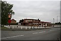
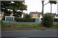
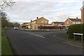
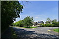
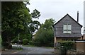
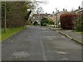
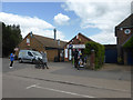
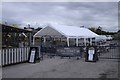
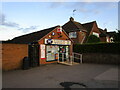
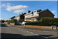
Photos of PE9 2SP

Area Information
PE9 2SP is a compact residential postcode located in England, housing a population of 1,342 people across an area measuring 9,120 square metres. This small community forms a tight-knight residential cluster typical of the Stamford corridor, offering residents a settled lifestyle within a defined boundary. The density here is remarkably high, standing at 147,145 people per square kilometre, which reflects the concentrated nature of this specific rural settlement rather than extended tract housing. Living in PE9 2SP means you reside in space that balances accessibility with the quietude of a countryside postcode. The area represents a specific slice of Stamford's wider hinterland, designed primarily for permanent residence rather than transient living. Its small footprint ensures that distance from local services is minimal, making daily trips to Stamford town centre a straightforward part of routine life. The community functions as a unified neighbourhood where local knowledge travels quickly and property interactions are frequent. You are purchasing a home in an established pocket where the character of the place is defined by its exclusivity and small scale. This distinctiveness appeals to those seeking a premium feel without the massive infrastructure of a larger urban district. The demographic profile reinforces the idea of a stable, established community. With a median age of 47 years, many residents have put down roots and are looking for long-term security. This stability often translates into well-maintained properties and a predictable community atmosphere. Buying a home here offers a direct line to the wider amenities of Stamford while maintaining a self-contained local identity. The area showcases a specific type of English rural living where proximity to town is maximised without sacrificing the residential tranquillity found at that latitude.
- Area Type
- Postcode
- Area Size
- 9120 m²
- Population
- 1342
- Population Density
- 5068 people/km²
Living in PE9 2SP largely means purchasing into a property market dominated by owner-occupiers. With home ownership standing at 74 per cent, the area is financially stable and primarily suited for buyers rather than tenants. This high participation rate indicates a robust local market where individuals invest directly in their property portfolio rather than relying on landlord management. The overwhelming presence of houses in the accommodation type data confirms that this postcode is built exclusively for houses, not flats or apartments. Consequently, your options for purchasing in PE9 2SP will be strictly limited to houses. Prospective buyers cannot expect to find rental stock or purpose-built multi-unit developments within this small 9,120 square metre boundary. The market here serves those seeking a standalone home, potentially detached or semi-detached, which aligns with the 147,145 people per square kilometre density figure. This density, while seemingly high, effectively creates a cluster of individual homes close to one another without forming a dense urban block. The lack of rental data implies that investing in this area targets long-term ownership. You are buying land and structure alike, ensuring your investment is tied to a specific piece of real estate rather than a leasehold agreement. The high home ownership percentage suggests that property values are driven by owner-demand rather than speculative rental yields. When you look at homes in PE9 2SP, you are engaging with a market that values permanence. This environment suits buyers who intend to stay for decades and who prefer the full legal and financial control that freehold ownership provides.
House Prices in PE9 2SP
Showing 27 properties
| Address | Type | Beds | Baths | Last Sale Price | Last Sale Date | |
|---|---|---|---|---|---|---|
| 249 Empingham Road, Stamford, PE9 2SP | Retail | 4 | 1 | £242,050 | Apr 2022 | |
| 251 Empingham Road, Stamford, PE9 2SP | Flat | - | - | £117,000 | Feb 2019 | |
| 247 Empingham Road, Stamford, PE9 2SP | Semi-detached | 4 | 1 | £200,000 | Oct 2016 | |
| 241 Empingham Road, Stamford, PE9 2SP | Flat | - | - | £70,000 | Nov 2014 | |
| 217 Empingham Road, Stamford, PE9 2SP | Flat | - | - | £95,000 | Jan 2011 | |
| 213 Empingham Road, Stamford, PE9 2SP | Flat | 2 | 1 | £97,500 | Jul 2009 | |
| 245 Empingham Road, Stamford, PE9 2SP | Semi-detached | - | - | £155,000 | Feb 2008 | |
| 239 Empingham Road, Stamford, PE9 2SP | Flat | - | - | £105,000 | May 2007 | |
| 259 Empingham Road, Stamford, PE9 2SP | Flat | 2 | 1 | £79,995 | Jan 2004 | |
| Flat 1, 261 Empingham Road, Stamford, PE9 2SP | Flat | - | - | - | - |
Energy Efficiency in PE9 2SP
Living in PE9 2SP offers immediate access to a range of high-quality amenities in Stamford that form the backbone of local commerce. You can find five key retail outlets, including Waitrose Stamford, Tesco Stamford, and M&S Stamford SF, all within easy reach. These venues provide everything from gourmet groceries to fashion essentials, eliminating the need for long shopping trips to distant cities. The availability of these specific brands confirms that the local economy supports a high standard of daily convenience. Transport options are equally well curated for the area's residents. Stamford Railway Station serves as your primary rail link, while the Bus Interchange offers frequent bus services to connect you with neighbouring towns. For aviation needs, RAF Wittering operates within practical reach, supporting both commercial and private flight requirements. This diversity in transport choices ensures that you can travel flexibly by train, road, or air depending on your destination. Your daily life includes walking or driving to Stamford to access broader cultural and recreational offerings. The presence of major supermarkets and department stores indicates a town centre that meets all household necessities. Shopping trips involve visiting familiar locations like Waitrose or Tesco rather than venturing into unfamiliar chains. The combination of these retail staples with reliable rail and bus services creates a lifestyle where you attend to business without compromising your quality of life. This balance of rural living and town access defines the appeal of PE9 2SP.
Amenities
Schools
| Rank | School | Type | Entry gender | Ages |
|---|
Explore more schools in this area
Go to Schools tabDemographics
The people living in PE9 2SP demonstrate a mature community profile with a median age of 47 years. The most common age range falls within adults aged 30 to 64 years, indicating a population established in their working or pre-retirement years. This age distribution suggests a neighbourhood where residents have likely long-term plans for the area, contributing to social stability. High levels of home ownership further underscore this settled character, with 74 per cent of housing stock held by its occupants. This high ownership rate creates an environment where residents are emotionally invested in their surroundings. You will find that decisions regarding community changes or development often involve long-term residents who understand the value of preserving the area's character. The predominant ethnic group in PE9 2SP is White, reflecting the broader patterns of settlement in this part of Lincolnshire. There are no significant transitory populations, leading to a consistent social fabric where neighbours often know each other well. The accommodation type is almost exclusively houses, with no data suggesting significant apartment or flat development within this postcode. This confirms the area's alignment with traditional rural living standards. The housing stock caters to families and individuals seeking standalone property rather than shared residential complexes. Such a composition supports a lifestyle centred on private gardens and detached or semi-detached units. The demographic data paints a picture of a demographic whereby the majority of adults are financially stable enough to buy rather than rent, significantly influencing the local market dynamics.
Household Size
Accommodation Type
Tenure
Ethnic Group
Religion
Household Composition
Age
Household Deprivation
NS-SEC
Explore more demographic insights in this area
Go to Demographics tabPlanning
Planning Constraints
- Flood RiskPremium
- Ramsar Wetland SitesPremium
- Area of Outstanding Natural BeautyPremium
- Protected Nature ReservePremium
- Protected WoodlandPremium