Area Overview for PE6 9PE
Photos of PE6 9PE
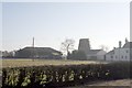
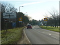
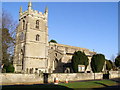
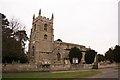

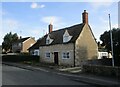
47 photos from this area
Area Information
Key information about the PE6 9PE including its size, population, and administrative classification.
- Area Type
- Postcode
- Area Size
- 2.1 hectares
- Population
- 1865
- Population Density
- 130 people/km²
House Prices in PE6 9PE
16
Properties
£336,762
Average Sold Price
£90,000
Lowest Price
£505,000
Highest Price
Showing 16 properties
| Address | Type | Beds | Baths | Last Sale Price | Last Sale Date | |
|---|---|---|---|---|---|---|
| 22 Church Street, Baston, PE6 9PE | Cottage | 3 | 1 | £455,000 | Aug 2024 | |
| 26 Church Street, Baston, PE6 9PE | house | - | - | £485,000 | Nov 2022 | |
| 5 Church Street, Baston, PE6 9PE | Detached | 4 | 3 | £505,000 | Oct 2019 | |
| 24 Church Street, Baston, PE6 9PE | Terraced | - | - | £380,000 | May 2019 | |
| 2B Church Street, Baston, PE6 9PE | Bungalow | 2 | 2 | £245,000 | Nov 2018 | |
| 7 Church Street, Baston, PE6 9PE | Cottage | 4 | 1 | £315,000 | Sep 2017 | |
| 2 Church Street, Baston, PE6 9PE | house | - | - | £350,000 | Apr 2017 | |
| 2A Church Street, Baston, PE6 9PE | Bungalow | 4 | - | £349,140 | Feb 2017 | |
| The Mayfields, 30 Church Street, Baston, PE6 9PE | Detached | 5 | 4 | £365,000 | Mar 2008 | |
| 1 Church Street, Baston, PE6 9PE | Detached | - | - | £277,000 | Sep 2007 |
Page 1 of 2
Energy Efficiency in PE6 9PE
Amenities
Schools
| Rank | School | Type | Entry gender | Ages |
|---|
Explore more schools in this area
Go to Schools tabDemographics
Household Size
Two person
most common
Accommodation Type
Houses
most common
Tenure
85
majority
Ethnic Group
White
most common
Religion
N/A
most common
Household Composition
N/A
most common
Age
47
median
Adults (30-64 years)
most common
Household Deprivation
N/A
with no deprivation
NS-SEC
43
in Lower managerial occupations
Explore more demographic insights in this area
Go to Demographics tabPlanning
Planning Constraints
- Flood RiskPremium
- Ramsar Wetland SitesPremium
- Area of Outstanding Natural BeautyPremium
- Protected Nature ReservePremium
- Protected WoodlandPremium