Area Overview for PE6 9ND
Photos of PE6 9ND
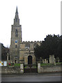

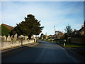
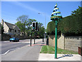

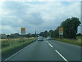
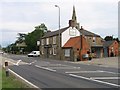
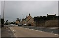
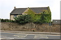
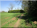

57 photos from this area
Area Information
Key information about the PE6 9ND including its size, population, and administrative classification.
- Area Type
- Postcode
- Area Size
- 1.3 hectares
- Population
- 1721
- Population Density
- 154 people/km²
House Prices in PE6 9ND
28
Properties
£149,855
Average Sold Price
£38,000
Lowest Price
£365,000
Highest Price
Showing 28 properties
| Address | Type | Beds | Baths | Last Sale Price | Last Sale Date | |
|---|---|---|---|---|---|---|
| 24 Manor Way, Langtoft, PE6 9ND | Detached | 3 | 1 | £260,000 | Feb 2025 | |
| 11 Manor Way, Langtoft, PE6 9ND | Semi-detached | 2 | - | £193,000 | Jul 2023 | |
| 16 Manor Way, Langtoft, PE6 9ND | Semi-detached | - | - | £125,000 | Feb 2022 | |
| 7 Manor Way, Langtoft, PE6 9ND | Bungalow | - | - | £190,000 | Jul 2021 | |
| 4 Manor Way, Langtoft, PE6 9ND | Bungalow | 3 | 1 | £195,000 | Oct 2020 | |
| Taku, 1 Manor Way, Langtoft, PE6 9ND | Bungalow | - | - | £365,000 | Sep 2020 | |
| 13 Manor Way, Langtoft, PE6 9ND | Semi-detached | 2 | 2 | £197,500 | Jan 2020 | |
| 22 Manor Way, Langtoft, PE6 9ND | Semi-detached | 2 | 1 | £158,000 | Jun 2015 | |
| 6 Manor Way, Langtoft, PE6 9ND | Bungalow | 3 | 2 | £250,000 | May 2015 | |
| Manor Barn, Manor Way, Langtoft, PE6 9ND | house | - | - | £169,995 | May 2011 |
Page 1 of 3
Energy Efficiency in PE6 9ND
Amenities
Schools
| Rank | School | Type | Entry gender | Ages |
|---|
Explore more schools in this area
Go to Schools tabDemographics
Household Size
Two person
most common
Accommodation Type
Houses
most common
Tenure
87
majority
Ethnic Group
White
most common
Religion
N/A
most common
Household Composition
N/A
most common
Age
47
median
Adults (30-64 years)
most common
Household Deprivation
N/A
with no deprivation
NS-SEC
40
in Lower managerial occupations
Explore more demographic insights in this area
Go to Demographics tabPlanning
Planning Constraints
- Flood RiskPremium
- Ramsar Wetland SitesPremium
- Area of Outstanding Natural BeautyPremium
- Protected Nature ReservePremium
- Protected WoodlandPremium