Area Overview for PE6 9BY
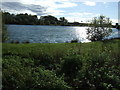
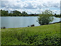
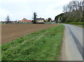
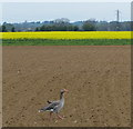
Photos of PE6 9BY
Area Information
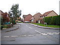
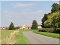
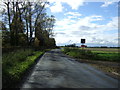
Living in PE6 9BY offers a quiet refuge for those who prioritise stability and space. This specific postcode covers a small residential cluster spanning 1.8 hectares, containing a population of 1721 people. The density here stands at 154 inhabitants per square kilometre, meaning homes sit respectfully apart from one another without the intensity of larger urban settings. You will find a neighbourhood character defined by its calm atmosphere rather than bustling activity. The area serves as a foothill community, providing a stable environment for families and individuals seeking a slower pace of life. When you consider houses in PE6 9BY, you are entering an established zone where daily routines rely on proximity rather than speed. Residents enjoy a sense of ownership over their immediate surroundings, backed by high home ownership rates. The 1721 residents create a tight-knit community feel within this defined boundary. You can anticipate a lifestyle where neighbours know each other, and the lack of major planning constraints allows for a predictable living experience. Whether you are looking for a retirement home or a family dwelling, the physical layout of PE6 9BY supports a comfortable distance from traffic noise. This small footprint ensures you remain connected to local roots while maintaining peace and quiet.
- Area Type
- Postcode
- Area Size
- 1.8 hectares
- Population
- 1721
- Population Density
- 154 people/km²
You will find that the property market in PE6 9BY is driven almost entirely by owner-occupiers. A striking 87 per cent of households own their homes, leaving very little room for a rental market operating within this specific postcode. This statistic suggests that if you buy a house in PE6 9BY, you are joining a long list of previous owners who secured their stay. The accommodation type is strictly houses, meaning you will encounter detached or semi-detached properties rather than flats or apartments. This housing stock typically commands higher values per square metre and appeals to buyers seeking security. When searching for homes in PE6 9BY, competition often comes from local investors or commuters buying into the stability of the area. The total size of 1.8 hectares limits the total number of properties, which helps maintain property values. You do not face the volatility of a large rental district where tenants move frequently. Instead, the market focuses on family buyers, retirees, and those seeking a permanent base. The 1.8 hectares cannot support rapid development, so supply remains constant. If you are looking to sell later, the strong ownership figures suggest internal demand persists. This section guarantees you a market defined by stability and tangible assets rather than speculative tenancies.
House Prices in PE6 9BY
Showing 9 properties
| Address | Type | Beds | Baths | Last Sale Price | Last Sale Date | |
|---|---|---|---|---|---|---|
| 5 Teal Way, Langtoft, PE6 9BY | house | - | - | £580,000 | Sep 2025 | |
| 7 Teal Way, Langtoft, PE6 9BY | house | - | - | £595,000 | Feb 2025 | |
| 4 Teal Way, Langtoft, PE6 9BY | house | - | - | £650,000 | Feb 2023 | |
| 6 Teal Way, Langtoft, PE6 9BY | Detached | 5 | 3 | - | - | |
| 10 Teal Way, Langtoft, PE6 9BY | house | - | - | - | - | |
| 3 Teal Way, Langtoft, PE6 9BY | house | - | - | - | - | |
| 1 Teal Way, Langtoft, PE6 9BY | house | - | - | - | - | |
| 8 Teal Way, Langtoft, PE6 9BY | Bungalow | - | - | - | - | |
| 2 Teal Way, Langtoft, PE6 9BY | house | - | - | - | - |
Energy Efficiency in PE6 9BY
Your daily life in PE6 9BY revolves around a small circle of practical amenities within a short walk. You will find five major retail outlets offering your weekly shopping needs. Notable supermarkets include Budgens Market, Tesco Market, and Co-op Market. This selection allows you to buy food without travelling far from the 1.8 hectare zone. For public transport, a single Bus Interchange serves the neighbourhood, connecting you to wider road networks. While there are no parks or leisure centres listed in the immediate data, residents often utilise green spaces just beyond the postcode boundary. The character of the area is defined by self-sufficiency and local convenience. You do not need to drive for basic groceries, saving time and money on fuel. The presence of three different market types provides price variety and choice for your household budget. Life in PE6 9BY is quiet, with no vibrant nightclubs or cinemas inside the immediate area. Instead, you find a lifestyle focused on home, local shops, and the occasional bus ride to the town. The five retail venues ensure you stay stocked from the comfort of your home. This practical setup suits the 87 per cent of residents who own their homes and settle in for the long term.
Amenities
Schools
Families considering living in PE6 9BY have access to at least one recognised educational institution directly within their catchment considerations. Langtoft Primary School stands as the nearest school for younger children in the area. It operates as a primary school and holds a Ofsted rating of good. This rating indicates that the school meets the required standards for education and care. While the data does not list secondary schools nearby, the primary option offers a solid foundation for local education. The presence of this Good rated school supports the demographic finding that adults between 30 and 64 years old form the core of the community. The mix of school types here is currently single-tier, focusing on early years and primary education. You do not have multiple primary options listed, which means the local council controls the intake for this specific zone. When you look at schools near PE6 9BY, Langtoft Primary School is the definitive choice for residents. The good rating provides reassurance that curriculum delivery is effective. This single school name dominates the educational landscape for this 1.8 hectare area. Parents will find that the proximity to Langtoft Primary School aligns well with the age profile of the 1721 residents. If you require secondary education, you will likely need to travel beyond the immediate vicinity of PE6 9BY.
| Rank | School | Type | Entry gender | Ages |
|---|
Explore more schools in this area
Go to Schools tabDemographics
The community in PE6 9BY reflects an established demographic profile suitable for mature residents and older children. The median age stands at 47 years, confirming that the most common age range comprises adults between 30 and 64 years old. You are living among a population that has likely settled in this location for some time. Home ownership is entrenched within this area, with an exceptional 87 per cent of households owning their residences outright. This high figure indicates a stable neighbourhood where investment and permanence are the norm rather than renting. The accommodation type is exclusively houses, ensuring no high-rise blocks or terraced rows dominate the streetscape. You will not find modern social housing stacks; instead, you find traditional residences suited to the local planning constraints. The predominant ethnic group is White, mirroring the established settlement patterns found in many stable parts of rural England. This homogeneity contributes to the cohesive feel of the area. With a population of 1721 spread across 1.8 hectares, the demographic density supports a close community where neighbours interact regularly. Living in PE6 9BY means joining a group that values stability, age-appropriate socialising, and the ownership of a brick-and-mortar home.
Household Size
Accommodation Type
Tenure
Ethnic Group
Religion
Household Composition
Age
Household Deprivation
NS-SEC
Explore more demographic insights in this area
Go to Demographics tabPlanning
Planning Constraints
- Flood RiskPremium
- Ramsar Wetland SitesPremium
- Area of Outstanding Natural BeautyPremium
- Protected Nature ReservePremium
- Protected WoodlandPremium