Area Overview for PE6 8RQ
Photos of PE6 8RQ
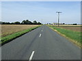
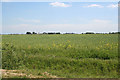
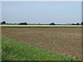
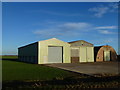
8 photos from this area
Area Information
Key information about the PE6 8RQ including its size, population, and administrative classification.
- Area Type
- Postcode
- Area Size
- 1.5 km²
- Population
- 1485
- Population Density
- 107 people/km²
House Prices in PE6 8RQ
10
Properties
£170,000
Average Sold Price
£135,000
Lowest Price
£245,000
Highest Price
Showing 10 properties
| Address | Type | Beds | Baths | Last Sale Price | Last Sale Date | |
|---|---|---|---|---|---|---|
| 66 Station Road, Deeping St James, PE6 8RQ | Detached | 3 | 1 | £147,000 | Nov 2020 | |
| 131 Station Road, Deeping St James, PE6 8RQ | Detached | 3 | 1 | £170,000 | Feb 2020 | |
| Lyndale, 129 Station Road, Deeping St James, PE6 8RQ | house | 3 | 2 | £153,000 | Mar 2016 | |
| 135 Station Road, Deeping St James, PE6 8RQ | Semi-detached | 3 | 1 | £135,000 | Oct 2008 | |
| Stonehouse Cottage, 36 Station Road, Deeping St James, PE6 8RQ | Land | - | - | £245,000 | Nov 2006 | |
| Whichcote, Station Road, Deeping St James, PE6 8RQ | Bungalow | - | - | - | - | |
| 133 Station Road, Deeping St James, PE6 8RQ | house | - | - | - | - | |
| Glasmere Butchery, 127 Station Road, Deeping St James, PE6 8RQ | Detached | - | - | - | - | |
| 74 Station Road, Deeping St James, PE6 8RQ | storage_distribution | - | - | - | - | |
| Lakeside Cottage, Station Road, Deeping St James, PE6 8RQ | Bungalow | - | - | - | - |
Energy Efficiency in PE6 8RQ
Amenities
Schools
| Rank | School | Type | Entry gender | Ages |
|---|
Explore more schools in this area
Go to Schools tabDemographics
Household Size
Two person
most common
Accommodation Type
Houses
most common
Tenure
86
majority
Ethnic Group
White
most common
Religion
N/A
most common
Household Composition
N/A
most common
Age
47
median
Adults (30-64 years)
most common
Household Deprivation
N/A
with no deprivation
NS-SEC
43
in Lower managerial occupations
Explore more demographic insights in this area
Go to Demographics tabPlanning
Planning Constraints
- Flood RiskPremium
- Ramsar Wetland SitesPremium
- Area of Outstanding Natural BeautyPremium
- Protected Nature ReservePremium
- Protected WoodlandPremium