Area Overview for PE6 8QL
Photos of PE6 8QL
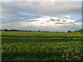
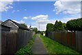
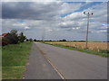
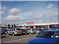
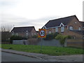
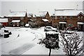
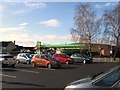
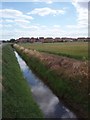
8 photos from this area
Area Information
Key information about the PE6 8QL including its size, population, and administrative classification.
- Area Type
- Postcode
- Area Size
- 2.1 hectares
- Population
- 1309
- Population Density
- 2151 people/km²
House Prices in PE6 8QL
59
Properties
£184,149
Average Sold Price
£41,000
Lowest Price
£315,000
Highest Price
Showing 59 properties
| Address | Type | Beds | Baths | Last Sale Price | Last Sale Date | |
|---|---|---|---|---|---|---|
| 43 Fraser Close, Deeping St James, PE6 8QL | Detached | 4 | 1 | £305,000 | Aug 2025 | |
| 65 Fraser Close, Deeping St James, PE6 8QL | Detached | 3 | 1 | £259,950 | Mar 2025 | |
| 22 Fraser Close, Deeping St James, PE6 8QL | house | - | - | £241,000 | Mar 2025 | |
| 16 Fraser Close, Deeping St James, PE6 8QL | Semi-detached | 3 | 1 | £247,500 | Sep 2024 | |
| 79 Fraser Close, Deeping St James, PE6 8QL | Detached | 4 | 1 | £280,000 | Jul 2024 | |
| 67 Fraser Close, Deeping St James, PE6 8QL | house | 4 | 1 | £257,000 | May 2024 | |
| 53 Fraser Close, Deeping St James, PE6 8QL | house | - | - | £315,000 | Oct 2023 | |
| 26 Fraser Close, Deeping St James, PE6 8QL | house | - | - | £232,000 | Mar 2023 | |
| 10 Fraser Close, Deeping St James, PE6 8QL | house | - | - | £245,000 | Feb 2023 | |
| 15 Fraser Close, Deeping St James, PE6 8QL | Semi-detached | 3 | 1 | £228,500 | Feb 2023 |
Page 1 of 6
Energy Efficiency in PE6 8QL
Amenities
Schools
| Rank | School | Type | Entry gender | Ages |
|---|
Explore more schools in this area
Go to Schools tabDemographics
Household Size
Two person
most common
Accommodation Type
Houses
most common
Tenure
76
majority
Ethnic Group
White
most common
Religion
N/A
most common
Household Composition
N/A
most common
Age
47
median
Adults (30-64 years)
most common
Household Deprivation
N/A
with no deprivation
NS-SEC
39
in Lower managerial occupations
Explore more demographic insights in this area
Go to Demographics tabPlanning
Planning Constraints
- Flood RiskPremium
- Ramsar Wetland SitesPremium
- Area of Outstanding Natural BeautyPremium
- Protected Nature ReservePremium
- Protected WoodlandPremium