Area Overview for PE6 8HA
Photos of PE6 8HA
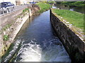
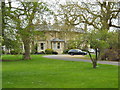
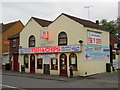
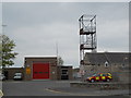
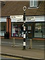
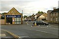
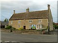

100 photos from this area
Area Information
Key information about the PE6 8HA including its size, population, and administrative classification.
- Area Type
- Postcode
- Area Size
- 4.0 hectares
- Population
- 1272
- Population Density
- 3389 people/km²
House Prices in PE6 8HA
65
Properties
£232,445
Average Sold Price
£10,000
Lowest Price
£750,000
Highest Price
Showing 65 properties
| Address | Type | Beds | Baths | Last Sale Price | Last Sale Date | |
|---|---|---|---|---|---|---|
| 84 Bridge Street, Deeping St James, PE6 8HA | Cottage | 2 | 1 | £165,000 | Sep 2025 | |
| 20 Bridge Street, Deeping St James, PE6 8HA | house | 3 | 1 | £261,000 | Jun 2023 | |
| 98 Bridge Street, Deeping St James, PE6 8HA | Detached | 4 | 2 | £380,000 | Mar 2022 | |
| High Locks House, 1 Bridge Street, Deeping St James, PE6 8HA | Detached | 3 | - | £402,000 | Mar 2022 | |
| 28 Bridge Street, Deeping St James, PE6 8HA | Terraced | 2 | 1 | £10,000 | Jul 2021 | |
| 37 Bridge Street, Deeping St James, PE6 8HA | Detached | 4 | 1 | £435,000 | Jun 2021 | |
| 94 Bridge Street, Deeping St James, PE6 8HA | Terraced | 2 | 1 | £229,950 | Jun 2021 | |
| The Old Forge, 6 Bridge Street, Deeping St James, PE6 8HA | house | - | - | £750,000 | Apr 2021 | |
| 8A Bridge Street, Deeping St James, PE6 8HA | house | - | - | £650,000 | Dec 2020 | |
| 86 Bridge Street, Deeping St James, PE6 8HA | Cottage | 3 | 1 | £200,000 | Nov 2019 |
Page 1 of 7
Energy Efficiency in PE6 8HA
Amenities
Schools
| Rank | School | Type | Entry gender | Ages |
|---|
Explore more schools in this area
Go to Schools tabDemographics
Household Size
Two person
most common
Accommodation Type
Houses
most common
Tenure
81
majority
Ethnic Group
White
most common
Religion
N/A
most common
Household Composition
N/A
most common
Age
47
median
Adults (30-64 years)
most common
Household Deprivation
N/A
with no deprivation
NS-SEC
39
in Lower managerial occupations
Explore more demographic insights in this area
Go to Demographics tabPlanning
Planning Constraints
- Flood RiskPremium
- Ramsar Wetland SitesPremium
- Area of Outstanding Natural BeautyPremium
- Protected Nature ReservePremium
- Protected WoodlandPremium