Area Overview for PE25 2UG
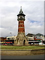
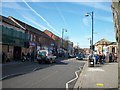
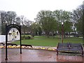
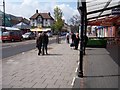
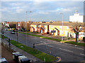
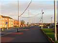
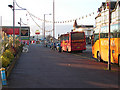
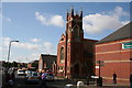
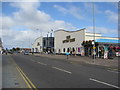
Photos of PE25 2UG
Area Information
PE25 2UG is a small residential cluster located within the Lincolnshire postcode district of PE25. The area covers just 3.2 hectares, which creates a compact living environment where residents are in close proximity to one another. You will find 1,812 people calling this specific zone home, resulting in a population density of 57,035 people per square kilometre. This high density characterises a tightly packed neighbourhood where space is at a premium. Living in PE25 2UG means navigating a very confined locality where the immediate surroundings are entirely residential. The location serves as a dense pocket within the wider Skegness and surrounding region, offering a discreet and defined address. Despite the small footprint, the area functions as a complete residential unit with defined boundaries. Your daily life here revolves around this concentrated settlement, providing a specific sense of locality within the broader East Midlands landscape. The physical constraints of the 3.2 hectare site mean that expansion is limited and the development pattern remains static. You buy into a fixed, small-scale community rather than a sprawling suburb. This density ensures that neighbours are always nearby, creating a setting where community interaction is part of the daily routine due to spatial limitations.
- Area Type
- Postcode
- Area Size
- 3.2 hectares
- Population
- 1812
- Population Density
- 2651 people/km²
The property market in PE25 2UG is defined by a specific and limited housing stock. Flats are the main accommodation type, meaning you will find apartment-style living rather than detached or semi-detached homes dominating the landscape. This preference for flats aligns with the area's high population density of 57,035 people per square kilometre on just 3.2 hectares. With a home ownership rate of 28 per cent, the area functions significantly as a rental market. Most residents do not own their properties, which means the local inventory will feature a high proportion of properties available to rent. If you are considering buying homes in PE25 2UG, you should expect a scarcity of buy-to-let or owner-occupied detached houses. The 57 per cent of the population who do not own their homes suggests a steady demand for affordable, high-density living options. This structure makes the area attractive to professionals seeking affordable entry into property, provided they can meet the specific criteria of living in a flat. The market is tight because the 3.2 hectare site restricts the number of land-based homes that can be built or sold.
House Prices in PE25 2UG
Showing 16 properties
| Address | Type | Beds | Baths | Last Sale Price | Last Sale Date | |
|---|---|---|---|---|---|---|
| 10-12 Grand Parade, Skegness, PE25 2UG | undefined | - | - | - | - | |
| Flat, 10 Grand Parade, Skegness, PE25 2UG | Flat | - | - | - | - | |
| Flat, Plaza Family Entertainment Centre, Grand Parade, Skegness, PE25 2UG | Flat | - | - | - | - | |
| Flat 2, 11 Grand Parade, Skegness, PE25 2UG | Flat | - | - | - | - | |
| Flat 2, 16-17 Grand Parade, Skegness, PE25 2UG | Flat | - | - | - | - | |
| Flat 1, 16-17 Grand Parade, Skegness, PE25 2UG | Flat | - | - | - | - | |
| Flat 1, 12 Grand Parade, Skegness, PE25 2UG | Flat | - | - | - | - | |
| Flat 1, 11 Grand Parade, Skegness, PE25 2UG | Flat | - | - | - | - | |
| Flat 2, 12 Grand Parade, Skegness, PE25 2UG | Flat | - | - | - | - | |
| Flat, 14-15 Grand Parade, Skegness, PE25 2UG | Flat | - | - | - | - |
Energy Efficiency in PE25 2UG
Residents of PE25 2UG benefit from convenient access to retail and transport hubs within practical reach. There are five notable retail locations nearby, including Heron Skegness, Iceland Skegness, and Lidl Skegness. These shops provide essential groceries and daily necessities without requiring a long commute. Four railway stations are accessible for your travel needs: Skegness Railway Station, Havenhouse Railway Station, and Wainfleet Railway Station, alongside a Coach Station. Public transport links are supported by four railway services and one coach service, offering flexibility for journeys beyond the local cluster. Your lifestyle depends on these nearby amenities, which sit just outside the tight boundaries of the postcode area. You can walk to Harrow Skegness or Iceland Skegness for a quick shop after returning from a day out. The presence of a Coach Station at Havenhouse Railway Station ensures you have multiple modes of transport available. This proximity to Lidl Skegness and other retailers supports a self-sufficient daily routine for the 1,812 residents of this small area.
Amenities
Schools
| Rank | School | Type | Entry gender | Ages |
|---|
Explore more schools in this area
Go to Schools tabDemographics
The community in PE25 2UG reflects a mature demographic with a median age of 47 years. Most residents fall into the 30 to 64-year-old age bracket, indicating a stable population of working adults and families. House ownership stands at 28 per cent, which suggests that a significant majority of the population lives within the private rented sector or social housing. Flats are the predominant accommodation type in this area, shaping the architectural character of the 3.2 hectare site. The population is predominantly White, aligning with the broader national trend for England. With a median age of 47, the neighbourhood avoids the transient nature often found in student quarters or tourism-heavy zones. A home ownership rate of 28 per cent implies that many people may not have long-term roots in the postcode but reside here for varying durations. The age profile of adults between 30 and 64 years suggests a focus on established careers and stability rather than entry-level housing markets. You can expect a neighbourhood where the residents have moved past the earliest stages of their lives into mid-career planning. The concentration of flats and the high density of 57,035 people per square kilometre reinforce this profile of shared living and efficient urban space utilisation.
Household Size
Accommodation Type
Tenure
Ethnic Group
Religion
Household Composition
Age
Household Deprivation
NS-SEC
Explore more demographic insights in this area
Go to Demographics tabPlanning
Planning Constraints
- Flood RiskPremium
- Ramsar Wetland SitesPremium
- Area of Outstanding Natural BeautyPremium
- Protected Nature ReservePremium
- Protected WoodlandPremium