Area Overview for PE24 5DH
Photos of PE24 5DH


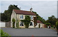
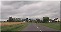
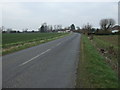
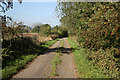
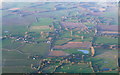
11 photos from this area
Area Information
Key information about the PE24 5DH including its size, population, and administrative classification.
- Area Type
- Postcode
- Area Size
- 13.6 hectares
- Population
- 1139
- Population Density
- 43 people/km²
House Prices in PE24 5DH
19
Properties
£284,500
Average Sold Price
£78,000
Lowest Price
£550,000
Highest Price
Showing 19 properties
| Address | Type | Beds | Baths | Last Sale Price | Last Sale Date | |
|---|---|---|---|---|---|---|
| Bifield Cottage, Pinfold Lane, Irby In The Marsh, PE24 5DH | house | - | - | £320,000 | Mar 2022 | |
| Wren Cottage, Pinfold Lane, Irby In The Marsh, PE24 5DH | Bungalow | 3 | 2 | £325,000 | Nov 2021 | |
| The Poplars, Pinfold Lane, Irby In The Marsh, PE24 5DH | house | - | - | £260,000 | Aug 2021 | |
| Merton Villa, Pinfold Lane, Irby In The Marsh, PE24 5DH | house | - | - | £350,000 | Jun 2021 | |
| Pinfold House, Pinfold Lane, Irby In The Marsh, PE24 5DH | house | - | - | £550,000 | Apr 2021 | |
| Sheaf Cottage, Pinfold Lane, Irby In The Marsh, PE24 5DH | Detached | 4 | 2 | £250,000 | Feb 2021 | |
| The Old Mineral Water Works, Pinfold Lane, Irby In The Marsh, PE24 5DH | Bungalow | - | - | £120,000 | Feb 2021 | |
| Tudor Lodge, Pinfold Lane, Irby In The Marsh, PE24 5DH | house | - | - | £327,500 | Feb 2018 | |
| The Hornbeams, Pinfold Lane, Irby In The Marsh, PE24 5DH | Detached | 5 | - | £299,000 | Aug 2013 | |
| Latchmere, Pinfold Lane, Irby In The Marsh, PE24 5DH | house | - | - | £250,000 | Aug 2013 |
Page 1 of 2
Energy Efficiency in PE24 5DH
Amenities
Schools
| Rank | School | Type | Entry gender | Ages |
|---|
Explore more schools in this area
Go to Schools tabDemographics
Household Size
Two person
most common
Accommodation Type
Houses
most common
Tenure
87
majority
Ethnic Group
White
most common
Religion
N/A
most common
Household Composition
N/A
most common
Age
47
median
Adults (30-64 years)
most common
Household Deprivation
N/A
with no deprivation
NS-SEC
30
in Lower managerial occupations
Explore more demographic insights in this area
Go to Demographics tabPlanning
Planning Constraints
- Flood RiskPremium
- Ramsar Wetland SitesPremium
- Area of Outstanding Natural BeautyPremium
- Protected Nature ReservePremium
- Protected WoodlandPremium