Area Overview for PE23 5AW
Photos of PE23 5AW
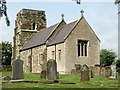
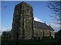
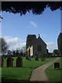
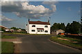
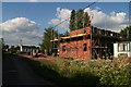
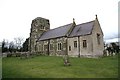
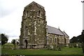
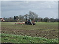
18 photos from this area
Area Information
Key information about the PE23 5AW including its size, population, and administrative classification.
- Area Type
- Postcode
- Area Size
- 19.4 hectares
- Population
- 1208
- Population Density
- 59 people/km²
House Prices in PE23 5AW
10
Properties
£199,200
Average Sold Price
£133,300
Lowest Price
£292,500
Highest Price
Showing 10 properties
| Address | Type | Beds | Baths | Last Sale Price | Last Sale Date | |
|---|---|---|---|---|---|---|
| The Conifers, Eastville Road, Toynton St Peter, PE23 5AW | Bungalow | - | - | £225,000 | Jul 2018 | |
| The Arches, Eastville Road, Toynton St Peter, PE23 5AW | Bungalow | - | - | £146,000 | Feb 2007 | |
| Hawthorne House, Eastville Road, Toynton St Peter, PE23 5AW | Detached | - | - | £292,500 | Dec 2004 | |
| The Buddleias, Eastville Road, Toynton St Peter, PE23 5AW | Bungalow | 3 | 2 | £133,300 | Jul 2003 | |
| Gannalty, Eastville Road, Toynton St Peter, PE23 5AW | Retail | 3 | 1 | - | - | |
| Aveland, Eastville Road, Toynton St Peter, PE23 5AW | Bungalow | 3 | - | - | - | |
| Brierley House, Eastville Road, Toynton St Peter, PE23 5AW | Detached | - | - | - | - | |
| Marbrae, Eastville Road, Toynton St Peter, PE23 5AW | Detached | - | - | - | - | |
| Home Farm, Eastville Road, Toynton St Peter, PE23 5AW | Detached | - | - | - | - | |
| Agricultural Building Opposite Hawthorne House, Eastville Road, Toynton St Peter, PE23 5AW | Farm | - | - | - | - |
Energy Efficiency in PE23 5AW
Amenities
Schools
| Rank | School | Type | Entry gender | Ages |
|---|
Explore more schools in this area
Go to Schools tabDemographics
Household Size
Two person
most common
Accommodation Type
Houses
most common
Tenure
83
majority
Ethnic Group
White
most common
Religion
N/A
most common
Household Composition
N/A
most common
Age
47
median
Adults (30-64 years)
most common
Household Deprivation
N/A
with no deprivation
NS-SEC
27
in Lower managerial occupations
Explore more demographic insights in this area
Go to Demographics tabPlanning
Planning Constraints
- Flood RiskPremium
- Ramsar Wetland SitesPremium
- Area of Outstanding Natural BeautyPremium
- Protected Nature ReservePremium
- Protected WoodlandPremium