Area Overview for PE23 4BA
Photos of PE23 4BA
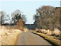
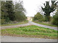
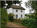
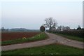
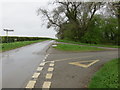
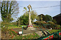
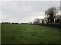
39 photos from this area
Area Information
Key information about the PE23 4BA including its size, population, and administrative classification.
- Area Type
- Postcode
- Area Size
- 33.6 hectares
- Population
- 1293
- Population Density
- 37 people/km²
House Prices in PE23 4BA
32
Properties
£215,239
Average Sold Price
£59,995
Lowest Price
£456,009
Highest Price
Showing 32 properties
| Address | Type | Beds | Baths | Last Sale Price | Last Sale Date | |
|---|---|---|---|---|---|---|
| Rose Lea, Main Road, East Keal, PE23 4BA | Bungalow | 2 | 1 | £240,000 | Oct 2022 | |
| The Cottage, Main Road, East Keal, PE23 4BA | house | - | - | £325,000 | Dec 2020 | |
| Eversley, Main Road, East Keal, PE23 4BA | Bungalow | 3 | 1 | £266,500 | Aug 2019 | |
| Lindsey House, Main Road, East Keal, PE23 4BA | Detached | - | - | £108,365 | Mar 2018 | |
| Marden House, Main Road, East Keal, PE23 4BA | Detached | 4 | 2 | £262,500 | Mar 2016 | |
| The Lodge, Main Road, East Keal, PE23 4BA | Detached | - | - | £150,000 | Jul 2015 | |
| Saracens Head, Main Road, East Keal, PE23 4BA | house | - | - | £230,000 | Dec 2010 | |
| East Keal Hall, Main Road, East Keal, PE23 4BA | house | 9 | - | £456,009 | Nov 2010 | |
| Kiln Toft, Main Road, East Keal, PE23 4BA | Semi-detached | - | - | £90,000 | May 2009 | |
| The Manor, Main Road, East Keal, PE23 4BA | house | 5 | - | £210,000 | May 2003 |
Page 1 of 4
Energy Efficiency in PE23 4BA
Amenities
Schools
| Rank | School | Type | Entry gender | Ages |
|---|
Explore more schools in this area
Go to Schools tabDemographics
Household Size
Two person
most common
Accommodation Type
Houses
most common
Tenure
81
majority
Ethnic Group
White
most common
Religion
N/A
most common
Household Composition
N/A
most common
Age
47
median
Adults (30-64 years)
most common
Household Deprivation
N/A
with no deprivation
NS-SEC
33
in Lower managerial occupations
Explore more demographic insights in this area
Go to Demographics tabPlanning
Planning Constraints
- Flood RiskPremium
- Ramsar Wetland SitesPremium
- Area of Outstanding Natural BeautyPremium
- Protected Nature ReservePremium
- Protected WoodlandPremium