Area Overview for PE22 9BL
Photos of PE22 9BL
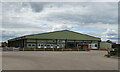
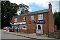
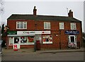
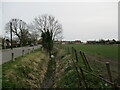
18 photos from this area
Area Information
Key information about the PE22 9BL including its size, population, and administrative classification.
- Area Type
- Postcode
- Area Size
- 7.6 hectares
- Population
- 1375
- Population Density
- 49 people/km²
House Prices in PE22 9BL
42
Properties
£127,000
Average Sold Price
£26,500
Lowest Price
£330,000
Highest Price
Showing 42 properties
| Address | Type | Beds | Baths | Last Sale Price | Last Sale Date | |
|---|---|---|---|---|---|---|
| Birchwood, Tooley Lane, Wrangle, Boston, PE22 9BL | Semi-detached | 2 | 1 | £125,000 | Jul 2023 | |
| Elmswood, Tooley Lane, Wrangle, Boston, PE22 9BL | Semi-detached | 2 | 1 | £127,000 | Jun 2023 | |
| The Cottage, Tooley Lane, Wrangle, Boston, PE22 9BL | Semi-detached | 3 | 1 | £165,000 | Apr 2022 | |
| 9 Tooley Lane, Wrangle, Boston, PE22 9BL | house | - | - | £180,000 | Aug 2021 | |
| Tudor Lodge, Tooley Lane, Wrangle, Boston, PE22 9BL | Detached | 3 | 2 | £330,000 | Nov 2020 | |
| Edgefield, Tooley Lane, Wrangle, Boston, PE22 9BL | Bungalow | 3 | 3 | £225,000 | Dec 2017 | |
| Vegas, Tooley Lane, Wrangle, Boston, PE22 9BL | Bungalow | 3 | 1 | £185,000 | Jun 2017 | |
| The Pantiles, 31 Tooley Lane, Wrangle, Boston, PE22 9BL | Bungalow | 3 | 2 | £187,000 | Jul 2016 | |
| Oaktree, Tooley Lane, Wrangle, Boston, PE22 9BL | Semi-detached | 2 | - | £84,000 | Nov 2013 | |
| Woodlands, Tooley Lane, Wrangle, Boston, PE22 9BL | house | - | - | £72,000 | Jun 2013 |
Page 1 of 5
Energy Efficiency in PE22 9BL
Amenities
Schools
| Rank | School | Type | Entry gender | Ages |
|---|
Explore more schools in this area
Go to Schools tabDemographics
Household Size
Two person
most common
Accommodation Type
Houses
most common
Tenure
72
majority
Ethnic Group
White
most common
Religion
N/A
most common
Household Composition
N/A
most common
Age
47
median
Adults (30-64 years)
most common
Household Deprivation
N/A
with no deprivation
NS-SEC
24
in Lower managerial occupations
Explore more demographic insights in this area
Go to Demographics tabPlanning
Planning Constraints
- Flood RiskPremium
- Ramsar Wetland SitesPremium
- Area of Outstanding Natural BeautyPremium
- Protected Nature ReservePremium
- Protected WoodlandPremium