Area Overview for PE22 8NL
Photos of PE22 8NL
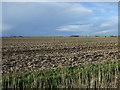
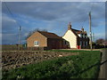
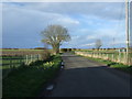
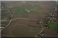
19 photos from this area
Area Information
Key information about the PE22 8NL including its size, population, and administrative classification.
- Area Type
- Postcode
- Area Size
- 14.2 hectares
- Population
- 1555
- Population Density
- 42 people/km²
House Prices in PE22 8NL
31
Properties
£291,636
Average Sold Price
£71,000
Lowest Price
£1,252,000
Highest Price
Showing 31 properties
| Address | Type | Beds | Baths | Last Sale Price | Last Sale Date | |
|---|---|---|---|---|---|---|
| Ivy Dene Cottage, Eaudyke, Friskney, PE22 8NL | Detached | 5 | 2 | £275,000 | Mar 2025 | |
| Lazywood, Eaudyke, Friskney, PE22 8NL | Bungalow | 3 | 1 | £180,000 | Oct 2023 | |
| The Old Shop, Eaudyke, Friskney, PE22 8NL | house | - | - | £217,500 | Dec 2019 | |
| Heathers, Eaudyke, Friskney, PE22 8NL | Bungalow | 2 | - | £142,500 | Sep 2019 | |
| Sira Anka, Eaudyke, Friskney, PE22 8NL | Bungalow | - | - | £1,252,000 | Jul 2019 | |
| Shamrock Cottage, Eaudyke, Friskney, PE22 8NL | Detached | 4 | 2 | £249,500 | Aug 2018 | |
| Mullein, Eaudyke, Friskney, PE22 8NL | Bungalow | 3 | 1 | £235,000 | Oct 2013 | |
| April Rise, Eaudyke, Friskney, PE22 8NL | Detached | - | - | £156,500 | Aug 2006 | |
| Bransby House, Eaudyke, Friskney, PE22 8NL | Detached | - | - | £237,000 | Aug 2006 | |
| Westwood House, Eaudyke, Friskney, PE22 8NL | Detached | 4 | - | £192,000 | Nov 2002 |
Page 1 of 4
Energy Efficiency in PE22 8NL
Amenities
Schools
| Rank | School | Type | Entry gender | Ages |
|---|
Explore more schools in this area
Go to Schools tabDemographics
Household Size
Two person
most common
Accommodation Type
Houses
most common
Tenure
71
majority
Ethnic Group
White
most common
Religion
N/A
most common
Household Composition
N/A
most common
Age
47
median
Adults (30-64 years)
most common
Household Deprivation
N/A
with no deprivation
NS-SEC
21
in Lower managerial occupations
Explore more demographic insights in this area
Go to Demographics tabPlanning
Planning Constraints
- Flood RiskPremium
- Ramsar Wetland SitesPremium
- Area of Outstanding Natural BeautyPremium
- Protected Nature ReservePremium
- Protected WoodlandPremium