Area Overview for PE22 8EH
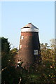
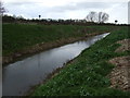
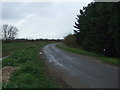
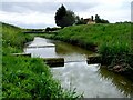
Photos of PE22 8EH


Area Information
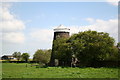
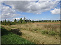
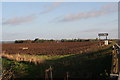
Living in PE22 8EH means residing in a compact residential cluster defined by a precise postcode. This area covers a specific geographic footprint of 6.0 hectares, containing a total population of 2307 people. You are looking at a small, contained community rather than a sprawling suburban expansion. The local environment is characterised by its density profile, with population figures indicating 43 people per square kilometre. This moderate density suggests a quieter pace of life compared to larger urban centres, yet the community remains distinct and identifiable. The setting is largely rural in character, typical of the Lincolnshire countryside where this postcode resides. Residents here live close to their neighbours, creating a tight-knit social environment within this limited physical space. For prospective homebuyers, PE22 8EH represents a specific slice of country living. The area functions as a self-contained pocket within the wider district, offering a degree of privacy without total isolation. The low population density of 43 people per square kilometre ensures that noise levels and traffic volumes remain manageable for families and retirees alike. You should understand that this is a defined residential zone rather than a mixed-use commercial district. The homes here are situated in a neighbourhood that balances seclusion with access to essential services found in the immediate vicinity. When you consider homes in PE22 8EH, you are choosing a location with clear boundaries and a foreseeable environment. The area appeals to those seeking a stable, low-rise setting where the built environment does not overwhelm the natural surroundings.
- Area Type
- Postcode
- Area Size
- 6.0 hectares
- Population
- 2307
- Population Density
- 43 people/km²
The property market in PE22 8EH is defined by a scarcity of rental units and a heavy reliance on owner-occupation. With 80% of residents owning their homes, the vast majority of properties on the market will be listed by private sellers looking to move, rather than landlords managing a portfolio. This dynamic means you will encounter a steady stream of homes for sale, but few private rentals available for immediate occupation. The accommodation type is consistently houses, which narrows the search criteria to traditional estate designs common to the Lincolnshire countryside. Prospective buyers searching for homes in PE22 8EH should focus on the secondary market. The dominant presence of owner-occupied households creates a transactional environment focused on equity rather than cash flow. You will not find a high turnover of tenants moving in and out frequently. Instead, property changes occur at a slower pace, typical of areas where families stay put for decades. This stability often results in competitive pricing as owners aim to exit their current properties while holding onto the area's predictable value. The mix of houses suggests a specific architectural profile, likely featuring brick construction and established gardens. There are no significant pockets of social housing or student accommodation within this 6.0 hectare cluster. Consequently, the market offers a straightforward choice for those who prefer a permanent residence over temporary lettings. If you need a property with a large garden or multiple bedrooms, the house-centric nature of PE22 8EH supports these requirements directly. The 80% ownership figure is a key indicator that this area is a primary market destination, not a commuter hub dependent on hourly rental availability.
House Prices in PE22 8EH
Showing 2 properties
| Address | Type | Beds | Baths | Last Sale Price | Last Sale Date | |
|---|---|---|---|---|---|---|
| Bar Green Cottage, Main Road, Stickney, PE22 8EH | house | 3 | 2 | £460,000 | Oct 2022 | |
| Hilton House, Main Road, Stickney, PE22 8EH | Detached | - | - | £98,500 | Sep 2001 |
Energy Efficiency in PE22 8EH
Daily life in PE22 8EH revolves around a modest but adequate range of retail amenities. The nearest practical services include two main supermarkets within easy reach. You can shop at Sainsburys Spilsby or the Lincolnshire Co-operative Co. These venues provide all the necessary groceries and household goods for a standard weekly shop. The availability of two major retailers suggests that shopping trips do not require a long drive, fitting into a routine that values convenience without clutter. Beyond retail, the area offers a quiet residential experience focused on the home and garden rather than nightlife or urban entertainment. The 6.0 hectare size limits the local commercial footprint, meaning you will find parks, leisure centres, and cafés further away in the wider Spilsby district. However, the essential stores are conveniently located to support daily living. This setup works well for families who prioritise supermarkets over high street fashion or cinemas. The character of the lifestyle here is defined by this reliance on village shops and occasional outings to larger centres. You will find a calm atmosphere where the community comes together over errands rather than in busy business districts. The proximity to these named stores ensures that basic needs are met without significant travel time. This balance allows residents to enjoy the peace of the countryside while maintaining access to the essentials required for a comfortable modern life.
Amenities
Schools
Families considering PE22 8EH have access to a defined selection of educational institutions within practical reach. The nearest primary school with a 'good' Ofsted rating is The New Leake Primary School. This is a strong option for younger children, offering a quality education within the local catchment. Another primary choice is Stickney Church of England Primary School, which holds a 'satisfactory' Ofsted rating. This school provides a faith-based education for its pupils, serving as an alternative for parents seeking a different pedagogical approach. Further options include William Lovell Church of England School. The data confirms this institution exists near the area, though specific Ofsted ratings are not listed for this particular venue in the current records. For secondary education, William Lovell Church of England Academy is located nearby. This academy holds a 'satisfactory' Ofsted rating, indicating a baseline standard of education acceptable for most parents, though not reaching the higher tiers. The mix of schools near PE22 8EH presents a balanced choice for families. You have both primary and secondary options available, reducing the need for complex commuting arrangements. The presence of multiple primary schools, including one with a 'good' rating, suggests the area caters well to those with school-age children. The combination of Church of England schools indicates a community with strong local faith connections. When planning for the future, you can rely on these specific names for your research. The variety ensures that families are not forced to travel far for their children's schooling, which is a major benefit for households in this rural postcode.
| Rank | School | Type | Entry gender | Ages |
|---|
Explore more schools in this area
Go to Schools tabDemographics
The community profile of PE22 8EH reveals a mature and established population base. The median age stands at 47, with the most common age range comprising adults aged between 30 and 64 years. This demographic structure indicates a neighbourhood dominated by working-age individuals and established families rather than young children or elderly residents in the statistical majority. You will find a lack of the younger student demographic that characterises university town edges, instead seeing a steady presence of mid-life households. Home ownership is exceptionally high in this area, with 80% of residents owning their properties outright. This figure suggests a stable, settled community where households have likely been established for a significant period. The accommodation type is almost exclusively houses, which aligns perfectly with the higher age profile and ownership rates. There are very few apartments or flats within the postcode, meaning the footprint consists of detached or semi-detached family homes typical of the region. The predominant ethnic group is White, reflecting the broader Lincolnshire demographic trends found in rural settlements. This demographic makeup explains the general character of the streets. You are seeing a community reliant on single-income or dual-income family units rather than student tenants or transient workers. The high ownership rate of 80% creates a market where house prices are driven by estate value and local demand rather than rental yield. When you look at who lives in PE22 8EH, you are looking at long-term residents who have weathered economic cycles and built equity in these houses. The absence of a large young person cluster means the street scene is likely more subdued, lacking the vibrant activity seen in areas with student populations.
Household Size
Accommodation Type
Tenure
Ethnic Group
Religion
Household Composition
Age
Household Deprivation
NS-SEC
Explore more demographic insights in this area
Go to Demographics tabPlanning
Planning Constraints
- Flood RiskPremium
- Ramsar Wetland SitesPremium
- Area of Outstanding Natural BeautyPremium
- Protected Nature ReservePremium
- Protected WoodlandPremium