Area Overview for PE22 7PL
Photos of PE22 7PL
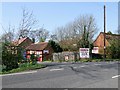
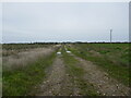
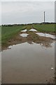
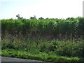
5 photos from this area
Area Information
Key information about the PE22 7PL including its size, population, and administrative classification.
- Area Type
- Postcode
- Area Size
- 1.1 km²
- Population
- 2182
- Population Density
- 28 people/km²
House Prices in PE22 7PL
10
Properties
£281,929
Average Sold Price
£52,500
Lowest Price
£600,000
Highest Price
Showing 10 properties
| Address | Type | Beds | Baths | Last Sale Price | Last Sale Date | |
|---|---|---|---|---|---|---|
| Royal Oak House, Back Lane, Moorby, PE22 7PL | house | - | - | £415,000 | Jun 2021 | |
| Field Cottage, Lion Lane, Moorby, PE22 7PL | Detached | - | - | £600,000 | Mar 2021 | |
| Grange Farmhouse, Highgate Lane, Moorby, PE22 7PL | house | - | - | £296,000 | Aug 2016 | |
| Glebe House, Main Road, Moorby, PE22 7PL | Land | 3 | - | £245,000 | Aug 2014 | |
| The Old Rectory, Main Road, Moorby, PE22 7PL | Detached | - | - | £285,000 | Aug 2002 | |
| The Old School House, Highgate Lane, Moorby, PE22 7PL | Detached | - | - | £80,000 | Jun 1998 | |
| White House Farm, Main Road, Moorby, PE22 7PL | house | - | - | £52,500 | Aug 1995 | |
| Moorby House, Main Road, Moorby, PE22 7PL | Detached | - | - | - | - | |
| The Old Barn, Highgate Lane, Moorby, PE22 7PL | Bungalow | - | - | - | - | |
| The Bungalow, Back Lane, Moorby, PE22 7PL | Detached | - | - | - | - |
Energy Efficiency in PE22 7PL
Amenities
Schools
| Rank | School | Type | Entry gender | Ages |
|---|
Explore more schools in this area
Go to Schools tabDemographics
Household Size
Two person
most common
Accommodation Type
Houses
most common
Tenure
72
majority
Ethnic Group
White
most common
Religion
N/A
most common
Household Composition
N/A
most common
Age
47
median
Adults (30-64 years)
most common
Household Deprivation
N/A
with no deprivation
NS-SEC
27
in Lower managerial occupations
Explore more demographic insights in this area
Go to Demographics tabPlanning
Planning Constraints
- Flood RiskPremium
- Ramsar Wetland SitesPremium
- Area of Outstanding Natural BeautyPremium
- Protected Nature ReservePremium
- Protected WoodlandPremium