Area Overview for PE22 0TW
Photos of PE22 0TW
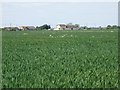

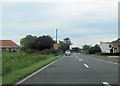
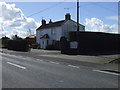
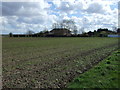
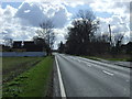
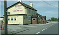
9 photos from this area
Area Information
Key information about the PE22 0TW including its size, population, and administrative classification.
- Area Type
- Postcode
- Area Size
- 59.7 hectares
- Population
- 2033
- Population Density
- 92 people/km²
House Prices in PE22 0TW
24
Properties
£287,538
Average Sold Price
£88,000
Lowest Price
£775,000
Highest Price
Showing 24 properties
| Address | Type | Beds | Baths | Last Sale Price | Last Sale Date | |
|---|---|---|---|---|---|---|
| Rhoades Mill, Main Road, Sibsey, PE22 0TW | Detached | 5 | 2 | £775,000 | Jan 2025 | |
| Tudor Lodge, Main Road, Sibsey, PE22 0TW | house | - | - | £500,000 | Dec 2022 | |
| Foinaven, Main Road, Sibsey, PE22 0TW | Detached | 2 | 1 | £335,000 | Jul 2022 | |
| Rosslyn, Main Road, Sibsey, PE22 0TW | Terraced | 2 | 1 | £195,000 | Sep 2021 | |
| Almondbury House, Main Road, Sibsey, PE22 0TW | house | 3 | 1 | £200,000 | Oct 2018 | |
| East View, Main Road, Sibsey, PE22 0TW | house | 4 | 2 | £175,000 | May 2016 | |
| Elm Farm, Main Road, Sibsey, PE22 0TW | Detached | - | - | £175,500 | Mar 2016 | |
| Hania, Main Road, Sibsey, PE22 0TW | house | 4 | 2 | £410,000 | Aug 2015 | |
| Cranswick House, Main Road, Sibsey, PE22 0TW | house | 4 | - | £230,000 | Feb 2015 | |
| Vernon Cottage, Main Road, Sibsey, PE22 0TW | Detached | - | - | £165,000 | Jan 2008 |
Page 1 of 3
Energy Efficiency in PE22 0TW
Amenities
Schools
| Rank | School | Type | Entry gender | Ages |
|---|
Explore more schools in this area
Go to Schools tabDemographics
Household Size
Two person
most common
Accommodation Type
Houses
most common
Tenure
83
majority
Ethnic Group
White
most common
Religion
N/A
most common
Household Composition
N/A
most common
Age
47
median
Adults (30-64 years)
most common
Household Deprivation
N/A
with no deprivation
NS-SEC
32
in Lower managerial occupations
Explore more demographic insights in this area
Go to Demographics tabPlanning
Planning Constraints
- Flood RiskPremium
- Ramsar Wetland SitesPremium
- Area of Outstanding Natural BeautyPremium
- Protected Nature ReservePremium
- Protected WoodlandPremium