Area Overview for PE22 0JD
Photos of PE22 0JD
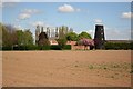
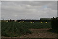
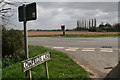

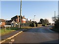
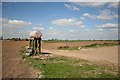
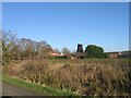
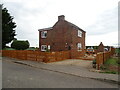
23 photos from this area
Area Information
Key information about the PE22 0JD including its size, population, and administrative classification.
- Area Type
- Postcode
- Area Size
- 9.6 hectares
- Population
- 1117
- Population Density
- 156 people/km²
House Prices in PE22 0JD
39
Properties
£145,593
Average Sold Price
£30,000
Lowest Price
£325,000
Highest Price
Showing 39 properties
| Address | Type | Beds | Baths | Last Sale Price | Last Sale Date | |
|---|---|---|---|---|---|---|
| Wychelonde, 76 Brand End Road, Butterwick, Boston, PE22 0JD | Bungalow | 3 | 1 | £260,000 | Feb 2024 | |
| Keepers Cottage, 24 Brand End Road, Butterwick, Boston, PE22 0JD | house | - | - | £169,950 | Nov 2021 | |
| Ashgrove, 62 Brand End Road, Butterwick, Boston, PE22 0JD | house | - | - | £285,000 | Sep 2021 | |
| 60 Brand End Road, Butterwick, Boston, PE22 0JD | house | - | - | £189,950 | Jun 2021 | |
| 47 Brand End Road, Butterwick, Boston, PE22 0JD | house | - | - | £250,000 | Jun 2021 | |
| 87 Brand End Road, Butterwick, Boston, PE22 0JD | house | - | - | £325,000 | Mar 2021 | |
| Wren House, 89 Brand End Road, Butterwick, Boston, PE22 0JD | Detached | - | - | £110,000 | Jan 2021 | |
| 61 Brand End Road, Butterwick, Boston, PE22 0JD | Detached | 3 | 1 | £160,000 | Feb 2020 | |
| 56 Brand End Road, Butterwick, Boston, PE22 0JD | house | - | - | £66,250 | Nov 2019 | |
| 40 Brand End Road, Butterwick, Boston, PE22 0JD | Detached | - | - | £70,000 | Jul 2018 |
Page 1 of 4
Energy Efficiency in PE22 0JD
Amenities
Schools
| Rank | School | Type | Entry gender | Ages |
|---|
Explore more schools in this area
Go to Schools tabDemographics
Household Size
Two person
most common
Accommodation Type
Houses
most common
Tenure
86
majority
Ethnic Group
White
most common
Religion
N/A
most common
Household Composition
N/A
most common
Age
47
median
Adults (30-64 years)
most common
Household Deprivation
N/A
with no deprivation
NS-SEC
24
in Lower managerial occupations
Explore more demographic insights in this area
Go to Demographics tabPlanning
Planning Constraints
- Flood RiskPremium
- Ramsar Wetland SitesPremium
- Area of Outstanding Natural BeautyPremium
- Protected Nature ReservePremium
- Protected WoodlandPremium