Area Overview for PE22 0BU
Photos of PE22 0BU
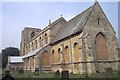
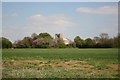
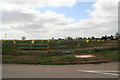
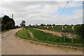

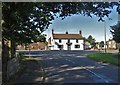
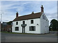
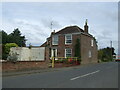
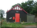
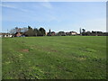
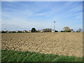
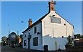
27 photos from this area
Area Information
Key information about the PE22 0BU including its size, population, and administrative classification.
- Area Type
- Postcode
- Area Size
- 17.5 hectares
- Population
- 1223
- Population Density
- 48 people/km²
House Prices in PE22 0BU
11
Properties
£134,583
Average Sold Price
£35,000
Lowest Price
£195,000
Highest Price
Showing 11 properties
| Address | Type | Beds | Baths | Last Sale Price | Last Sale Date | |
|---|---|---|---|---|---|---|
| Melrose House, West End Road, Benington, Boston, PE22 0BU | house | 4 | - | £190,000 | Oct 2016 | |
| South View, West End Road, Benington, Boston, PE22 0BU | Bungalow | 3 | 2 | £86,000 | May 2014 | |
| Chestnuts, West End Road, Benington, Boston, PE22 0BU | Detached | - | - | £195,000 | Jun 2009 | |
| Cawood, West End Road, Benington, Boston, PE22 0BU | Detached | - | - | £189,000 | Jan 2007 | |
| Beldale, West End Road, Benington, Boston, PE22 0BU | Bungalow | 3 | 1 | £112,500 | Sep 2005 | |
| Sunnymead, West End Road, Benington, Boston, PE22 0BU | Detached | - | - | £35,000 | Mar 1996 | |
| The Willows, West End Road, Benington, Boston, PE22 0BU | Detached | - | - | - | - | |
| Dovetail Cottage, West End Road, Benington, Boston, PE22 0BU | Detached | - | - | - | - | |
| Arcadia, West End Road, Benington, Boston, PE22 0BU | Detached | - | - | - | - | |
| Fairview, West End Road, Benington, Boston, PE22 0BU | Detached | - | - | - | - |
Page 1 of 2
Energy Efficiency in PE22 0BU
Amenities
Schools
| Rank | School | Type | Entry gender | Ages |
|---|
Explore more schools in this area
Go to Schools tabDemographics
Household Size
Two person
most common
Accommodation Type
Houses
most common
Tenure
73
majority
Ethnic Group
White
most common
Religion
N/A
most common
Household Composition
N/A
most common
Age
47
median
Adults (30-64 years)
most common
Household Deprivation
N/A
with no deprivation
NS-SEC
21
in Lower managerial occupations
Explore more demographic insights in this area
Go to Demographics tabPlanning
Planning Constraints
- Flood RiskPremium
- Ramsar Wetland SitesPremium
- Area of Outstanding Natural BeautyPremium
- Protected Nature ReservePremium
- Protected WoodlandPremium