Area Overview for PE22 0AA
Photos of PE22 0AA
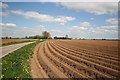

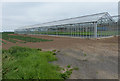
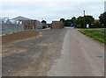
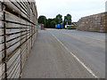
27 photos from this area
Area Information
Key information about the PE22 0AA including its size, population, and administrative classification.
- Area Type
- Postcode
- Area Size
- 65.5 hectares
- Population
- 1223
- Population Density
- 48 people/km²
House Prices in PE22 0AA
25
Properties
£204,871
Average Sold Price
£48,000
Lowest Price
£445,000
Highest Price
Showing 25 properties
| Address | Type | Beds | Baths | Last Sale Price | Last Sale Date | |
|---|---|---|---|---|---|---|
| Outgate Cottage, Outgate, Leverton, Boston, PE22 0AA | Retail | 3 | 1 | £230,000 | Jul 2025 | |
| Colingwood, Outgate, Leverton, Boston, PE22 0AA | Bungalow | 3 | 1 | £207,000 | Mar 2025 | |
| Krytno, Outgate, Leverton, Boston, PE22 0AA | Detached | 3 | 3 | £445,000 | May 2022 | |
| Sea View, Outgate, Leverton, Boston, PE22 0AA | house | - | - | £267,500 | Jan 2022 | |
| Holly Cottage, Outgate, Leverton, Boston, PE22 0AA | Detached | 3 | - | £371,000 | Jul 2021 | |
| Darby Cottage, Outgate, Leverton, Boston, PE22 0AA | Detached | 3 | - | £350,000 | Jun 2016 | |
| Sycamore Farm, Outgate, Leverton, Boston, PE22 0AA | Detached | - | - | £209,950 | Oct 2007 | |
| Keel Cottage, Outgate, Leverton, Boston, PE22 0AA | house | 4 | - | £160,000 | Oct 2003 | |
| The Gables, Outgate, Leverton, Boston, PE22 0AA | house | 3 | - | £60,000 | Dec 2000 | |
| Wesley Place, Outgate, Leverton, Boston, PE22 0AA | Detached | 3 | 1 | £58,000 | Aug 2000 |
Page 1 of 3
Energy Efficiency in PE22 0AA
Amenities
Schools
| Rank | School | Type | Entry gender | Ages |
|---|
Explore more schools in this area
Go to Schools tabDemographics
Household Size
Two person
most common
Accommodation Type
Houses
most common
Tenure
73
majority
Ethnic Group
White
most common
Religion
N/A
most common
Household Composition
N/A
most common
Age
47
median
Adults (30-64 years)
most common
Household Deprivation
N/A
with no deprivation
NS-SEC
21
in Lower managerial occupations
Explore more demographic insights in this area
Go to Demographics tabPlanning
Planning Constraints
- Flood RiskPremium
- Ramsar Wetland SitesPremium
- Area of Outstanding Natural BeautyPremium
- Protected Nature ReservePremium
- Protected WoodlandPremium