Area Overview for PE21 8JG
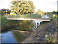
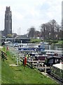
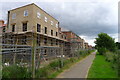
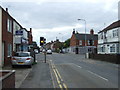
Photos of PE21 8JG


Area Information
Living in PE21 8JG means residing in a compact residential cluster defined by a single postcode. This specific area covers just 3.2 hectares, creating an intimate setting where households are in close proximity. You are part of a small population of 1,947 people, which fosters a tightly knit community atmosphere. The high population density indicates a concentrated living environment within this limited footprint. Residents here experience a distinct lifestyle characterised by immediate neighbourhood interaction and a focused local presence. While the area is small in physical terms, it functions as a complete residential unit within the broader Boston region. Your daily life is shaped by these boundaries, emphasising proximity and shared space over the spread of larger urban developments. The postcode serves as the primary identifier for those seeking homes in this specific, small-scale location. Understanding the scale of PE21 8JG is essential for grasping the intensity of community life and the close quarters typical of this residential pocket.
- Area Type
- Postcode
- Area Size
- 3.2 hectares
- Population
- 1947
- Population Density
- 4823 people/km²
The property market in PE21 8JG is characterised by a mix of ownership models and specific housing types. Houses constitute the main accommodation type found across the 3.2-hectare site, suggesting a preference for traditional residential structures over flats or apartments. Forty-five per cent of residents are homeowners, meaning nearly half the population holds title to their dwellings. This signifies a balanced market where owner-occupiers play a significant role alongside the remaining residents who rent their homes. Given the small scale of the area, the housing stock appears limited to this specific postcode cluster. Prospective buyers looking at homes in PE21 8JG should expect primarily detached or semi-detached properties suitable for families or couples. The high density figure of 61,007 people per square kilometre further implies that space is at a premium within these house boundaries. When searching for properties, focus on this specific postcode as it contains the relevant residential inventory defined by the available data. The market dynamics here are driven by the need for housing within this constrained, house-focused environment.
House Prices in PE21 8JG
Showing 24 properties
| Address | Type | Beds | Baths | Last Sale Price | Last Sale Date | |
|---|---|---|---|---|---|---|
| 9 Woodhall Close, Boston, PE21 8JG | Bungalow | 2 | 1 | £198,000 | Nov 2024 | |
| 22 Woodhall Close, Boston, PE21 8JG | Bungalow | 3 | 1 | £269,950 | Nov 2024 | |
| 13 Woodhall Close, Boston, PE21 8JG | Bungalow | 4 | 1 | £248,000 | Jul 2021 | |
| 23 Woodhall Close, Boston, PE21 8JG | Bungalow | 3 | 2 | £260,000 | Aug 2018 | |
| 10 Woodhall Close, Boston, PE21 8JG | Bungalow | - | - | £170,000 | Apr 2017 | |
| 17 Woodhall Close, Boston, PE21 8JG | Bungalow | 3 | - | £167,500 | Aug 2016 | |
| 19 Woodhall Close, Boston, PE21 8JG | Bungalow | - | - | £168,000 | Jul 2016 | |
| 1 Woodhall Close, Boston, PE21 8JG | Bungalow | 2 | 1 | £163,000 | Jun 2016 | |
| 8 Woodhall Close, Boston, PE21 8JG | Bungalow | 3 | - | £155,000 | Nov 2015 | |
| 11 Woodhall Close, Boston, PE21 8JG | Bungalow | 3 | - | £147,000 | Feb 2014 |
Energy Efficiency in PE21 8JG
Your daily lifestyle in PE21 8JG benefits from immediate access to essential retail and transport hubs. Three railway stations within practical reach include Boston Railway Station, Hubberts Bridge Railway Station, and Swineshead Railway Station, offering direct rail connections for commuters. For shopping needs, five major retail outlets stand nearby, specifically Asda Boston, Lincolnshire Co-operative Co, and Aldi Hubbert's. These supermarkets provide you with convenient access to groceries and household essentials without requiring long travel times. The concentration of rail stations and supermarkets ensures that day-to-day errands are manageable from your front door. You can access fresh food, general merchandise, and potentially job opportunities through the railway links. This amenity-rich environment compensates for the small size of the postcode itself. Living in PE21 8JG grants you the convenience of major supermarket chains and multiple transport nodes within a short distance. The practical reach of these facilities defines the ease of living here, blending local convenience with regional connectivity.
Amenities
Schools
Families residing in PE21 8JG have access to two key educational institutions nearby. Boston Carlton Road Primary School serves the younger children in the locality, providing infant and junior education. Further on for older students, Carlton Road Academy operates as an academy with an Ofsted rating of outstanding. This rating signals a high standard of performance and education delivery at the secondary level. The presence of both a primary school and an academy means that many families may be able to send their children to these local establishments. Having an 'outstanding' rated academy in the vicinity is a significant positive factor for parents considering homes in PE21 8JG. You do not need to look far beyond this corridor to find reputable educational options. The combination of a local primary school and a highly rated academy creates a supportive learning environment for students growing up in the area. These institutions anchor the family orientation of the neighbourhood and contribute to the appeal of living here.
| Rank | School | Type | Entry gender | Ages |
|---|
Explore more schools in this area
Go to Schools tabDemographics
The community in PE21 8JG reflects a mature demographic profile. The median age stands at 47 years, confirming that Adults aged 30 to 64 years form the most common age range. This skew towards middle and older adults shapes the local demand for suitable housing and community spaces. Home ownership rates stand at 45%, indicating that nearly half of the residents own their properties while the remainder likely rent or share costs. Houses are the predominant accommodation type throughout the area, catering to families and established households seeking standalone living spaces. The population is predominantly White, reflecting the general ethnic composition of this specific postcode. These figures paint a picture of a stable, settled community where property ownership is common among a largely middle-aged population. The data suggests a neighbourhood where long-term residents are the norm rather than a transient population. Understanding these demographics helps you gauge the community vibe and the likely needs of your neighbours in PE21 8JG.
Household Size
Accommodation Type
Tenure
Ethnic Group
Religion
Household Composition
Age
Household Deprivation
NS-SEC
Explore more demographic insights in this area
Go to Demographics tabPlanning
Planning Constraints
- Flood RiskPremium
- Ramsar Wetland SitesPremium
- Area of Outstanding Natural BeautyPremium
- Protected Nature ReservePremium
- Protected WoodlandPremium