Area Overview for PE21 8DN
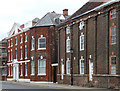
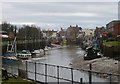
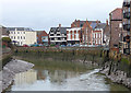
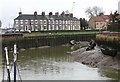
Photos of PE21 8DN


Area Information
PE21 8DN represents a specific postcode cluster covering 4052 square metres within the PE21 postcode area. This small residential zone accommodates a population of 2612 people, resulting in a population density of 644684 people per square kilometre. Such a high density indicates that homes in this area are situated very close to one another, creating a compact living environment typical of established urban or semi-urban surroundings. The location is defined by its concentrated nature rather than sprawling landscapes, meaning daily travel distances to local facilities are likely to be short. For anyone considering living in PE21 8DN, the setup offers immediate proximity to services within a tightly knit geographic footprint. The area functions as a distinct residential unit where the close quarters between properties foster a specific type of neighbourhood interaction. Prospective buyers must recognise this setting provides a front-line location where amenities and transport connections are not far away.
- Area Type
- Postcode
- Area Size
- 4052 m²
- Population
- 2612
- Population Density
- 6083 people/km²
Homes in PE21 8DN are predominantly houses rather than flats or other accommodation types. This stock profile suggests a market geared towards family living or individuals seeking detached or semi-detached properties. The home ownership rate sits at 29%, meaning roughly seven out of ten residents rent their properties. This imbalance creates a rental-heavy market where landlords and letting agents play a major role in the local housing economy. Buyers looking at this specific postcode area find themselves competing in an environment where long-term rental tenure may be more common than in neighbourly regions with higher ownership rates. The prevalence of houses indicates that ground-level access and garden space are likely features of the available stock. For those interested in buying, understanding this 29% ownership baseline is crucial for evaluating property prices and investment potential. The market reflects a zone where housing supply caters to a population that largely prefers renting.
House Prices in PE21 8DN
Showing 15 properties
| Address | Type | Beds | Baths | Last Sale Price | Last Sale Date | |
|---|---|---|---|---|---|---|
| 45 Tennyson Close, Boston, PE21 8DN | Bungalow | - | - | - | - | |
| 47 Tennyson Close, Boston, PE21 8DN | Bungalow | - | - | - | - | |
| 46 Tennyson Close, Boston, PE21 8DN | Bungalow | - | - | - | - | |
| 52 Tennyson Close, Boston, PE21 8DN | Bungalow | - | - | - | - | |
| 44 Tennyson Close, Boston, PE21 8DN | Bungalow | - | - | - | - | |
| 50 Tennyson Close, Boston, PE21 8DN | Bungalow | - | - | - | - | |
| 51 Tennyson Close, Boston, PE21 8DN | Bungalow | - | - | - | - | |
| 54 Tennyson Close, Boston, PE21 8DN | Bungalow | - | - | - | - | |
| 49 Tennyson Close, Boston, PE21 8DN | Bungalow | - | - | - | - | |
| 58 Tennyson Close, Boston, PE21 8DN | Bungalow | - | - | - | - |
Energy Efficiency in PE21 8DN
Residents of PE21 8DN benefit from practical access to retail and rail facilities within reach. Weekly shopping trips can be made to Farmfoods Boston, Aldi Hubbert's, or the Lincolnshire Co-operative Co, with five retail outlets identified as key options nearby. These supermarkets provide comprehensive goods selection for household needs without requiring long journeys to town. For travel, train connections are available via Boston Railway Station and Hubberts Bridge Railway Station, which serve the community as major transport nodes. Having two railway stations within practical reach enhances mobility and expands commuting options beyond local roads. The availability of these specific venues means that daily life in PE21 8DN balances local convenience with broader regional access. Shoppers and commuters appreciate the proximity to established brands like Aldi and Boston Railway Station, which anchors the local lifestyle economy.
Amenities
Schools
Families in PE21 8DN have access to four nearby educational institutions, providing options from the early years through to senior secondary levels. Boston Staniland Primary & Nursery School offers education for younger children in the primary sector. Staniland County Junior School and Staniland County Infant School complete the primary education chain available in the vicinity. For older students, Staniland Academy serves as the local academy. Isofsted records list Staniland Academy with an outstanding rating, a rare achievement highlighting the high quality of education provided there. The presence of multiple schools sharing the Staniland name suggests a cohesive educational community with shared values or administrative structures. This mix ensures that children can progress through a recognised school system without needing to travel far from their homes in PE21 8DN. The combination of primary and academy provision makes this locality attractive for parents seeking continuity of education.
| Rank | School | Type | Entry gender | Ages |
|---|
Explore more schools in this area
Go to Schools tabDemographics
The community profile for PE21 8DN reflects a mature demographic structure with a median age of 47 years. Adults aged between 30 and 64 years constitute the most common age range, indicating the area attracts and retains families or individuals in their working and mid-life years. House ownership stands at 29%, a figure that suggests a significant portion of residents rent their homes rather than own them outright. This statistic points towards a diverse tenant base alongside a stable minority of owner-occupiers. The predominant ethnic group is White, which shapes the cultural make-up of the neighbourhood. Accommodation types are primarily houses, providing a traditional housing stock for this population. With a median age near mid-life and a mix of homeowners and renters, locals here likely balance substantial daily routines around family needs and work commitments. The demographic data paints a picture of a stable, older-than-average community settled within the residential clusters.
Household Size
Accommodation Type
Tenure
Ethnic Group
Religion
Household Composition
Age
Household Deprivation
NS-SEC
Explore more demographic insights in this area
Go to Demographics tabPlanning
Planning Constraints
- Flood RiskPremium
- Ramsar Wetland SitesPremium
- Area of Outstanding Natural BeautyPremium
- Protected Nature ReservePremium
- Protected WoodlandPremium