Area Overview for PE21 7HP
Photos of PE21 7HP

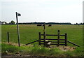
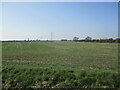

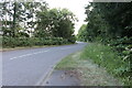
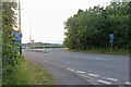

20 photos from this area
Area Information
Key information about the PE21 7HP including its size, population, and administrative classification.
- Area Type
- Postcode
- Area Size
- 2.3 hectares
- Population
- 1709
- Population Density
- 202 people/km²
House Prices in PE21 7HP
25
Properties
£146,789
Average Sold Price
£38,000
Lowest Price
£260,000
Highest Price
Showing 25 properties
| Address | Type | Beds | Baths | Last Sale Price | Last Sale Date | |
|---|---|---|---|---|---|---|
| 72 Tytton Lane East, Wyberton, Boston, PE21 7HP | Semi-detached | 3 | 1 | £175,000 | Jul 2023 | |
| 43 Tytton Lane East, Wyberton, Boston, PE21 7HP | Bungalow | - | - | £220,000 | Sep 2021 | |
| 70 Tytton Lane East, Wyberton, Boston, PE21 7HP | house | - | - | £132,000 | Feb 2020 | |
| 41 Tytton Lane East, Wyberton, Boston, PE21 7HP | Land | - | - | £260,000 | Nov 2019 | |
| 84 Tytton Lane East, Wyberton, Boston, PE21 7HP | Semi-detached | 3 | 1 | £126,000 | Aug 2019 | |
| 86 Tytton Lane East, Wyberton, Boston, PE21 7HP | Semi-detached | 3 | 1 | £115,000 | Jul 2019 | |
| 47 Tytton Lane East, Wyberton, Boston, PE21 7HP | Detached | 4 | 2 | £213,500 | Jan 2019 | |
| 76 Tytton Lane East, Wyberton, Boston, PE21 7HP | house | - | - | £123,000 | Oct 2017 | |
| 62 Tytton Lane East, Wyberton, Boston, PE21 7HP | Semi-detached | 3 | 1 | £158,000 | Aug 2016 | |
| 78 Tytton Lane East, Wyberton, Boston, PE21 7HP | Semi-detached | 3 | 2 | £143,000 | May 2016 |
Page 1 of 3
Energy Efficiency in PE21 7HP
Amenities
Schools
| Rank | School | Type | Entry gender | Ages |
|---|
Explore more schools in this area
Go to Schools tabDemographics
Household Size
Family (3-5 people)
most common
Accommodation Type
Houses
most common
Tenure
73
majority
Ethnic Group
White
most common
Religion
N/A
most common
Household Composition
N/A
most common
Age
47
median
Adults (30-64 years)
most common
Household Deprivation
N/A
with no deprivation
NS-SEC
25
in Lower managerial occupations
Explore more demographic insights in this area
Go to Demographics tabPlanning
Planning Constraints
- Flood RiskPremium
- Ramsar Wetland SitesPremium
- Area of Outstanding Natural BeautyPremium
- Protected Nature ReservePremium
- Protected WoodlandPremium