Area Overview for PE21 7AT
Photos of PE21 7AT


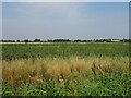
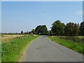
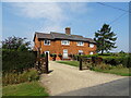
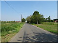


21 photos from this area
Area Information
Key information about the PE21 7AT including its size, population, and administrative classification.
- Area Type
- Postcode
- Area Size
- 58.1 hectares
- Population
- 1714
- Population Density
- 57 people/km²
House Prices in PE21 7AT
18
Properties
£169,093
Average Sold Price
£68,500
Lowest Price
£275,000
Highest Price
Showing 18 properties
| Address | Type | Beds | Baths | Last Sale Price | Last Sale Date | |
|---|---|---|---|---|---|---|
| 72 Saundergate Lane East, Wyberton, Boston, PE21 7AT | Detached | 3 | 1 | £275,000 | May 2022 | |
| 64 Saundergate Lane East, Wyberton, Boston, PE21 7AT | Bungalow | 3 | 1 | £250,000 | Apr 2022 | |
| 74 Saundergate Lane East, Wyberton, Boston, PE21 7AT | Bungalow | 2 | - | £159,950 | Nov 2021 | |
| 62 Saundergate Lane East, Wyberton, Boston, PE21 7AT | Bungalow | 3 | 2 | £189,950 | Sep 2021 | |
| 100 Saundergate Lane East, Wyberton, Boston, PE21 7AT | Semi-detached | 3 | 1 | £192,000 | Sep 2021 | |
| 96 Saundergate Lane East, Wyberton, Boston, PE21 7AT | house | - | - | £194,950 | Jul 2021 | |
| 76 Saundergate Lane East, Wyberton, Boston, PE21 7AT | Bungalow | 3 | - | £179,950 | Aug 2015 | |
| Kings Cottage, 78 Saundergate Lane East, Wyberton, Boston, PE21 7AT | Bungalow | 4 | - | £170,000 | Sep 2012 | |
| 131 Saundergate Lane East, Wyberton, Boston, PE21 7AT | Detached | 3 | 1 | £227,500 | Jul 2012 | |
| 58 Saundergate Lane East, Wyberton, Boston, PE21 7AT | house | - | - | £150,000 | Apr 2003 |
Page 1 of 2
Energy Efficiency in PE21 7AT
Amenities
Schools
| Rank | School | Type | Entry gender | Ages |
|---|
Explore more schools in this area
Go to Schools tabDemographics
Household Size
Two person
most common
Accommodation Type
Houses
most common
Tenure
86
majority
Ethnic Group
White
most common
Religion
N/A
most common
Household Composition
N/A
most common
Age
47
median
Adults (30-64 years)
most common
Household Deprivation
N/A
with no deprivation
NS-SEC
30
in Lower managerial occupations
Explore more demographic insights in this area
Go to Demographics tabPlanning
Planning Constraints
- Flood RiskPremium
- Ramsar Wetland SitesPremium
- Area of Outstanding Natural BeautyPremium
- Protected Nature ReservePremium
- Protected WoodlandPremium