Area Overview for PE21 6RU
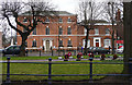
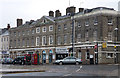
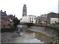
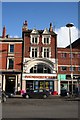
Photos of PE21 6RU


Area Information
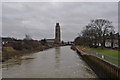
Living in PE21 6RU offers a specific residential experience centred around a tightly defined cluster of properties. This postcode covers a mere 499 square metres of land, indicating a highly concentrated area rather than a sprawling neighbourhood. With a population of 1,585 residents, the community functions as a small, intimate cluster within the wider region. The density figure of 3,178,912 people per square kilometre reflects the mathematical concentration within this specific code, though the reality for residents is likely defined by the physical proximity of homes rather than extreme crowding. This area serves as a distinct pocket of housing where daily life revolves around an immediate, localised environment. Prospective buyers should understand that PE21 6RU is not a large district but a precise location, making it easy to navigate while ensuring you are exactly where you intend to be. The compact nature of the zone means that accessing your immediate surroundings often requires minimal travel, fitting well with those who prefer a straightforward, low-movement lifestyle.
- Area Type
- Postcode
- Area Size
- 499 m²
- Population
- 1585
- Population Density
- 2866 people/km²
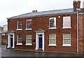
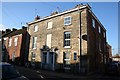
Homes in PE21 6RU are characterised by a housing stock that is primarily composed of houses. This distinguishes the area from urban zones where flats or apartments dominate the skyline. With only 499 square metres of land covered, the physical footprint of the residential cluster is small, yet the accommodation type remains consistent with a traditional suburban or semi-rural dwelling style. The home ownership rate of 44 per cent signals that nearly half of the residents purchase their properties, while the other half reside in rented accommodation. This balance suggests a functional property market where both buying and renting options are active. For buyers, the presence of houses implies access to gardens and private living spaces, contrasted with the shared walls of flat complexes. The limited land area means that properties in this postcode are likely closer together than in a wider borough. This compact layout means that neighbours are immediate influences on daily life. The market here reflects a niche slice of the broader England housing sector, offering a specific type of house-based living within a constrained geographical boundary.
House Prices in PE21 6RU
No properties found in this postcode.
Energy Efficiency in PE21 6RU
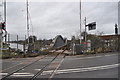
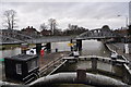
Residents of PE21 6RU benefit from a practical list of retail and transport amenities within practical reach. The area provides access to five nearby retail outlets, including Heron Boston, Lidl Langrick, and Morrisons Daily. These shops offer essential goods and daily necessities, ensuring you do not need to travel far for groceries or essential purchases. Transport links are supported by two railway stations: Boston Railway Station and Hubberts Bridge Railway Station. The presence of these rail hubs allows residents to connect to wider networks for commuting or leisure travel. Having a Morrisons Daily nearby means quick access to fresh produce and household items. Lidl Langrick and Heron Boston provide alternative shopping choices, appealing to different consumer preferences. This amenity mix creates a self-contained lifestyle where daily requirements are met locally. You can complete most errands without leaving the immediate vicinity of the postcode. The combination of these facilities supports a convenient, low-effort daily routine for housebound or busy families.
Amenities
Schools
Conway School is the only specific educational institution named in the immediate vicinity of PE21 6RU. This facility operates as an independent school, presenting a distinct option for families seeking private education. The presence of an independent school suggests that the area attracts families who can afford alternative schooling arrangements outside the state system. Because no other schools are listed in the data for this specific postcode, prospective parents must look to this single institution as the primary local option. The independence of the school often correlates with different pedagogical approaches compared to state-funded academies or maintained schools. Families considering homes in PE21 6RU will need to verify the current Ofsted rating and admission criteria for Conway School directly. Relying solely on the name and type provided may be insufficient for a full educational assessment. You should contact the school office to confirm year-group availability and term dates before making a final decision on a property.
| Rank | School | Type | Entry gender | Ages |
|---|
Explore more schools in this area
Go to Schools tabDemographics
The community profile for PE21 6RU is dominated by adults, with the most common age range falling between 30 and 64 years. The median age sits at 47, confirming that this is an established neighbourhood rather than a hub for young families or students. Home ownership stands at 44 per cent, meaning roughly half of the residents own their homes while the remainder likely rent. Although the data indicates houses as the predominant accommodation type, the high density score attached to this small postcode suggests a unique urban arrangement within the England property landscape. The area is predominantly White, reflecting a specific demographic composition. Understanding that the majority of residents are working-age adults helps buyers gauge the local pace of life. This age bracket typically correlates with established careers or retirement planning, suggesting a stable, mature population. The 44 per cent ownership rate indicates a balanced mix of owner-occupiers and tenant households. This distribution suggests a practical, lived-in environment without the transient feel of a purely tourist or student zone.
Household Size
Accommodation Type
Tenure
Ethnic Group
Religion
Household Composition
Age
Household Deprivation
NS-SEC
Explore more demographic insights in this area
Go to Demographics tabPlanning
Planning Constraints
- Flood RiskPremium
- Ramsar Wetland SitesPremium
- Area of Outstanding Natural BeautyPremium
- Protected Nature ReservePremium
- Protected WoodlandPremium