Area Overview for PE21 6PE
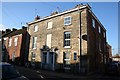
Photos of PE21 6PE


Area Information
You are looking at a very small, densely populated residential cluster defined by the postcode PE21 6PE. This specific area covers just 1.2 hectares, yet it holds a population of 1,585 people. This results in an extremely high population density of 131,244 people per square kilometre. Living in this concentrated zone means you reside within a compact footprint close enough for daily necessities but with unique structural characteristics typical of such small urban clusters. The area functions as a tight-knit residential pocket where every resident is close to their neighbour. You experience a neighbourhood defined strictly by volume rather than expansive sprawl. The sheer number of people within such a limited space shapes the daily rhythm of the area. It is an environment where local services and residential buildings are packed closely together. Prospective buyers should understand that this is a micro-community with a precise population count and no margin for expansion or zoning changes. The location offers immediate proximity to neighbours, creating a distinct sense of community density found nowhere else in the wider PE21 region. ### The community in PE21 6PE is dominated by adults between the ages of 30 and 64 years. The median age for residents is 47, indicating a mature demographic profile. Contrary to areas geared toward young families or retirees, this neighbourhood caters primarily to working-age adults. Only 44% of residents own their homes, meaning the majority live in rented accommodation. Houses form the main type of accommodation available in this postcode area, though the high rental proportion suggests many occupants are expatriates or students living with owners. The predominant ethnic group is White, reflecting the general demographics of this part of Lincolnshire. You will find a community composed largely of settled adult households rather than transient populations. The lack of significant youth or elderly skew highlights a workforce-centred population. This age distribution often correlates with lower rates of single-parent households and higher rates of dual-income families. Deprivation levels are not explicitly detailed in available statistics, but the high density and mixed ownership suggest a standard middle-to-working-class community. The area lacks the diversity seen in major metropolitan centres, focusing instead on a traditional, age-defined demographic structure typical of smaller English towns. ### The housing stock in PE21 6PE is characterised by houses, which remain the predominant form of accommodation. However, only 44% of residents are homeowners, indicating that more than half the population rents their homes. This split creates a market where you might encounter both owner-occupied properties available for purchase and rental units frequently on the market. The high density of 131,244 people per square kilometre on just 1.2 hectares implies that available housing inventory is tight. You may find limited space to choose between different floor plans or property styles compared to wider suburban areas. The presence of independent schools nearby, such as Conway School, often influences property values and demand. Families seeking homes near these institutions might compete for the same limited stock of houses. Buyers should expect a market driven by proximity to amenities and specific educational facilities rather than vast plots of land. The 55% rental rate suggests a significant share of the market is tailored to tenants. You must consider whether you are buying into a stable, long-term community or entering a sector with higher turnover. The property landscape is defined by this specific balance of part-ownership and part-rental within a very small geographical boundary. ### The educational landscape immediately surrounding PE21 6PE centres on one key institution: Conway School. This is an independent school serving the local catchment. You do not have access to a diverse range of state or faith-based options listed in the immediate vicinity. The presence of a private institution means families typically have the financial capacity for independent education. Many residents may choose to send their children directly to Conway School or commute from neighbouring areas. For those seeking state education, the nearest options are not detailed in the current data, so you must look further afield. The independence of Conway School often implies higher fee costs for parents, which aligns with the area's mature demographic profile. There are no comprehensive lists of nearby state primary or secondary schools provided for this specific postcode. Consequently, the school-run traffic in the mornings and evenings will largely reflect the intake of this single independent governing body. Families considering purchase here should verify the school's age range and curriculum fit. The absence of other listed schools makes this area distinct, often catering to those who prioritise independent education over state-system schooling. ### Digital connectivity in PE21 6PE is robust, supporting both remote work and daily internet usage without significant hindrance. Fixed broadband quality scores at 95 on a 0 to 100 scale, which rates as excellent. You can expect fast, reliable fixed-line internet suitable for high-bandwidth activities like streaming or video conferencing. Mobile network coverage also performs well, scoring 84 out of 100. This is a good rating, ensuring you stay connected while walking around the neighbourhood or stepping outside your home. For residents working from home, the area offers sufficient digital infrastructure to handle modern connectivity demands. High-speed broadband means you can keep up with colleagues even during peak usage times. Good mobile signal complements this, providing redundancy if you move locations within the village. The combination of a top-tier broadband score and a solid mobile score removes digital concerns for most professionals. You do not need to worry about poor signal zones disrupting your daily routine. The area's digital readiness supports a flexible lifestyle where location does not dictate internet speed. Whether you are uploading large files or making business calls, the connection quality meets high standards found in many parts of the UK. ### Your daily life in PE21 6PE is anchored by immediate access to essential retail and travel hubs. Five notable retail locations serve the local population, including Lidl Langrick, Iceland Boston, and Heron Boston. These high street stores provide routine shopping for food and general goods without requiring long journeys. You can visit Iceland Boston for fresh produce or Lidl Langrick for value groceries within walking or short driving distance. Two railway stations offer convenient rail connections: Boston Railway Station and Hubberts Bridge Railway Station. These hubs link the area to broader transport networks, making commuting feasible for those working outside the immediate vicinity. The proximity of these amenities defines the practical convenience of living here. You avoid the need for extensive car dependency for basic tasks. Retail choices are focused on established chains, offering reliability and familiarity. The rail links provide a lifeline to Peterborough, Lincoln, and beyond, integrating this small postcode into the wider regional economy. Your lifestyle blends the convenience of nearby supermarkets with the connectivity of national rail services. This balance ensures that even in a dense, small-area postcode, you maintain access to the wider world efficiently. ### Safety and environmental factors in PE21 6PE present a mixture of significant concerns and clear positives. The crime risk assessment is critical, with a safety score of 1 out of 100. Crime rates are above average, and enhanced security measures are recommended for residents. You must remain vigilant and consider installing smart locks or alarm systems to protect your property. This high risk level distinguishes the area and requires proactive safety planning. In contrast, the flood risk assessment is also critical, showing a score of 100 out of 100. This indicates high flood risk coverage, meaning you should review insurance policies carefully and check building drainage systems. However, several planning constraints offer reassurance. There is no Ramsar wetland coverage, no Area of Outstanding Natural Beauty designation, and no protected nature reserve or woodland within the boundaries. These passing assessments mean you face fewer restrictions on future development or landscaping changes. You will not encounter the complicated planning arguments often found near protected ecological sites. Despite the excellent planning constraints, the critical grades for crime and flooding dominate the safety profile. Residents must navigate these real risks while benefiting from the lack of environmental planning constraints. ### What is the community feel like in PE21 6PE? This is a tightly packed residential cluster with 1,585 people on just 1.2 hectares. The median age is 47, creating a mature community dominated by adults aged 30 to 64. With only 44% home ownership, it functions as a mixed market of renters and owners rather than a purely family-led enclave. The area is defined by its high density and proximity to local services. What schools are available near this postcode? The primary educational facility listed is Conway School, an independent school. There are no other state or faith-based schools mentioned in the immediate vicinity data. This suggests families may rely on this private institution or commute further for state education options. The availability of education is thus centred on this single independent provider. Is the area safe and environmentally constrained? Safety is a distinct concern with a critical crime risk score of 1/100 and an equally critical flood risk score of 100/100. Residents face above-average crime rates and potential flooding issues. Conversely, there are no planning constraints like protected woodlands, AONBs, or Ramsar sites, which allows for greater flexibility in local development and property use. How well does the area connect to the wider region? Digital connectivity is excellent, with a broadband score of 95/100 and a mobile score of 84/100. Transport links include Boston Railway Station and Hubberts Bridge Railway Station for train travel. Local retail options include Lidl Langrick, Iceland Boston, and Heron Boston, ensuring daily needs are met within a small footprint.
- Area Type
- Postcode
- Area Size
- 1.2 hectares
- Population
- 1585
- Population Density
- 2866 people/km²
The housing stock in PE21 6PE is characterised by houses, which remain the predominant form of accommodation. However, only 44% of residents are homeowners, indicating that more than half the population rents their homes. This split creates a market where you might encounter both owner-occupied properties available for purchase and rental units frequently on the market. The high density of 131,244 people per square kilometre on just 1.2 hectares implies that available housing inventory is tight. You may find limited space to choose between different floor plans or property styles compared to wider suburban areas. The presence of independent schools nearby, such as Conway School, often influences property values and demand. Families seeking homes near these institutions might compete for the same limited stock of houses. Buyers should expect a market driven by proximity to amenities and specific educational facilities rather than vast plots of land. The 55% rental rate suggests a significant share of the market is tailored to tenants. You must consider whether you are buying into a stable, long-term community or entering a sector with higher turnover. The property landscape is defined by this specific balance of part-ownership and part-rental within a very small geographical boundary. ### The educational landscape immediately surrounding PE21 6PE centres on one key institution: Conway School. This is an independent school serving the local catchment. You do not have access to a diverse range of state or faith-based options listed in the immediate vicinity. The presence of a private institution means families typically have the financial capacity for independent education. Many residents may choose to send their children directly to Conway School or commute from neighbouring areas. For those seeking state education, the nearest options are not detailed in the current data, so you must look further afield. The independence of Conway School often implies higher fee costs for parents, which aligns with the area's mature demographic profile. There are no comprehensive lists of nearby state primary or secondary schools provided for this specific postcode. Consequently, the school-run traffic in the mornings and evenings will largely reflect the intake of this single independent governing body. Families considering purchase here should verify the school's age range and curriculum fit. The absence of other listed schools makes this area distinct, often catering to those who prioritise independent education over state-system schooling. ### Digital connectivity in PE21 6PE is robust, supporting both remote work and daily internet usage without significant hindrance. Fixed broadband quality scores at 95 on a 0 to 100 scale, which rates as excellent. You can expect fast, reliable fixed-line internet suitable for high-bandwidth activities like streaming or video conferencing. Mobile network coverage also performs well, scoring 84 out of 100. This is a good rating, ensuring you stay connected while walking around the neighbourhood or stepping outside your home. For residents working from home, the area offers sufficient digital infrastructure to handle modern connectivity demands. High-speed broadband means you can keep up with colleagues even during peak usage times. Good mobile signal complements this, providing redundancy if you move locations within the village. The combination of a top-tier broadband score and a solid mobile score removes digital concerns for most professionals. You do not need to worry about poor signal zones disrupting your daily routine. The area's digital readiness supports a flexible lifestyle where location does not dictate internet speed. Whether you are uploading large files or making business calls, the connection quality meets high standards found in many parts of the UK. ### Your daily life in PE21 6PE is anchored by immediate access to essential retail and travel hubs. Five notable retail locations serve the local population, including Lidl Langrick, Iceland Boston, and Heron Boston. These high street stores provide routine shopping for food and general goods without requiring long journeys. You can visit Iceland Boston for fresh produce or Lidl Langrick for value groceries within walking or short driving distance. Two railway stations offer convenient rail connections: Boston Railway Station and Hubberts Bridge Railway Station. These hubs link the area to broader transport networks, making commuting feasible for those working outside the immediate vicinity. The proximity of these amenities defines the practical convenience of living here. You avoid the need for extensive car dependency for basic tasks. Retail choices are focused on established chains, offering reliability and familiarity. The rail links provide a lifeline to Peterborough, Lincoln, and beyond, integrating this small postcode into the wider regional economy. Your lifestyle blends the convenience of nearby supermarkets with the connectivity of national rail services. This balance ensures that even in a dense, small-area postcode, you maintain access to the wider world efficiently. ### Safety and environmental factors in PE21 6PE present a mixture of significant concerns and clear positives. The crime risk assessment is critical, with a safety score of 1 out of 100. Crime rates are above average, and enhanced security measures are recommended for residents. You must remain vigilant and consider installing smart locks or alarm systems to protect your property. This high risk level distinguishes the area and requires proactive safety planning. In contrast, the flood risk assessment is also critical, showing a score of 100 out of 100. This indicates high flood risk coverage, meaning you should review insurance policies carefully and check building drainage systems. However, several planning constraints offer reassurance. There is no Ramsar wetland coverage, no Area of Outstanding Natural Beauty designation, and no protected nature reserve or woodland within the boundaries. These passing assessments mean you face fewer restrictions on future development or landscaping changes. You will not encounter the complicated planning arguments often found near protected ecological sites. Despite the excellent planning constraints, the critical grades for crime and flooding dominate the safety profile. Residents must navigate these real risks while benefiting from the lack of environmental planning constraints. ### What is the community feel like in PE21 6PE? This is a tightly packed residential cluster with 1,585 people on just 1.2 hectares. The median age is 47, creating a mature community dominated by adults aged 30 to 64. With only 44% home ownership, it functions as a mixed market of renters and owners rather than a purely family-led enclave. The area is defined by its high density and proximity to local services. What schools are available near this postcode? The primary educational facility listed is Conway School, an independent school. There are no other state or faith-based schools mentioned in the immediate vicinity data. This suggests families may rely on this private institution or commute further for state education options. The availability of education is thus centred on this single independent provider. Is the area safe and environmentally constrained? Safety is a distinct concern with a critical crime risk score of 1/100 and an equally critical flood risk score of 100/100. Residents face above-average crime rates and potential flooding issues. Conversely, there are no planning constraints like protected woodlands, AONBs, or Ramsar sites, which allows for greater flexibility in local development and property use. How well does the area connect to the wider region? Digital connectivity is excellent, with a broadband score of 95/100 and a mobile score of 84/100. Transport links include Boston Railway Station and Hubberts Bridge Railway Station for train travel. Local retail options include Lidl Langrick, Iceland Boston, and Heron Boston, ensuring daily needs are met within a small footprint.
House Prices in PE21 6PE
Showing 28 properties
| Address | Type | Beds | Baths | Last Sale Price | Last Sale Date | |
|---|---|---|---|---|---|---|
| 67 Norfolk Street, Boston, PE21 6PE | Bungalow | - | - | £180,000 | Jul 2025 | |
| 57 Norfolk Street, Boston, PE21 6PE | Semi-detached | 3 | 3 | £190,000 | Jul 2024 | |
| Minden House, 22 Norfolk Street, Boston, PE21 6PE | Semi-detached | 1 | 2 | £177,650 | Jul 2023 | |
| 69 Norfolk Street, Boston, PE21 6PE | Detached | 3 | 2 | £229,000 | Aug 2022 | |
| 71 Norfolk Street, Boston, PE21 6PE | Semi-detached | 2 | 1 | £165,000 | Nov 2020 | |
| 83 Norfolk Street, Boston, PE21 6PE | house | - | - | £175,000 | Dec 2018 | |
| 24 Norfolk Street, Boston, PE21 6PE | house | - | - | £130,000 | Nov 2016 | |
| 77A Norfolk Street, Boston, PE21 6PE | Detached | 3 | 2 | £183,000 | Apr 2015 | |
| Kingswood, 75 Norfolk Street, Boston, PE21 6PE | Semi-detached | 5 | - | £165,000 | Feb 2015 | |
| 65 Norfolk Street, Boston, PE21 6PE | Detached | 3 | - | £72,000 | Apr 2014 |
Energy Efficiency in PE21 6PE
Your daily life in PE21 6PE is anchored by immediate access to essential retail and travel hubs. Five notable retail locations serve the local population, including Lidl Langrick, Iceland Boston, and Heron Boston. These high street stores provide routine shopping for food and general goods without requiring long journeys. You can visit Iceland Boston for fresh produce or Lidl Langrick for value groceries within walking or short driving distance. Two railway stations offer convenient rail connections: Boston Railway Station and Hubberts Bridge Railway Station. These hubs link the area to broader transport networks, making commuting feasible for those working outside the immediate vicinity. The proximity of these amenities defines the practical convenience of living here. You avoid the need for extensive car dependency for basic tasks. Retail choices are focused on established chains, offering reliability and familiarity. The rail links provide a lifeline to Peterborough, Lincoln, and beyond, integrating this small postcode into the wider regional economy. Your lifestyle blends the convenience of nearby supermarkets with the connectivity of national rail services. This balance ensures that even in a dense, small-area postcode, you maintain access to the wider world efficiently. ### Safety and environmental factors in PE21 6PE present a mixture of significant concerns and clear positives. The crime risk assessment is critical, with a safety score of 1 out of 100. Crime rates are above average, and enhanced security measures are recommended for residents. You must remain vigilant and consider installing smart locks or alarm systems to protect your property. This high risk level distinguishes the area and requires proactive safety planning. In contrast, the flood risk assessment is also critical, showing a score of 100 out of 100. This indicates high flood risk coverage, meaning you should review insurance policies carefully and check building drainage systems. However, several planning constraints offer reassurance. There is no Ramsar wetland coverage, no Area of Outstanding Natural Beauty designation, and no protected nature reserve or woodland within the boundaries. These passing assessments mean you face fewer restrictions on future development or landscaping changes. You will not encounter the complicated planning arguments often found near protected ecological sites. Despite the excellent planning constraints, the critical grades for crime and flooding dominate the safety profile. Residents must navigate these real risks while benefiting from the lack of environmental planning constraints. ### What is the community feel like in PE21 6PE? This is a tightly packed residential cluster with 1,585 people on just 1.2 hectares. The median age is 47, creating a mature community dominated by adults aged 30 to 64. With only 44% home ownership, it functions as a mixed market of renters and owners rather than a purely family-led enclave. The area is defined by its high density and proximity to local services. What schools are available near this postcode? The primary educational facility listed is Conway School, an independent school. There are no other state or faith-based schools mentioned in the immediate vicinity data. This suggests families may rely on this private institution or commute further for state education options. The availability of education is thus centred on this single independent provider. Is the area safe and environmentally constrained? Safety is a distinct concern with a critical crime risk score of 1/100 and an equally critical flood risk score of 100/100. Residents face above-average crime rates and potential flooding issues. Conversely, there are no planning constraints like protected woodlands, AONBs, or Ramsar sites, which allows for greater flexibility in local development and property use. How well does the area connect to the wider region? Digital connectivity is excellent, with a broadband score of 95/100 and a mobile score of 84/100. Transport links include Boston Railway Station and Hubberts Bridge Railway Station for train travel. Local retail options include Lidl Langrick, Iceland Boston, and Heron Boston, ensuring daily needs are met within a small footprint.
Amenities
Schools
The educational landscape immediately surrounding PE21 6PE centres on one key institution: Conway School. This is an independent school serving the local catchment. You do not have access to a diverse range of state or faith-based options listed in the immediate vicinity. The presence of a private institution means families typically have the financial capacity for independent education. Many residents may choose to send their children directly to Conway School or commute from neighbouring areas. For those seeking state education, the nearest options are not detailed in the current data, so you must look further afield. The independence of Conway School often implies higher fee costs for parents, which aligns with the area's mature demographic profile. There are no comprehensive lists of nearby state primary or secondary schools provided for this specific postcode. Consequently, the school-run traffic in the mornings and evenings will largely reflect the intake of this single independent governing body. Families considering purchase here should verify the school's age range and curriculum fit. The absence of other listed schools makes this area distinct, often catering to those who prioritise independent education over state-system schooling. ### Digital connectivity in PE21 6PE is robust, supporting both remote work and daily internet usage without significant hindrance. Fixed broadband quality scores at 95 on a 0 to 100 scale, which rates as excellent. You can expect fast, reliable fixed-line internet suitable for high-bandwidth activities like streaming or video conferencing. Mobile network coverage also performs well, scoring 84 out of 100. This is a good rating, ensuring you stay connected while walking around the neighbourhood or stepping outside your home. For residents working from home, the area offers sufficient digital infrastructure to handle modern connectivity demands. High-speed broadband means you can keep up with colleagues even during peak usage times. Good mobile signal complements this, providing redundancy if you move locations within the village. The combination of a top-tier broadband score and a solid mobile score removes digital concerns for most professionals. You do not need to worry about poor signal zones disrupting your daily routine. The area's digital readiness supports a flexible lifestyle where location does not dictate internet speed. Whether you are uploading large files or making business calls, the connection quality meets high standards found in many parts of the UK. ### Your daily life in PE21 6PE is anchored by immediate access to essential retail and travel hubs. Five notable retail locations serve the local population, including Lidl Langrick, Iceland Boston, and Heron Boston. These high street stores provide routine shopping for food and general goods without requiring long journeys. You can visit Iceland Boston for fresh produce or Lidl Langrick for value groceries within walking or short driving distance. Two railway stations offer convenient rail connections: Boston Railway Station and Hubberts Bridge Railway Station. These hubs link the area to broader transport networks, making commuting feasible for those working outside the immediate vicinity. The proximity of these amenities defines the practical convenience of living here. You avoid the need for extensive car dependency for basic tasks. Retail choices are focused on established chains, offering reliability and familiarity. The rail links provide a lifeline to Peterborough, Lincoln, and beyond, integrating this small postcode into the wider regional economy. Your lifestyle blends the convenience of nearby supermarkets with the connectivity of national rail services. This balance ensures that even in a dense, small-area postcode, you maintain access to the wider world efficiently. ### Safety and environmental factors in PE21 6PE present a mixture of significant concerns and clear positives. The crime risk assessment is critical, with a safety score of 1 out of 100. Crime rates are above average, and enhanced security measures are recommended for residents. You must remain vigilant and consider installing smart locks or alarm systems to protect your property. This high risk level distinguishes the area and requires proactive safety planning. In contrast, the flood risk assessment is also critical, showing a score of 100 out of 100. This indicates high flood risk coverage, meaning you should review insurance policies carefully and check building drainage systems. However, several planning constraints offer reassurance. There is no Ramsar wetland coverage, no Area of Outstanding Natural Beauty designation, and no protected nature reserve or woodland within the boundaries. These passing assessments mean you face fewer restrictions on future development or landscaping changes. You will not encounter the complicated planning arguments often found near protected ecological sites. Despite the excellent planning constraints, the critical grades for crime and flooding dominate the safety profile. Residents must navigate these real risks while benefiting from the lack of environmental planning constraints. ### What is the community feel like in PE21 6PE? This is a tightly packed residential cluster with 1,585 people on just 1.2 hectares. The median age is 47, creating a mature community dominated by adults aged 30 to 64. With only 44% home ownership, it functions as a mixed market of renters and owners rather than a purely family-led enclave. The area is defined by its high density and proximity to local services. What schools are available near this postcode? The primary educational facility listed is Conway School, an independent school. There are no other state or faith-based schools mentioned in the immediate vicinity data. This suggests families may rely on this private institution or commute further for state education options. The availability of education is thus centred on this single independent provider. Is the area safe and environmentally constrained? Safety is a distinct concern with a critical crime risk score of 1/100 and an equally critical flood risk score of 100/100. Residents face above-average crime rates and potential flooding issues. Conversely, there are no planning constraints like protected woodlands, AONBs, or Ramsar sites, which allows for greater flexibility in local development and property use. How well does the area connect to the wider region? Digital connectivity is excellent, with a broadband score of 95/100 and a mobile score of 84/100. Transport links include Boston Railway Station and Hubberts Bridge Railway Station for train travel. Local retail options include Lidl Langrick, Iceland Boston, and Heron Boston, ensuring daily needs are met within a small footprint.
| Rank | School | Type | Entry gender | Ages |
|---|
Explore more schools in this area
Go to Schools tabDemographics
The community in PE21 6PE is dominated by adults between the ages of 30 and 64 years. The median age for residents is 47, indicating a mature demographic profile. Contrary to areas geared toward young families or retirees, this neighbourhood caters primarily to working-age adults. Only 44% of residents own their homes, meaning the majority live in rented accommodation. Houses form the main type of accommodation available in this postcode area, though the high rental proportion suggests many occupants are expatriates or students living with owners. The predominant ethnic group is White, reflecting the general demographics of this part of Lincolnshire. You will find a community composed largely of settled adult households rather than transient populations. The lack of significant youth or elderly skew highlights a workforce-centred population. This age distribution often correlates with lower rates of single-parent households and higher rates of dual-income families. Deprivation levels are not explicitly detailed in available statistics, but the high density and mixed ownership suggest a standard middle-to-working-class community. The area lacks the diversity seen in major metropolitan centres, focusing instead on a traditional, age-defined demographic structure typical of smaller English towns. ### The housing stock in PE21 6PE is characterised by houses, which remain the predominant form of accommodation. However, only 44% of residents are homeowners, indicating that more than half the population rents their homes. This split creates a market where you might encounter both owner-occupied properties available for purchase and rental units frequently on the market. The high density of 131,244 people per square kilometre on just 1.2 hectares implies that available housing inventory is tight. You may find limited space to choose between different floor plans or property styles compared to wider suburban areas. The presence of independent schools nearby, such as Conway School, often influences property values and demand. Families seeking homes near these institutions might compete for the same limited stock of houses. Buyers should expect a market driven by proximity to amenities and specific educational facilities rather than vast plots of land. The 55% rental rate suggests a significant share of the market is tailored to tenants. You must consider whether you are buying into a stable, long-term community or entering a sector with higher turnover. The property landscape is defined by this specific balance of part-ownership and part-rental within a very small geographical boundary. ### The educational landscape immediately surrounding PE21 6PE centres on one key institution: Conway School. This is an independent school serving the local catchment. You do not have access to a diverse range of state or faith-based options listed in the immediate vicinity. The presence of a private institution means families typically have the financial capacity for independent education. Many residents may choose to send their children directly to Conway School or commute from neighbouring areas. For those seeking state education, the nearest options are not detailed in the current data, so you must look further afield. The independence of Conway School often implies higher fee costs for parents, which aligns with the area's mature demographic profile. There are no comprehensive lists of nearby state primary or secondary schools provided for this specific postcode. Consequently, the school-run traffic in the mornings and evenings will largely reflect the intake of this single independent governing body. Families considering purchase here should verify the school's age range and curriculum fit. The absence of other listed schools makes this area distinct, often catering to those who prioritise independent education over state-system schooling. ### Digital connectivity in PE21 6PE is robust, supporting both remote work and daily internet usage without significant hindrance. Fixed broadband quality scores at 95 on a 0 to 100 scale, which rates as excellent. You can expect fast, reliable fixed-line internet suitable for high-bandwidth activities like streaming or video conferencing. Mobile network coverage also performs well, scoring 84 out of 100. This is a good rating, ensuring you stay connected while walking around the neighbourhood or stepping outside your home. For residents working from home, the area offers sufficient digital infrastructure to handle modern connectivity demands. High-speed broadband means you can keep up with colleagues even during peak usage times. Good mobile signal complements this, providing redundancy if you move locations within the village. The combination of a top-tier broadband score and a solid mobile score removes digital concerns for most professionals. You do not need to worry about poor signal zones disrupting your daily routine. The area's digital readiness supports a flexible lifestyle where location does not dictate internet speed. Whether you are uploading large files or making business calls, the connection quality meets high standards found in many parts of the UK. ### Your daily life in PE21 6PE is anchored by immediate access to essential retail and travel hubs. Five notable retail locations serve the local population, including Lidl Langrick, Iceland Boston, and Heron Boston. These high street stores provide routine shopping for food and general goods without requiring long journeys. You can visit Iceland Boston for fresh produce or Lidl Langrick for value groceries within walking or short driving distance. Two railway stations offer convenient rail connections: Boston Railway Station and Hubberts Bridge Railway Station. These hubs link the area to broader transport networks, making commuting feasible for those working outside the immediate vicinity. The proximity of these amenities defines the practical convenience of living here. You avoid the need for extensive car dependency for basic tasks. Retail choices are focused on established chains, offering reliability and familiarity. The rail links provide a lifeline to Peterborough, Lincoln, and beyond, integrating this small postcode into the wider regional economy. Your lifestyle blends the convenience of nearby supermarkets with the connectivity of national rail services. This balance ensures that even in a dense, small-area postcode, you maintain access to the wider world efficiently. ### Safety and environmental factors in PE21 6PE present a mixture of significant concerns and clear positives. The crime risk assessment is critical, with a safety score of 1 out of 100. Crime rates are above average, and enhanced security measures are recommended for residents. You must remain vigilant and consider installing smart locks or alarm systems to protect your property. This high risk level distinguishes the area and requires proactive safety planning. In contrast, the flood risk assessment is also critical, showing a score of 100 out of 100. This indicates high flood risk coverage, meaning you should review insurance policies carefully and check building drainage systems. However, several planning constraints offer reassurance. There is no Ramsar wetland coverage, no Area of Outstanding Natural Beauty designation, and no protected nature reserve or woodland within the boundaries. These passing assessments mean you face fewer restrictions on future development or landscaping changes. You will not encounter the complicated planning arguments often found near protected ecological sites. Despite the excellent planning constraints, the critical grades for crime and flooding dominate the safety profile. Residents must navigate these real risks while benefiting from the lack of environmental planning constraints. ### What is the community feel like in PE21 6PE? This is a tightly packed residential cluster with 1,585 people on just 1.2 hectares. The median age is 47, creating a mature community dominated by adults aged 30 to 64. With only 44% home ownership, it functions as a mixed market of renters and owners rather than a purely family-led enclave. The area is defined by its high density and proximity to local services. What schools are available near this postcode? The primary educational facility listed is Conway School, an independent school. There are no other state or faith-based schools mentioned in the immediate vicinity data. This suggests families may rely on this private institution or commute further for state education options. The availability of education is thus centred on this single independent provider. Is the area safe and environmentally constrained? Safety is a distinct concern with a critical crime risk score of 1/100 and an equally critical flood risk score of 100/100. Residents face above-average crime rates and potential flooding issues. Conversely, there are no planning constraints like protected woodlands, AONBs, or Ramsar sites, which allows for greater flexibility in local development and property use. How well does the area connect to the wider region? Digital connectivity is excellent, with a broadband score of 95/100 and a mobile score of 84/100. Transport links include Boston Railway Station and Hubberts Bridge Railway Station for train travel. Local retail options include Lidl Langrick, Iceland Boston, and Heron Boston, ensuring daily needs are met within a small footprint.
Household Size
Accommodation Type
Tenure
Ethnic Group
Religion
Household Composition
Age
Household Deprivation
NS-SEC
Explore more demographic insights in this area
Go to Demographics tabPlanning
Planning Constraints
- Flood RiskPremium
- Ramsar Wetland SitesPremium
- Area of Outstanding Natural BeautyPremium
- Protected Nature ReservePremium
- Protected WoodlandPremium