Area Overview for PE21 0NP
Photos of PE21 0NP
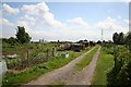
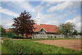
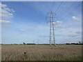
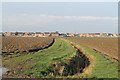
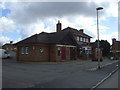
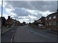
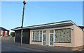
7 photos from this area
Area Information
Key information about the PE21 0NP including its size, population, and administrative classification.
- Area Type
- Postcode
- Area Size
- 1.6 hectares
- Population
- 1676
- Population Density
- 2318 people/km²
House Prices in PE21 0NP
36
Properties
£113,000
Average Sold Price
£46,250
Lowest Price
£194,950
Highest Price
Showing 36 properties
| Address | Type | Beds | Baths | Last Sale Price | Last Sale Date | |
|---|---|---|---|---|---|---|
| 86 Woodthorpe Avenue, Boston, PE21 0NP | Terraced | 2 | 1 | £136,500 | Mar 2022 | |
| 94 Woodthorpe Avenue, Boston, PE21 0NP | Semi-detached | 2 | 1 | £125,000 | Jan 2020 | |
| 44 Woodthorpe Avenue, Boston, PE21 0NP | Semi-detached | 3 | 1 | £148,000 | May 2018 | |
| 96 Woodthorpe Avenue, Boston, PE21 0NP | Semi-detached | 2 | 1 | £124,950 | Aug 2017 | |
| 64 Woodthorpe Avenue, Boston, PE21 0NP | house | 4 | - | £194,950 | Aug 2017 | |
| 46 Woodthorpe Avenue, Boston, PE21 0NP | house | - | - | £104,000 | Mar 2013 | |
| 72 Woodthorpe Avenue, Boston, PE21 0NP | house | 3 | - | £125,000 | Aug 2012 | |
| 78 Woodthorpe Avenue, Boston, PE21 0NP | Detached | - | - | £98,500 | Feb 2011 | |
| 74 Woodthorpe Avenue, Boston, PE21 0NP | house | 3 | 3 | £120,000 | May 2010 | |
| 90 Woodthorpe Avenue, Boston, PE21 0NP | house | - | - | £123,950 | Aug 2007 |
Page 1 of 4
Energy Efficiency in PE21 0NP
Amenities
Schools
| Rank | School | Type | Entry gender | Ages |
|---|
Explore more schools in this area
Go to Schools tabDemographics
Household Size
Two person
most common
Accommodation Type
Houses
most common
Tenure
60
majority
Ethnic Group
White
most common
Religion
N/A
most common
Household Composition
N/A
most common
Age
47
median
Adults (30-64 years)
most common
Household Deprivation
N/A
with no deprivation
NS-SEC
20
in Lower managerial occupations
Explore more demographic insights in this area
Go to Demographics tabPlanning
Planning Constraints
- Flood RiskPremium
- Ramsar Wetland SitesPremium
- Area of Outstanding Natural BeautyPremium
- Protected Nature ReservePremium
- Protected WoodlandPremium