Area Overview for PE20 3RJ
Photos of PE20 3RJ
Area Information
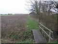
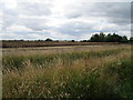
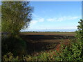
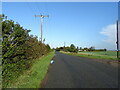
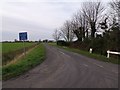
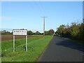
PE20 3RJ defines a specific postcode area covering a small residential cluster on the fringes of Lincolnshire. You are looking at an expanse of 57.5 hectares with a total population of 2,389. This translates to a low density of just 30 people per square kilometre, suggesting a spacious feel where properties are set back from neighbours. Living in this postcode means you accept a location characterised by quiet country roads and open space rather than urban bustle. The area functions as a modest bubble where daily commutes and local errands dominate the rhythm of life. It is a place where time moves slower compared to nearby towns, appealing to those who prioritise solitude over proximity. The sheer compactness of the settlement means you can reach within walking or short driving distance to the main services that define your week. Your days will often centre around the immediate vicinity, as the layout does not sprawl far beyond these boundaries. You should approach this location with an understanding that it is a self-contained pocket of countryside living rather than a suburb of a larger hub. The challenge lies in the isolation, but the reward is the unobstructed views that encompass your surroundings.
- Area Type
- Postcode
- Area Size
- 57.5 hectares
- Population
- 2389
- Population Density
- 30 people/km²
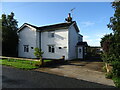
The property market in PE20 3RJ reflects a traditional, owner-occupied landscape. With a staggering 79 per cent home ownership rate, the area functions as a established market for those buying and selling against a long-term plan. You will predominantly encounter detached or semi-detached houses rather than rental apartments or shared properties. This high level of ownership means that the housing stock consists largely of pemilik who have upgraded over decades, leading to a mix of Victorian, Edwardian, or modernised stone cottages. Buyers looking at homes in this area should approach negotiations with the knowledge that seller motivation may vary as owners often sell only after years of living there. The small geographical footprint of 57.5 hectares means the total number of listings is naturally low, creating a slow-moving market where properties stay on the books for longer periods. When you survey the streets, you are seeing a space where families have grown older in the same streets. Availability is a potential constraint you must accept, as few homes trickle onto the market. The accommodation type data confirms that there are no flats to consider, limiting choices strictly to houses.
House Prices in PE20 3RJ
Showing 8 properties
| Address | Type | Beds | Baths | Last Sale Price | Last Sale Date | |
|---|---|---|---|---|---|---|
| Ivy Barn, Chapel Lane, Amber Hill, Boston, PE20 3RJ | Detached | 2 | 1 | £259,950 | Mar 2019 | |
| The Chapel, Chapel Lane, Amber Hill, Boston, PE20 3RJ | Detached | 4 | - | £278,000 | Feb 2019 | |
| May Cottage, Chapel Lane, Amber Hill, Boston, PE20 3RJ | house | - | - | £230,000 | Mar 2017 | |
| Amber House, Chapel Lane, Amber Hill, Boston, PE20 3RJ | Detached | 5 | 2 | £235,000 | Jul 2015 | |
| Kepplegate, Chapel Lane, Amber Hill, Boston, PE20 3RJ | Bungalow | 3 | 1 | £205,000 | Jul 2011 | |
| Gravel Farm, Chapel Lane, Amber Hill, Boston, PE20 3RJ | Farm | - | - | - | - | |
| Annexe, Windmill Lodge, Chapel Lane, Amber Hill, Boston, PE20 3RJ | Flat | - | - | - | - | |
| Windmill Lodge, Chapel Lane, Amber Hill, Boston, PE20 3RJ | Detached | - | - | - | - |
Energy Efficiency in PE20 3RJ
Your daily convenience in PE20 3RJ relies on practical amenities located within practical reach rather than immediate adjacency. For your weekly grocery trips, the Spar and the Lidl Hubberts offer two reliable supermarkets with a combined distance that minimises travel time. These retailers handle the bulk of household shopping needs without requiring a trip to the city centre. The Lincolnshire Co-operative Co is another option that provides a different range of local products, often featuring donations and ethical sourcing. Beyond retail, you have four railway stations nearby to handle your holiday travel or infrequent long-distance commutes. Swineshead Railway Station, Hubberts Bridge Railway Station, and Heckington Railway Station serve as your gateways to the national rail network. There are no specific parks, leisure centres, or dining venues named in the data, so entertainment likely revolves around local pubs not listed or countryside walks. Your lifestyle is defined by the ability to stock up on essentials quickly and take a short drive to the stations when the need arises. The 57.5 hectares of land surrounding you encourages outdoor activity, provided you have access to privately owned common land or nearby country parks not explicitly named here.
Amenities
Schools
Families considering moving to PE20 3RJ have one primary educational option immediately on their doorstep. Toftstead Primary School serves the local community as a primary institution. This is the only school listed within the immediate vicinity of the postcode. For parents, this means their children will enter the national curriculum at this specific local hub to complete the early years of their education. The presence of a single primary school suggests that secondary education requires a longer commute to a neighbouring town such as Sleaford or Lincoln. Living in PE20 3RJ means you rely on Toftstead Primary for the first stage of schooling before arranging onward transport for the 11 plus transition. The school does not offer secondary provisions, so you must factor in travel time when evaluating your overall lifestyle and daily schedule. There are no other named schools in the data provided for this specific area, so your choice is fixed rather than varied. You will need to verify the specific Ofsted rating for Toftstead Primary through official government channels, as the data does not list the specific indicator scores for this single institution.
| Rank | School | Type | Entry gender | Ages |
|---|
Explore more schools in this area
Go to Schools tabDemographics
The community in PE20 3RJ is defined by a mature household structure with a median age of 47 years. Most residents fall into the adult bracket spanning 30 to 64 years of age, indicating a dominance of established families and retirees. This demographic skew suggests a neighbourhood where long-term stability prevails. Homeownership is the primary mode of dwelling, with 79 per cent of residents owning their homes outright or with a mortgage. This high ownership rate implies that the local estate is composed of people who have put down roots and intend to stay for the foreseeable future. The accommodation type is almost exclusively houses, confirming that you will not find council flats or high-rise blocks within this cluster. The predominant ethnic group is White, which aligns with the traditional, consistent character of the village over time. There is no evidence of significant inward migration from other ethnic backgrounds in this specific dataset. Consequently, the social fabric is tight-knit, with neighbours likely knowing each other's names after a short period. The high proportion of owners and the age profile create a predictable environment where property value retention is a historical priority rather than speculative growth.
Household Size
Accommodation Type
Tenure
Ethnic Group
Religion
Household Composition
Age
Household Deprivation
NS-SEC
Explore more demographic insights in this area
Go to Demographics tabPlanning
Planning Constraints
- Flood RiskPremium
- Ramsar Wetland SitesPremium
- Area of Outstanding Natural BeautyPremium
- Protected Nature ReservePremium
- Protected WoodlandPremium