Area Overview for PE20 3RB
Photos of PE20 3RB
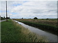
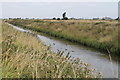
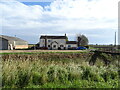
Area Information
Living in PE20 3RB means entering a very specific residential cluster defined by its postcode, which itself does not describe the local streets but marks this small neighbourhood in England. This area covers a total size of 24.1 hectares, creating a contained environment where residents know exactly their geographical boundaries. The population stands at 2,389 people, which results in a low density of just 30 people per square kilometre. This spaciousness defines daily life, offering a quiet atmosphere where houses dominate the landscape rather than high-density blocks. You will find this postcode situated within a community where ownership is the norm, reflecting a settled group that has invested in their local surroundings. The area feels distinct because every square kilometre holds roughly 30 neighbours, fostering a sense of familiarity without the noise of urban sprawl. When you look at the map, PE20 3RB appears as a manageable district where walking distances to amenities are often realistic due to the limited footprint. This specific small cluster provides a clear sense of place, separate from the wider city or town fabric. For anyone considering moving here, the sheer scale and low population count suggest a retreat from busy living into a more subdued rural or semi-rural setting. The character of PE20 3RB is simple: it is a defined pocket of homes surrounded by open space, where the 2,389 residents share a common, low-density environment.
- Area Type
- Postcode
- Area Size
- 24.1 hectares
- Population
- 2389
- Population Density
- 30 people/km²
The housing market in PE20 3RB is overwhelmingly characterised by owner-occupied properties, with 79% of households in this postcode owning their homes. This statistic highlights a market where rental conditions are rare, and the local economy relies heavily on resident stability rather than transient tenancy. The dominant accommodation type is houses, which fits the low-density profile of a 24.1 hectare cluster with only 30 people per square kilometre. You will find that your search here focuses on detached or semi-detached family homes rather than urban apartments or studio flats. Because ownership is so prevalent, sellers in this area are likely to be seasoned property owners looking to move on after many years, or those upgrading to larger properties to suit evolving needs. The scarcity of rental stock means that buying outright or with a mortgage is the only realistic path for securing a permanent home in this specific pocket. The property landscape is monolithic in its make-up, dominated by traditional housing forms suited to the quiet, spacious lifestyle of the region. Buyers targeting PE20 3RB should prepare for a market where competition is low but choice is limited, given the small population of just 2,389. Understanding that this is an owner-led market helps you approach negotiations with an appreciation for the deep ties residents have to their local addresses.
House Prices in PE20 3RB
Showing 5 properties
| Address | Type | Beds | Baths | Last Sale Price | Last Sale Date | |
|---|---|---|---|---|---|---|
| Rosedene, Claydyke Bank, Amber Hill, Boston, PE20 3RB | Bungalow | - | - | £254,000 | Aug 2021 | |
| Claydyke Farm Cottage, Claydyke Bank, Amber Hill, Boston, PE20 3RB | Bungalow | - | - | £300,000 | Dec 2019 | |
| The Stores, Waterside Farm, Claydyke Bank, Amber Hill, Boston, PE20 3RB | warehouse | - | - | - | - | |
| The Barns South Of Waterside, Claydyke Bank, Amber Hill, Boston, PE20 3RB | Detached | - | - | - | - | |
| Waterside Farm, Claydyke Bank, Amber Hill, Boston, PE20 3RB | Bungalow | - | - | - | - |
Energy Efficiency in PE20 3RB
Residents of PE20 3RB benefit from a practical mix of retail and rail transport within practical commuting distance. Four railway stations serve the area, including Hubberts Bridge Railway Station, Swineshead Railway Station, and Boston Railway Station. These hubs allow you to connect to broader transport networks, though you will need to rely on buses or private cars to reach the stations from your home. For daily shops, five retail locations are within close reach, featuring the Lincolnshire Co-operative Co, Spar, and Lidl Hubberts. These venues provide essential groceries and household needs without requiring long journeys into town centres. The presence of major supermarket chains like Co-operative and Lidl ensures you do not need to travel far for basics. While dining and nightlife options are not explicitly listed in the immediate vicinity, the reliable access to three named railway stations opens up wider opportunities for weekend trips or business travel. Living here means prioritising quality of life over urban convenience, while still having immediate access to the essentials through Spar and the Co-operative. The locality supports a self-sufficient lifestyle where your weekly shop is just a short drive or walk away from your house.
Amenities
Schools
For families considering the educational options near PE20 3RB, the immediate surroundings offer Toftstead Primary School as the central local institution. This establishment serves the primary education needs of children living in the nearby cluster and feeds students into the wider county system for secondary schooling. The data confirms only one named school in the immediate vicinity, which places a significant responsibility on this single institution to serve the local community effectively. As the only listed primary option, Toftstead Primary School is the focal point for childhood development within the 24.1 hectares of this postcode. Residents must travel beyond this immediate zone to access secondary education, as no high schools are listed within the direct proximity of PE20 3RB. The school mix is sparse, indicating a quieter community where schooling options are not as layered as they might be in a larger town. When evaluating schools near PE20 3RB, you will find that Toftstead Primary School is the gateway to local learning. Its ratings and performance would be the primary concern for any parent moving into this low-density area, as there are no alternative primary institutions to compare against within the immediate catchment.
| Rank | School | Type | Entry gender | Ages |
|---|
Explore more schools in this area
Go to Schools tabDemographics
The community within the PE20 3RB postcode reflects a mature population with a median age of 47 years. This demographic profile indicates that the core residents fall mostly into the 30 to 64 years age range, making it an area defined by adults rather than families with young children or teenagers. Home ownership stands at 79%, which is significantly higher than the national average and confirms that the vast majority of households in this postcode own their property outright or with a mortgage. This high level of tenure stability means the local culture revolves around homeowners who have established roots in the area. The accommodation type data shows that houses make up the primary housing stock, reinforcing the family-oriented or retiree nature of the community rather than flats or terraced housing. The predominant ethnic group is White, which aligns with the broader profile of established English villages and suburban clusters. With nearly four out of five households owning their homes, you can expect a neighbourhood where long-term residents shape local decisions and school attendance patterns. The age structure and ownership mix suggest a place where people stay for decades, building connections that persist across the 24.1 hectares covered by this single postcode.
Household Size
Accommodation Type
Tenure
Ethnic Group
Religion
Household Composition
Age
Household Deprivation
NS-SEC
Explore more demographic insights in this area
Go to Demographics tabPlanning
Planning Constraints
- Flood RiskPremium
- Ramsar Wetland SitesPremium
- Area of Outstanding Natural BeautyPremium
- Protected Nature ReservePremium
- Protected WoodlandPremium