Area Overview for PE20 2LB
Photos of PE20 2LB
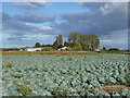
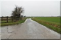
6 photos from this area
Area Information
Key information about the PE20 2LB including its size, population, and administrative classification.
- Area Type
- Postcode
- Area Size
- 87.7 hectares
- Population
- 1637
- Population Density
- 59 people/km²
House Prices in PE20 2LB
6
Properties
£274,050
Average Sold Price
£114,950
Lowest Price
£380,000
Highest Price
Showing 6 properties
| Address | Type | Beds | Baths | Last Sale Price | Last Sale Date | |
|---|---|---|---|---|---|---|
| Lynway, Dowdyke Road, Sutterton, Boston, PE20 2LB | Detached | 4 | - | £327,200 | Apr 2021 | |
| The Barn, Dowdyke Road, Sutterton, Boston, PE20 2LB | Semi-detached | - | - | £380,000 | Feb 2021 | |
| Ivy House, Dowdyke Road, Sutterton, Boston, PE20 2LB | Detached | - | - | £114,950 | Dec 1998 | |
| Gallery Tea Room, Cherry Holt Studio, Dowdyke Road, Sutterton, Boston, PE20 2LB | Restaurant | - | - | - | - | |
| Marlin Lodge, Dowdyke Road, Sutterton, Boston, PE20 2LB | Detached | - | - | - | - | |
| Willow Farm, Waterbelly Lane, Sutterton, Boston, PE20 2LB | Bungalow | - | - | - | - |
Energy Efficiency in PE20 2LB
Amenities
Schools
| Rank | School | Type | Entry gender | Ages |
|---|
Explore more schools in this area
Go to Schools tabDemographics
Household Size
Two person
most common
Accommodation Type
Houses
most common
Tenure
65
majority
Ethnic Group
White
most common
Religion
N/A
most common
Household Composition
N/A
most common
Age
47
median
Adults (30-64 years)
most common
Household Deprivation
N/A
with no deprivation
NS-SEC
22
in Lower managerial occupations
Explore more demographic insights in this area
Go to Demographics tabPlanning
Planning Constraints
- Flood RiskPremium
- Ramsar Wetland SitesPremium
- Area of Outstanding Natural BeautyPremium
- Protected Nature ReservePremium
- Protected WoodlandPremium