Area Overview for PE20 1LP
Photos of PE20 1LP
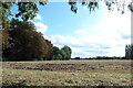
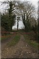
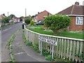
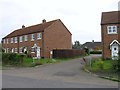
12 photos from this area
Area Information
Key information about the PE20 1LP including its size, population, and administrative classification.
- Area Type
- Postcode
- Area Size
- 3694 m²
- Population
- 2910
- Population Density
- 373 people/km²
House Prices in PE20 1LP
13
Properties
£150,177
Average Sold Price
£94,500
Lowest Price
£200,000
Highest Price
Showing 13 properties
| Address | Type | Beds | Baths | Last Sale Price | Last Sale Date | |
|---|---|---|---|---|---|---|
| 6 Kime Mews, Kirton, Boston, PE20 1LP | Semi-detached | 4 | 2 | £170,000 | Oct 2024 | |
| 11 Kime Mews, Kirton, Boston, PE20 1LP | Semi-detached | 4 | 2 | £200,000 | Apr 2024 | |
| 9 Kime Mews, Kirton, Boston, PE20 1LP | Terraced | 3 | 2 | £139,950 | Feb 2020 | |
| 12 Kime Mews, Kirton, Boston, PE20 1LP | house | - | - | £140,000 | Nov 2019 | |
| 1 Kime Mews, Kirton, Boston, PE20 1LP | house | - | - | £94,500 | Sep 2008 | |
| 5 Kime Mews, Kirton, Boston, PE20 1LP | house | - | - | £152,950 | Apr 2007 | |
| 2 Kime Mews, Kirton, Boston, PE20 1LP | house | - | - | £158,825 | Nov 2006 | |
| 3 Kime Mews, Kirton, Boston, PE20 1LP | house | - | - | £164,705 | Oct 2006 | |
| 4 Kime Mews, Kirton, Boston, PE20 1LP | house | - | - | £147,000 | Jul 2006 | |
| 7 Kime Mews, Kirton, Boston, PE20 1LP | house | - | - | £147,370 | May 2006 |
Page 1 of 2
Energy Efficiency in PE20 1LP
Amenities
Schools
| Rank | School | Type | Entry gender | Ages |
|---|
Explore more schools in this area
Go to Schools tabDemographics
Household Size
Two person
most common
Accommodation Type
Houses
most common
Tenure
70
majority
Ethnic Group
White
most common
Religion
N/A
most common
Household Composition
N/A
most common
Age
47
median
Adults (30-64 years)
most common
Household Deprivation
N/A
with no deprivation
NS-SEC
27
in Lower managerial occupations
Explore more demographic insights in this area
Go to Demographics tabPlanning
Planning Constraints
- Flood RiskPremium
- Ramsar Wetland SitesPremium
- Area of Outstanding Natural BeautyPremium
- Protected Nature ReservePremium
- Protected WoodlandPremium