Area Overview for PE12 9UE
Photos of PE12 9UE

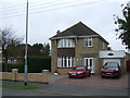
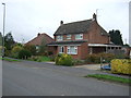
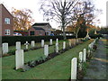

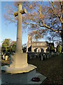
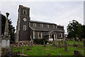
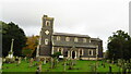
37 photos from this area
Area Information
Key information about the PE12 9UE including its size, population, and administrative classification.
- Area Type
- Postcode
- Area Size
- 1.0 hectares
- Population
- 1456
- Population Density
- 35 people/km²
House Prices in PE12 9UE
9
Properties
£254,583
Average Sold Price
£167,500
Lowest Price
£335,000
Highest Price
Showing 9 properties
| Address | Type | Beds | Baths | Last Sale Price | Last Sale Date | |
|---|---|---|---|---|---|---|
| Sedona, Mill Lane, Sutton Bridge, Spalding, PE12 9UE | Detached | 3 | 1 | £280,000 | Sep 2025 | |
| Millbank, Mill Lane, Sutton Bridge, Spalding, PE12 9UE | Bungalow | 3 | 2 | £335,000 | Aug 2023 | |
| The Mill House, Mill Lane, Sutton Bridge, Spalding, PE12 9UE | Detached | 3 | 2 | £240,000 | Feb 2022 | |
| Rylton House, Mill Lane, Sutton Bridge, Spalding, PE12 9UE | house | - | - | £285,000 | Jan 2020 | |
| Lowenva, Mill Lane, Sutton Bridge, Spalding, PE12 9UE | Detached | 3 | 2 | £167,500 | Feb 2018 | |
| Kookaburra, Mill Lane, Sutton Bridge, Spalding, PE12 9UE | Bungalow | 3 | 2 | £220,000 | Sep 2014 | |
| Thistle-dew, Mill Lane, Sutton Bridge, Spalding, PE12 9UE | Bungalow | 2 | 1 | - | - | |
| Poppins, Mill Lane, Sutton Bridge, Spalding, PE12 9UE | Bungalow | - | - | - | - | |
| East View, Mill Lane, Sutton Bridge, Spalding, PE12 9UE | Detached | - | - | - | - |
Energy Efficiency in PE12 9UE
Amenities
Schools
| Rank | School | Type | Entry gender | Ages |
|---|
Explore more schools in this area
Go to Schools tabDemographics
Household Size
Two person
most common
Accommodation Type
Houses
most common
Tenure
76
majority
Ethnic Group
White
most common
Religion
N/A
most common
Household Composition
N/A
most common
Age
47
median
Adults (30-64 years)
most common
Household Deprivation
N/A
with no deprivation
NS-SEC
21
in Lower managerial occupations
Explore more demographic insights in this area
Go to Demographics tabPlanning
Planning Constraints
- Flood RiskPremium
- Ramsar Wetland SitesPremium
- Area of Outstanding Natural BeautyPremium
- Protected Nature ReservePremium
- Protected WoodlandPremium