Area Overview for PE12 9NW
Photos of PE12 9NW
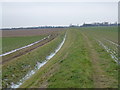
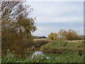
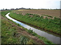
18 photos from this area
Area Information
Key information about the PE12 9NW including its size, population, and administrative classification.
- Area Type
- Postcode
- Area Size
- 1.4 km²
- Population
- 2312
- Population Density
- 45 people/km²
House Prices in PE12 9NW
23
Properties
£180,850
Average Sold Price
£43,000
Lowest Price
£440,000
Highest Price
Showing 23 properties
| Address | Type | Beds | Baths | Last Sale Price | Last Sale Date | |
|---|---|---|---|---|---|---|
| Marshbank, Dawsmere Road, Gedney Drove End, Spalding, PE12 9NW | Bungalow | 2 | 1 | £260,000 | Oct 2025 | |
| Anvil House, Dawsmere Road, Gedney Drove End, Spalding, PE12 9NW | house | - | - | £280,000 | Jul 2024 | |
| Alvica, Dawsmere Road, Gedney Drove End, Spalding, PE12 9NW | Bungalow | 2 | 1 | £235,000 | Nov 2021 | |
| Blacksmiths House, Dawsmere Road, Gedney Drove End, Spalding, PE12 9NW | house | - | - | £249,950 | Nov 2021 | |
| 4 Dawsmere Road, Gedney Drove End, Spalding, PE12 9NW | Bungalow | - | - | £205,000 | Aug 2020 | |
| Beverage House, Dawsmere Road, Gedney Drove End, Spalding, PE12 9NW | Detached | 3 | - | £440,000 | Jun 2017 | |
| Birchwood, Dawsmere Road, Gedney Drove End, Spalding, PE12 9NW | Bungalow | 2 | - | £165,000 | Aug 2014 | |
| The Bungalow, Dawsmere Road, Gedney Drove End, Spalding, PE12 9NW | Bungalow | 2 | - | £105,000 | Jan 2014 | |
| 1 Dawsmere Road, Gedney Drove End, Spalding, PE12 9NW | Semi-detached | 1 | - | £44,000 | Sep 2013 | |
| 5 Dawsmere Road, Gedney Drove End, Spalding, PE12 9NW | Bungalow | - | - | £65,000 | Feb 2012 |
Page 1 of 3
Energy Efficiency in PE12 9NW
Amenities
Schools
| Rank | School | Type | Entry gender | Ages |
|---|
Explore more schools in this area
Go to Schools tabDemographics
Household Size
Two person
most common
Accommodation Type
Houses
most common
Tenure
76
majority
Ethnic Group
White
most common
Religion
N/A
most common
Household Composition
N/A
most common
Age
47
median
Adults (30-64 years)
most common
Household Deprivation
N/A
with no deprivation
NS-SEC
25
in Lower managerial occupations
Explore more demographic insights in this area
Go to Demographics tabPlanning
Planning Constraints
- Flood RiskPremium
- Ramsar Wetland SitesPremium
- Area of Outstanding Natural BeautyPremium
- Protected Nature ReservePremium
- Protected WoodlandPremium