Area Overview for PE12 8SD
Photos of PE12 8SD
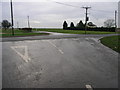
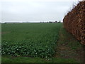

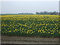
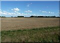


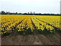

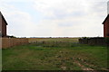
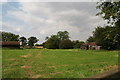
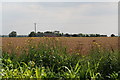
18 photos from this area
Area Information
Key information about the PE12 8SD including its size, population, and administrative classification.
- Area Type
- Postcode
- Area Size
- 36.7 hectares
- Population
- 2456
- Population Density
- 89 people/km²
House Prices in PE12 8SD
54
Properties
£134,380
Average Sold Price
£28,000
Lowest Price
£430,000
Highest Price
Showing 54 properties
| Address | Type | Beds | Baths | Last Sale Price | Last Sale Date | |
|---|---|---|---|---|---|---|
| 50 Joys Bank, Holbeach St Johns, Spalding, PE12 8SD | Semi-detached | 4 | 2 | £270,000 | Feb 2025 | |
| 10 Joys Bank, Holbeach St Johns, Spalding, PE12 8SD | Semi-detached | 4 | 2 | £273,000 | May 2024 | |
| 31 Joys Bank, Holbeach St Johns, Spalding, PE12 8SD | Detached | 4 | 2 | £430,000 | Mar 2024 | |
| 51 Joys Bank, Holbeach St Johns, Spalding, PE12 8SD | Bungalow | - | - | £150,000 | Nov 2021 | |
| 5 Joys Bank, Holbeach St Johns, Spalding, PE12 8SD | Terraced | 4 | 2 | £142,000 | Sep 2021 | |
| Broad Acres, 28 Joys Bank, Holbeach St Johns, Spalding, PE12 8SD | house | - | - | £190,000 | Apr 2021 | |
| Oakwood, 27 Joys Bank, Holbeach St Johns, Spalding, PE12 8SD | Semi-detached | 4 | 1 | £200,000 | Aug 2020 | |
| Chatsworth, 34 Joys Bank, Holbeach St Johns, Spalding, PE12 8SD | Semi-detached | 3 | 1 | £196,000 | May 2020 | |
| 40 Joys Bank, Holbeach St Johns, Spalding, PE12 8SD | house | - | - | £90,000 | Feb 2020 | |
| 41 Joys Bank, Holbeach St Johns, Spalding, PE12 8SD | Bungalow | 3 | 1 | £179,000 | May 2016 |
Page 1 of 6
Energy Efficiency in PE12 8SD
Amenities
Schools
| Rank | School | Type | Entry gender | Ages |
|---|
Explore more schools in this area
Go to Schools tabDemographics
Household Size
Two person
most common
Accommodation Type
Houses
most common
Tenure
81
majority
Ethnic Group
White
most common
Religion
N/A
most common
Household Composition
N/A
most common
Age
47
median
Adults (30-64 years)
most common
Household Deprivation
N/A
with no deprivation
NS-SEC
26
in Lower managerial occupations
Explore more demographic insights in this area
Go to Demographics tabPlanning
Planning Constraints
- Flood RiskPremium
- Ramsar Wetland SitesPremium
- Area of Outstanding Natural BeautyPremium
- Protected Nature ReservePremium
- Protected WoodlandPremium