Area Overview for PE12 7PW
Photos of PE12 7PW

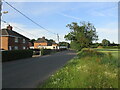
13 photos from this area
Area Information
Key information about the PE12 7PW including its size, population, and administrative classification.
- Area Type
- Postcode
- Area Size
- 20.6 hectares
- Population
- 2292
- Population Density
- 31 people/km²
House Prices in PE12 7PW
24
Properties
£149,550
Average Sold Price
£44,000
Lowest Price
£295,000
Highest Price
Showing 24 properties
| Address | Type | Beds | Baths | Last Sale Price | Last Sale Date | |
|---|---|---|---|---|---|---|
| 63 Low Lane, Holbeach, Spalding, PE12 7PW | Bungalow | 3 | 2 | £295,000 | Sep 2025 | |
| 41 Low Lane, Holbeach, Spalding, PE12 7PW | Bungalow | 3 | 1 | £187,000 | Jan 2016 | |
| 49 Low Lane, Holbeach, Spalding, PE12 7PW | Bungalow | - | - | £160,000 | Apr 2014 | |
| The Chestnuts, Low Lane, Holbeach, Spalding, PE12 7PW | house | - | - | £246,500 | Oct 2012 | |
| 29 Low Lane, Holbeach, Spalding, PE12 7PW | house | - | - | £100,000 | Oct 2009 | |
| 33 Low Lane, Holbeach, Spalding, PE12 7PW | Semi-detached | - | - | £114,000 | May 2004 | |
| 65 Low Lane, Holbeach, Spalding, PE12 7PW | Bungalow | - | - | £172,500 | Mar 2003 | |
| 67 Low Lane, Holbeach, Spalding, PE12 7PW | Detached | - | - | £132,500 | Nov 2001 | |
| Westfield Lodge, Low Lane, Holbeach, Spalding, PE12 7PW | Detached | 3 | 1 | £44,000 | Apr 1998 | |
| 37 Low Lane, Holbeach, Spalding, PE12 7PW | Detached | - | - | £44,000 | Feb 1996 |
Page 1 of 3
Energy Efficiency in PE12 7PW
Amenities
Schools
| Rank | School | Type | Entry gender | Ages |
|---|
Explore more schools in this area
Go to Schools tabDemographics
Household Size
Two person
most common
Accommodation Type
Houses
most common
Tenure
74
majority
Ethnic Group
White
most common
Religion
N/A
most common
Household Composition
N/A
most common
Age
47
median
Adults (30-64 years)
most common
Household Deprivation
N/A
with no deprivation
NS-SEC
24
in Lower managerial occupations
Explore more demographic insights in this area
Go to Demographics tabPlanning
Planning Constraints
- Flood RiskPremium
- Ramsar Wetland SitesPremium
- Area of Outstanding Natural BeautyPremium
- Protected Nature ReservePremium
- Protected WoodlandPremium