Area Overview for PE12 7PA
Photos of PE12 7PA
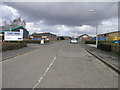
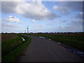


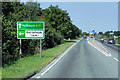
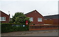
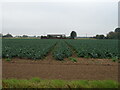
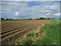

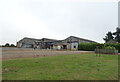
15 photos from this area
Area Information
Key information about the PE12 7PA including its size, population, and administrative classification.
- Area Type
- Postcode
- Area Size
- 13.4 hectares
- Population
- 2456
- Population Density
- 89 people/km²
House Prices in PE12 7PA
46
Properties
£200,027
Average Sold Price
£18,000
Lowest Price
£390,000
Highest Price
Showing 46 properties
| Address | Type | Beds | Baths | Last Sale Price | Last Sale Date | |
|---|---|---|---|---|---|---|
| Willow Dene, Foxes Low Road, Holbeach, Spalding, PE12 7PA | Bungalow | 3 | 2 | £290,000 | Oct 2024 | |
| Viron, Foxes Low Road, Holbeach, Spalding, PE12 7PA | Bungalow | 3 | 1 | £237,000 | Sep 2024 | |
| 6 Foxes Low Road, Holbeach, Spalding, PE12 7PA | Semi-detached | 2 | 1 | £170,000 | Aug 2024 | |
| Cheriton, Foxes Low Road, Holbeach, Spalding, PE12 7PA | Bungalow | - | - | £340,000 | Jan 2023 | |
| 21 Foxes Low Road, Holbeach, Spalding, PE12 7PA | Bungalow | - | - | £162,500 | Nov 2022 | |
| Caerleon, Foxes Low Road, Holbeach, Spalding, PE12 7PA | Semi-detached | 2 | 1 | £153,360 | Jun 2022 | |
| Savoy House, Foxes Low Road, Holbeach, Spalding, PE12 7PA | house | - | - | £390,000 | Mar 2021 | |
| Sussex Lodge, Foxes Low Road, Holbeach, Spalding, PE12 7PA | Bungalow | 3 | 1 | £310,000 | Apr 2020 | |
| Tolcarne, Foxes Low Road, Holbeach, Spalding, PE12 7PA | Bungalow | 3 | 1 | £238,000 | Aug 2019 | |
| 31 Foxes Low Road, Holbeach, Spalding, PE12 7PA | Detached | 3 | 1 | £218,000 | Jun 2019 |
Page 1 of 5
Energy Efficiency in PE12 7PA
Amenities
Schools
| Rank | School | Type | Entry gender | Ages |
|---|
Explore more schools in this area
Go to Schools tabDemographics
Household Size
Two person
most common
Accommodation Type
Houses
most common
Tenure
81
majority
Ethnic Group
White
most common
Religion
N/A
most common
Household Composition
N/A
most common
Age
47
median
Adults (30-64 years)
most common
Household Deprivation
N/A
with no deprivation
NS-SEC
26
in Lower managerial occupations
Explore more demographic insights in this area
Go to Demographics tabPlanning
Planning Constraints
- Flood RiskPremium
- Ramsar Wetland SitesPremium
- Area of Outstanding Natural BeautyPremium
- Protected Nature ReservePremium
- Protected WoodlandPremium