Area Overview for PE12 7JA
Photos of PE12 7JA
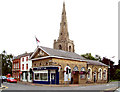
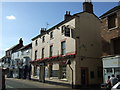
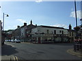
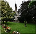
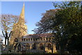
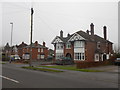
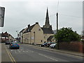
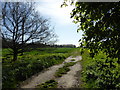
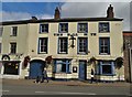
69 photos from this area
Area Information
Key information about the PE12 7JA including its size, population, and administrative classification.
- Area Type
- Postcode
- Area Size
- 1.4 hectares
- Population
- 2178
- Population Density
- 4367 people/km²
House Prices in PE12 7JA
33
Properties
£110,905
Average Sold Price
£26,950
Lowest Price
£225,000
Highest Price
Showing 33 properties
| Address | Type | Beds | Baths | Last Sale Price | Last Sale Date | |
|---|---|---|---|---|---|---|
| 53 Hall Gate, Holbeach, Spalding, PE12 7JA | Bungalow | - | - | £91,250 | May 2024 | |
| 51 Hall Gate, Holbeach, Spalding, PE12 7JA | Semi-detached | 3 | 1 | £155,000 | Nov 2023 | |
| 39 Hall Gate, Holbeach, Spalding, PE12 7JA | Semi-detached | 3 | 3 | £225,000 | Aug 2022 | |
| 42 Hall Gate, Holbeach, Spalding, PE12 7JA | Retail | 3 | 1 | £172,000 | Jul 2022 | |
| 34 Hall Gate, Holbeach, Spalding, PE12 7JA | house | - | - | £142,000 | Jul 2021 | |
| 41 Hall Gate, Holbeach, Spalding, PE12 7JA | house | - | - | £138,000 | Apr 2021 | |
| 20 Hall Gate, Holbeach, Spalding, PE12 7JA | house | - | - | £125,000 | Mar 2018 | |
| 55 Hall Gate, Holbeach, Spalding, PE12 7JA | Bungalow | - | - | £168,000 | Jan 2017 | |
| 49 Hall Gate, Holbeach, Spalding, PE12 7JA | house | - | - | £92,500 | Aug 2015 | |
| 59 Hall Gate, Holbeach, Spalding, PE12 7JA | Bungalow | - | - | £95,000 | Jan 2013 |
Page 1 of 4
Energy Efficiency in PE12 7JA
Amenities
Schools
| Rank | School | Type | Entry gender | Ages |
|---|
Explore more schools in this area
Go to Schools tabDemographics
Household Size
One person
most common
Accommodation Type
Houses
most common
Tenure
45
majority
Ethnic Group
White
most common
Religion
N/A
most common
Household Composition
N/A
most common
Age
47
median
Adults (30-64 years)
most common
Household Deprivation
N/A
with no deprivation
NS-SEC
19
in Lower managerial occupations
Explore more demographic insights in this area
Go to Demographics tabPlanning
Planning Constraints
- Flood RiskPremium
- Ramsar Wetland SitesPremium
- Area of Outstanding Natural BeautyPremium
- Protected Nature ReservePremium
- Protected WoodlandPremium