Area Overview for PE12 7EE
Photos of PE12 7EE
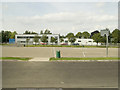
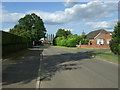

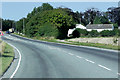
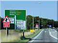


13 photos from this area
Area Information
Key information about the PE12 7EE including its size, population, and administrative classification.
- Area Type
- Postcode
- Area Size
- 6.0 hectares
- Population
- 1773
- Population Density
- 1278 people/km²
House Prices in PE12 7EE
48
Properties
£168,286
Average Sold Price
£37,600
Lowest Price
£365,000
Highest Price
Showing 48 properties
| Address | Type | Beds | Baths | Last Sale Price | Last Sale Date | |
|---|---|---|---|---|---|---|
| 32 Park Road, Holbeach, Spalding, PE12 7EE | Bungalow | 3 | 2 | £365,000 | Nov 2025 | |
| Ash Lodge, Park Road, Holbeach, Spalding, PE12 7EE | Bungalow | 3 | 2 | £349,995 | Jul 2025 | |
| 18 Park Road, Holbeach, Spalding, PE12 7EE | Semi-detached | 4 | 2 | £238,000 | Oct 2024 | |
| 14 Park Road, Holbeach, Spalding, PE12 7EE | house | - | - | £243,000 | Sep 2021 | |
| 12 Park Road, Holbeach, Spalding, PE12 7EE | Semi-detached | 3 | 1 | £185,000 | Apr 2021 | |
| 19 Park Road, Holbeach, Spalding, PE12 7EE | Semi-detached | 2 | - | £114,000 | Jun 2019 | |
| 13 Park Road, Holbeach, Spalding, PE12 7EE | Semi-detached | 2 | 1 | £120,100 | Mar 2018 | |
| 11 Park Road, Holbeach, Spalding, PE12 7EE | house | - | - | £127,500 | May 2017 | |
| Fern Cottage, 2 Park Road, Holbeach, Spalding, PE12 7EE | Cottage | 1 | 1 | £63,500 | Oct 2014 | |
| 16 Park Road, Holbeach, Spalding, PE12 7EE | Flat | - | - | £137,500 | Jun 2012 |
Page 1 of 5
Energy Efficiency in PE12 7EE
Amenities
Schools
| Rank | School | Type | Entry gender | Ages |
|---|
Explore more schools in this area
Go to Schools tabDemographics
Household Size
Two person
most common
Accommodation Type
Houses
most common
Tenure
72
majority
Ethnic Group
White
most common
Religion
N/A
most common
Household Composition
N/A
most common
Age
47
median
Adults (30-64 years)
most common
Household Deprivation
N/A
with no deprivation
NS-SEC
26
in Lower managerial occupations
Explore more demographic insights in this area
Go to Demographics tabPlanning
Planning Constraints
- Flood RiskPremium
- Ramsar Wetland SitesPremium
- Area of Outstanding Natural BeautyPremium
- Protected Nature ReservePremium
- Protected WoodlandPremium