Area Overview for PE12 6NB
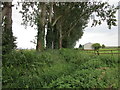
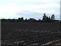
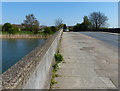
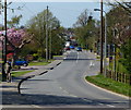
Photos of PE12 6NB


Area Information
Living in PE12 6NB means residing within a specific postcode cluster characterised by residential density and a tight-knit community feel. This small residential area forms part of the wider Spalding landscape in Lincolnshire, England. It encompasses a population of 1,873 residents spread across a relatively compact footprint. The area supports approximately 287 people per square kilometre, creating a moderate density that balances privacy with access to local services. You are locating yourself in a settlement defined by its practical connectivity to transport links and proximity to commercial hubs. Daily life here revolves around the immediate neighbourhood, which acts as a gateway to the town centre of Spalding. The environment offers a clear residential character without the noise or congestion of major urban centres. Prospective buyers often appreciate the straightforward nature of this postcode district. It represents a stable choice for those seeking a home outside the city limits but close to employment and retail opportunities. The distinction of PE12 6NB lies in its status as a contained residential zone rather than a sprawling suburb. You gain a home that sits comfortably within the established fabric of the region. This area does not boast grand landscapes or coastlines; instead, its value comes from its functional integration into the local housing market and its efficient distance from key amenities like railway stations and supermarkets.
- Area Type
- Postcode
- Area Size
- Not available
- Population
- 1873
- Population Density
- 287 people/km²
The property market in PE12 6NB is heavily influenced by the accommodation type, which is almost exclusively focused on houses. You will find very few flats or semi-detached buildings compared to the volume of detached or semi-detached homes. This skew towards houses indicates a market geared towards families requiring more space and outdoor areas. The 45% home ownership rate provides insight into the market balance, showing that nearly half of the residents actually own their dwellings. Consequently, the neighbourhood consists of a mix of long-term owners and those in the rental sector. For buyers searching for homes in this area, the primary opportunity lies in the house segment rather than the flat market. This profile often appeals to families seeking space and stability over investors looking for high-density rental yields. The small population of 1,873 within this specific cluster means properties sell relatively quickly once they hit the market, as there is limited turnover to satisfy a smaller buyer pool. Competition for houses may be higher than for other property types. When you view properties here, you are looking at stock designed for permanent residence rather than temporary accommodation. The market reflects a traditional suburban model where owners put down roots. Sales figures are likely driven by life events such as moves to larger homes within the postcode or downsizing from nearby towns. The absence of large apartment blocks reinforces the idea of a quiet, house-hearted community.
House Prices in PE12 6NB
No properties found in this postcode.
Energy Efficiency in PE12 6NB
Life in PE12 6NB places daily amenities within practical reach while maintaining distance from the main town centre. Residents benefit from a concentration of retail options without needing lengthy commutes for basic shopping. Five notable retail locations serve the area, including Tesco Spalding, M&S Springfields, and Lidl Spalding. These supermarkets provide comprehensive access to groceries, household essentials, and daily food requirements. M&S Springfields also offers convenience food, clothing, and personal care items in one location. You can complete your weekly shopping roster in a fraction of the time compared to urban dwellers reliant on public transport. Transport links extend beyond shopping with a single railway station, Spalding Railway Station, providing direct connections to broader networks. This rail access expands your effective lifestyle radius significantly. If you prefer walking to the shops, the proximity of multiple retailers allows for a car-free routine for some errands. The area supports a standard lifestyle where you have immediate access to fresh food and clothing. You do not need to drive far for routine needs, though larger trips likely require a vehicle. The presence of these specific stores anchors the commercial life of the neighbourhood. Residents can access quality goods and household staples consistently. This retail cluster effectively functions as the primary shopping centre for the surrounding postcode cluster.
Amenities
Schools
| Rank | School | Type | Entry gender | Ages |
|---|
Explore more schools in this area
Go to Schools tabDemographics
The community within PE12 6NB is defined by a mature household profile with a median age of 47 years. Adults between 30 and 64 years old represent the most common age range, indicating that families and empty nesters form the core of the population. Home ownership stands at 45%, a figure that suggests a mixed but significant presence of owner-occupied residences among the housing stock. The area predominantly houses families and individuals rather than student accommodation or transient rental units. Most people residing here live in houses, which aligns with the settlement's primary function as a residential zone for long-term living. The predominant ethnic group is White, reflecting the broader demographic composition of the surrounding Lincolnshire region. You are contending with a demographic that is stable and established rather than rapidly changing. This age structure often implies a community where neighbours know each other, resulting in a quiet domestic atmosphere. The high proportion of adults in the prime working years supports local businesses and generates steady demand for household purchases. There is no data suggesting significant transient populations or large institutions housed within the postcode. The demographic reality is one of consistency, where children are likely found in schools near the area and older residents may reside in larger properties. The 45% ownership rate means roughly half of the occupants have mortgages, while the other half may be living rent-free in owned homes or through shared ownership schemes, though specific tenure types beyond ownership are not quantified.
Household Size
Accommodation Type
Tenure
Ethnic Group
Religion
Household Composition
Age
Household Deprivation
NS-SEC
Explore more demographic insights in this area
Go to Demographics tabPlanning
Planning Constraints
- Flood RiskPremium
- Ramsar Wetland SitesPremium
- Area of Outstanding Natural BeautyPremium
- Protected Nature ReservePremium
- Protected WoodlandPremium