Area Overview for PE12 6JZ
Photos of PE12 6JZ
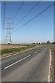
![Seas End Road [B1357], heading north in PE12 6JZ](https://images.propbar.co.uk/images/geograph/66/27/6627641_120.jpg)


13 photos from this area
Area Information
Key information about the PE12 6JZ including its size, population, and administrative classification.
- Area Type
- Postcode
- Area Size
- 41.3 hectares
- Population
- 1757
- Population Density
- 67 people/km²
House Prices in PE12 6JZ
5
Properties
£188,500
Average Sold Price
£95,000
Lowest Price
£282,000
Highest Price
Showing 5 properties
| Address | Type | Beds | Baths | Last Sale Price | Last Sale Date | |
|---|---|---|---|---|---|---|
| Penns Place, Seas End Road, Moulton Seas End, Spalding, PE12 6JZ | Detached | 4 | 2 | £282,000 | Feb 2021 | |
| Lyndale, Seas End Road, Moulton Seas End, Spalding, PE12 6JZ | Detached | - | - | £95,000 | Nov 1997 | |
| Jaco-rie, Seas End Road, Moulton Seas End, Spalding, PE12 6JZ | Detached | - | - | - | - | |
| Loose Gate House, Seas End Road, Moulton Seas End, Spalding, PE12 6JZ | house | - | - | - | - | |
| Pear Tree Cottage, Seas End Road, Moulton Seas End, Spalding, PE12 6JZ | Detached | - | - | - | - |
Energy Efficiency in PE12 6JZ
Amenities
Schools
| Rank | School | Type | Entry gender | Ages |
|---|
Explore more schools in this area
Go to Schools tabDemographics
Household Size
Two person
most common
Accommodation Type
Houses
most common
Tenure
83
majority
Ethnic Group
White
most common
Religion
N/A
most common
Household Composition
N/A
most common
Age
47
median
Adults (30-64 years)
most common
Household Deprivation
N/A
with no deprivation
NS-SEC
31
in Lower managerial occupations
Explore more demographic insights in this area
Go to Demographics tabPlanning
Planning Constraints
- Flood RiskPremium
- Ramsar Wetland SitesPremium
- Area of Outstanding Natural BeautyPremium
- Protected Nature ReservePremium
- Protected WoodlandPremium