Area Overview for PE11 4YP
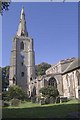
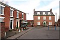
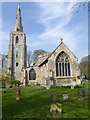
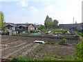
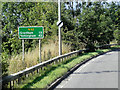
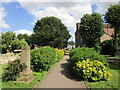
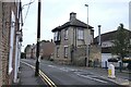
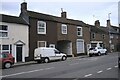
Photos of PE11 4YP


Area Information
PE11 4YP represents a distinct residential cluster south-east of Lincoln, characterised by steady growth and established communities. You are looking at a specific postcode area where 1,415 residents call it home. The population density stands at 517 people per square kilometre, suggesting a setting that is manageable yet connected. This is a place where daily life revolves around proximity to essential services rather than travel to distant town centres. You will find a layout that balances livability with a clear sense of place. Everyday routines involve walking to local shops or driving short distances to reach wider amenities. The area avoids the sprawl of major urban zones while maintaining access to the conveniences of a developing region. Living here means engaging with a community where the pace is set by local needs rather than city-level demands. You do not face the overwhelming crowds of larger towns but still benefit from modern infrastructure. The layout supports a quiet routine without isolating you from broader networks. It is a location where the 1,415 current residents shape the character through their long-term habitation. You can expect an environment where the focus remains on practical living standards. The postcode defines a specific zone where you will find a consistent housing stock and a community oriented towards family life.
- Area Type
- Postcode
- Area Size
- Not available
- Population
- 1415
- Population Density
- 517 people/km²
You are entering a property market defined by stability and established ownership. With 62% of the population owning their homes, the area leans heavily towards owner-occupied households. This percentage indicates that the majority of the 1,415 people living here have purchased their residences. Consequently, the housing stock consists principally of houses rather than rentals or investment properties. You will find a variety of house types catering to different family sizes, though the age of the estate may influence architectural styles. This high ownership rate often means properties are built to last and maintained by the owners. The market here differs from newer developments where developers control every unit. Instead, you deal with individual sellers and agents representing private owners. This structure can lead to varied pricing but also ensures that the homes have real-world living history. The focus is on family-sized dwellings suited to the predominant 30 to 64-year-old demographic. You should expect a market driven by long-term residents rather than transient investors. The 62% ownership figure signals a community where people have wanted to put down roots. When buying a home in this postcode, you are purchasing into a settled environment with established neighbours and stable tenures.
House Prices in PE11 4YP
No properties found in this postcode.
Energy Efficiency in PE11 4YP
Daily life in PE11 4YP offers practical access to essential retail and transport hubs. You have five notable retail options within practical reach, anchored by the Co-op Donington locations. These include entries such as Lincolnshire Co-operative Co, providing groceries and daily necessities. You can visit these shops for your weekly shop without needing a long drive. For rail travel, the Swineshead Railway Station is located nearby. This station gives you regular train services to connect with larger cities or regional hubs. The proximity of these amenities shapes your daily routine positively. You can run errands quickly or take a short trip out if the mood takes you. The presence of Co-op stores means you do not rely on large supermarkets far away. Swineshead Railway Station ensures you are never stranded when travel is necessary. You benefit from a layout where daily tasks happen within a short distance. The combination of local retail and rail access makes this postcode convenient for families. You will find that your day-to-day needs are met by these specific, named venues. These locations form the backbone of the lifestyle offered in PE11 4YP.
Amenities
Schools
Education options for families in PE11 4YP centre on two primary institutions located nearby. The Thomas Cowley High School operates both as a primary school and an academy. You will find this facility serves the younger years before pupils transition to secondary education. Additionally, Cowley Academy stands as the local secondary option. This academy handles the education of students in the latter stages of their schooling. The presence of both an academy and a primary institution within close range provides a clear path for your children. You do not need to travel far to secure education for your family. Families in this area benefit from a school network that covers the full range of compulsory education. The Thomas Cowley High School offers primary education followed by continuity at the academy level or through a seamless transition. Cowley Academy ensures that secondary education remains accessible without a lengthy commute. This setup supports parents looking for a straightforward educational journey for their children. The mix of school types means you have a variety of teaching environments available. Both institutions are situated to serve the PE11 4YP community directly. You can rely on these schools to meet the educational needs of the 1,415 residents in your immediate vicinity.
| Rank | School | Type | Entry gender | Ages |
|---|
Explore more schools in this area
Go to Schools tabDemographics
The community in PE11 4YP reflects a mature demographic profile suited to those seeking stability. The median age is 47, placing the area well beyond the youthful skew of new developments. Most commonly, you will encounter adults aged between 30 and 64 years. This age range indicates a neighbourhood where residents have often already established themselves. You are looking at a population where career and family planning have largely concluded. The predominant ethnic group is White, meaning the majority of neighbours share similar backgrounds. This homogeneity often contributes to a strong, cohesive local identity. Home ownership stands at 62%, revealing a territory where residents have a significant stake in their surroundings. This figure suggests that many families have lived here for years rather than renting short-term. Houses are the primary accommodation type, offering the space and gardens typical of this older age profile. You will find very few flats or purpose-built apartments within this specific cluster. The high ownership rate means you are moving into an area where the original owners likely maintained the properties themselves. This creates a consistent standard across the estate. The 62% figure also implies lower transaction volatility compared to rental-heavy zones.
Household Size
Accommodation Type
Tenure
Ethnic Group
Religion
Household Composition
Age
Household Deprivation
NS-SEC
Explore more demographic insights in this area
Go to Demographics tabPlanning
Planning Constraints
- Flood RiskPremium
- Ramsar Wetland SitesPremium
- Area of Outstanding Natural BeautyPremium
- Protected Nature ReservePremium
- Protected WoodlandPremium