Area Overview for PE11 4XL
Photos of PE11 4XL
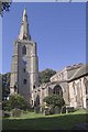

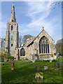
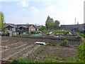
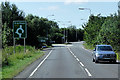
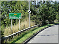
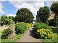
100 photos from this area
Area Information
Key information about the PE11 4XL including its size, population, and administrative classification.
- Area Type
- Postcode
- Area Size
- 1.8 hectares
- Population
- 1778
- Population Density
- 85 people/km²
House Prices in PE11 4XL
41
Properties
£116,172
Average Sold Price
£39,500
Lowest Price
£214,950
Highest Price
Showing 41 properties
| Address | Type | Beds | Baths | Last Sale Price | Last Sale Date | |
|---|---|---|---|---|---|---|
| 4 Maple Way, Donington, Spalding, PE11 4XL | Bungalow | 3 | 2 | £185,000 | May 2023 | |
| 3 Maple Way, Donington, Spalding, PE11 4XL | Retail | 3 | 1 | £214,950 | Jul 2022 | |
| 10 Maple Way, Donington, Spalding, PE11 4XL | Bungalow | 2 | 1 | £191,000 | Mar 2022 | |
| 18 Maple Way, Donington, Spalding, PE11 4XL | Bungalow | - | - | £154,995 | Oct 2021 | |
| 2 Maple Way, Donington, Spalding, PE11 4XL | Bungalow | 3 | 2 | £142,000 | May 2021 | |
| 11 Maple Way, Donington, Spalding, PE11 4XL | Detached | 2 | 1 | £110,000 | Mar 2021 | |
| 21 Maple Way, Donington, Spalding, PE11 4XL | Bungalow | - | - | £165,000 | Mar 2021 | |
| 12 Maple Way, Donington, Spalding, PE11 4XL | Bungalow | - | - | £155,000 | Mar 2019 | |
| 36 Maple Way, Donington, Spalding, PE11 4XL | Bungalow | 2 | - | £156,000 | Jun 2018 | |
| 34 Maple Way, Donington, Spalding, PE11 4XL | Bungalow | - | - | £169,950 | Jun 2017 |
Page 1 of 5
Energy Efficiency in PE11 4XL
Amenities
Schools
| Rank | School | Type | Entry gender | Ages |
|---|
Explore more schools in this area
Go to Schools tabDemographics
Household Size
Two person
most common
Accommodation Type
Houses
most common
Tenure
81
majority
Ethnic Group
White
most common
Religion
N/A
most common
Household Composition
N/A
most common
Age
47
median
Adults (30-64 years)
most common
Household Deprivation
N/A
with no deprivation
NS-SEC
26
in Lower managerial occupations
Explore more demographic insights in this area
Go to Demographics tabPlanning
Planning Constraints
- Flood RiskPremium
- Ramsar Wetland SitesPremium
- Area of Outstanding Natural BeautyPremium
- Protected Nature ReservePremium
- Protected WoodlandPremium