Area Overview for PE11 4JP
Photos of PE11 4JP

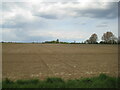
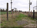
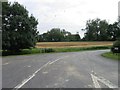
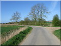
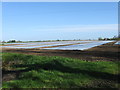
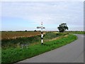

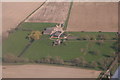
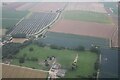
10 photos from this area
Area Information
Key information about the PE11 4JP including its size, population, and administrative classification.
- Area Type
- Postcode
- Area Size
- 1.1 km²
- Population
- 2334
- Population Density
- 66 people/km²
House Prices in PE11 4JP
15
Properties
£347,400
Average Sold Price
£129,000
Lowest Price
£500,000
Highest Price
Showing 15 properties
| Address | Type | Beds | Baths | Last Sale Price | Last Sale Date | |
|---|---|---|---|---|---|---|
| High Fen View, Chopdike Drove, Gosberton Clough, Spalding, PE11 4JP | house | - | - | £410,000 | Dec 2023 | |
| Wayside, Chopdike Drove, Gosberton Clough, Spalding, PE11 4JP | Detached | 5 | 1 | £278,000 | Oct 2020 | |
| Entry House, Chopdike Drove, Gosberton Clough, Spalding, PE11 4JP | Detached | 6 | 3 | £420,000 | Sep 2020 | |
| The Court Yard, Chopdike Drove, Gosberton Clough, Spalding, PE11 4JP | house | - | - | £500,000 | Feb 2017 | |
| 1 Chopdike Drove, Gosberton Clough, Spalding, PE11 4JP | Semi-detached | - | - | £129,000 | Sep 2006 | |
| Annexe, The Court Yard, Chopdike Drove, Gosberton Clough, Spalding, PE11 4JP | Semi-detached | - | - | - | - | |
| 2 Chopdike Drove, Gosberton Clough, Spalding, PE11 4JP | house | - | - | - | - | |
| 6 Chopdike Drove, Gosberton Clough, Spalding, PE11 4JP | house | - | - | - | - | |
| Guinea Fowl Cottage, Chopdike Drove, Gosberton Clough, Spalding, PE11 4JP | Detached | - | - | - | - | |
| 4 Chopdike Drove, Gosberton Clough, Spalding, PE11 4JP | house | - | - | - | - |
Page 1 of 2
Energy Efficiency in PE11 4JP
Amenities
Schools
| Rank | School | Type | Entry gender | Ages |
|---|
Explore more schools in this area
Go to Schools tabDemographics
Household Size
Two person
most common
Accommodation Type
Houses
most common
Tenure
81
majority
Ethnic Group
White
most common
Religion
N/A
most common
Household Composition
N/A
most common
Age
47
median
Adults (30-64 years)
most common
Household Deprivation
N/A
with no deprivation
NS-SEC
28
in Lower managerial occupations
Explore more demographic insights in this area
Go to Demographics tabPlanning
Planning Constraints
- Flood RiskPremium
- Ramsar Wetland SitesPremium
- Area of Outstanding Natural BeautyPremium
- Protected Nature ReservePremium
- Protected WoodlandPremium