Area Overview for PE11 4DT
Photos of PE11 4DT
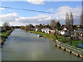

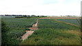

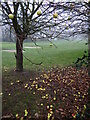
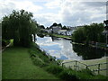
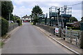
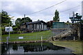
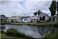
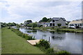
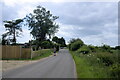
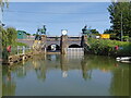
57 photos from this area
Area Information
Key information about the PE11 4DT including its size, population, and administrative classification.
- Area Type
- Postcode
- Area Size
- 58.3 hectares
- Population
- 2334
- Population Density
- 66 people/km²
House Prices in PE11 4DT
25
Properties
£159,995
Average Sold Price
£39,000
Lowest Price
£270,000
Highest Price
Showing 25 properties
| Address | Type | Beds | Baths | Last Sale Price | Last Sale Date | |
|---|---|---|---|---|---|---|
| Sunnyside, Newlands Road, Surfleet, Spalding, PE11 4DT | Bungalow | 3 | 2 | £228,000 | Feb 2025 | |
| 5 Newlands Road, Surfleet, Spalding, PE11 4DT | house | - | - | £199,950 | Aug 2023 | |
| Newlands Lodge, Newlands Road, Surfleet, Spalding, PE11 4DT | Bungalow | 3 | 2 | £255,000 | Nov 2022 | |
| 4 Newlands Road, Surfleet, Spalding, PE11 4DT | Retail | 4 | 1 | £245,000 | Jun 2022 | |
| West View, Newlands Road, Surfleet, Spalding, PE11 4DT | Detached | 4 | 2 | £270,000 | Jan 2020 | |
| 10 Newlands Road, Surfleet, Spalding, PE11 4DT | Semi-detached | 3 | 1 | £135,000 | Apr 2016 | |
| 1 Newlands Road, Surfleet, Spalding, PE11 4DT | house | - | - | £108,000 | Jan 2014 | |
| 7 Newlands Road, Surfleet, Spalding, PE11 4DT | Semi-detached | - | - | £132,000 | Apr 2005 | |
| 12 Newlands Road, Surfleet, Spalding, PE11 4DT | Semi-detached | - | - | £78,000 | Mar 2004 | |
| 2 Newlands Road, Surfleet, Spalding, PE11 4DT | Semi-detached | - | - | £69,995 | May 2002 |
Page 1 of 3
Energy Efficiency in PE11 4DT
Amenities
Schools
| Rank | School | Type | Entry gender | Ages |
|---|
Explore more schools in this area
Go to Schools tabDemographics
Household Size
Two person
most common
Accommodation Type
Houses
most common
Tenure
81
majority
Ethnic Group
White
most common
Religion
N/A
most common
Household Composition
N/A
most common
Age
47
median
Adults (30-64 years)
most common
Household Deprivation
N/A
with no deprivation
NS-SEC
28
in Lower managerial occupations
Explore more demographic insights in this area
Go to Demographics tabPlanning
Planning Constraints
- Flood RiskPremium
- Ramsar Wetland SitesPremium
- Area of Outstanding Natural BeautyPremium
- Protected Nature ReservePremium
- Protected WoodlandPremium