Area Overview for PE11 4DE
Photos of PE11 4DE
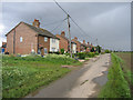
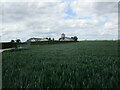

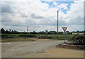
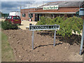
11 photos from this area
Area Information
Key information about the PE11 4DE including its size, population, and administrative classification.
- Area Type
- Postcode
- Area Size
- 5.2 hectares
- Population
- 2334
- Population Density
- 66 people/km²
House Prices in PE11 4DE
14
Properties
£164,333
Average Sold Price
£85,000
Lowest Price
£330,000
Highest Price
Showing 14 properties
| Address | Type | Beds | Baths | Last Sale Price | Last Sale Date | |
|---|---|---|---|---|---|---|
| Palm Trees, 31 Coalbeach Lane South, Surfleet, Spalding, PE11 4DE | Bungalow | 3 | 2 | £330,000 | Nov 2022 | |
| 29 Coalbeach Lane South, Surfleet, Spalding, PE11 4DE | Bungalow | - | - | £149,000 | Aug 2015 | |
| 6 Coalbeach Lane South, Surfleet, Spalding, PE11 4DE | Bungalow | 3 | - | £85,000 | Sep 2014 | |
| 34 Coalbeach Lane South, Surfleet, Spalding, PE11 4DE | Bungalow | - | - | £150,000 | Jun 2013 | |
| 32 Coalbeach Lane South, Surfleet, Spalding, PE11 4DE | Detached | - | - | £175,000 | Aug 2004 | |
| Waterways House, Coalbeach Lane South, Surfleet, Spalding, PE11 4DE | Detached | - | - | £97,000 | Aug 2000 | |
| 10 Coalbeach Lane South, Surfleet, Spalding, PE11 4DE | Detached | 3 | 2 | - | - | |
| Former Twenty Nine Annexe, Coalbeach Lane South, Surfleet, Spalding, PE11 4DE | Flat | - | - | - | - | |
| 4 Coalbeach Lane South, Surfleet, Spalding, PE11 4DE | Detached | - | - | - | - | |
| The Orchards, 22 Coalbeach Lane South, Surfleet, Spalding, PE11 4DE | Detached | - | - | - | - |
Page 1 of 2
Energy Efficiency in PE11 4DE
Amenities
Schools
| Rank | School | Type | Entry gender | Ages |
|---|
Explore more schools in this area
Go to Schools tabDemographics
Household Size
Two person
most common
Accommodation Type
Houses
most common
Tenure
81
majority
Ethnic Group
White
most common
Religion
N/A
most common
Household Composition
N/A
most common
Age
47
median
Adults (30-64 years)
most common
Household Deprivation
N/A
with no deprivation
NS-SEC
28
in Lower managerial occupations
Explore more demographic insights in this area
Go to Demographics tabPlanning
Planning Constraints
- Flood RiskPremium
- Ramsar Wetland SitesPremium
- Area of Outstanding Natural BeautyPremium
- Protected Nature ReservePremium
- Protected WoodlandPremium