Area Overview for PE11 3TD
Photos of PE11 3TD

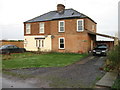
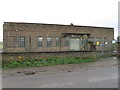
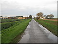
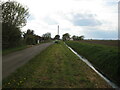
7 photos from this area
Area Information
Key information about the PE11 3TD including its size, population, and administrative classification.
- Area Type
- Postcode
- Area Size
- 3.4 km²
- Population
- 1736
- Population Density
- 43 people/km²
House Prices in PE11 3TD
47
Properties
£175,111
Average Sold Price
£103,000
Lowest Price
£325,000
Highest Price
Showing 47 properties
| Address | Type | Beds | Baths | Last Sale Price | Last Sale Date | |
|---|---|---|---|---|---|---|
| Wyndpoint Cottage, 7 Starlode Drove, West Pinchbeck, Spalding, PE11 3TD | Detached | 3 | - | £245,000 | Apr 2025 | |
| 39 Starlode Drove, West Pinchbeck, Spalding, PE11 3TD | Semi-detached | 3 | 2 | £165,000 | Apr 2022 | |
| Little Acorn, 93 Starlode Drove, West Pinchbeck, Spalding, PE11 3TD | Bungalow | - | - | £325,000 | Mar 2021 | |
| 72 Starlode Drove, West Pinchbeck, Spalding, PE11 3TD | Bungalow | 3 | 1 | £205,000 | Jul 2016 | |
| Proctors Farm Cottage, 87 Starlode Drove, West Pinchbeck, Spalding, PE11 3TD | house | 2 | 1 | £127,000 | Sep 2011 | |
| Capricorn, 68 Starlode Drove, West Pinchbeck, Spalding, PE11 3TD | house | - | - | £146,000 | Nov 2010 | |
| 45 Starlode Drove, West Pinchbeck, Spalding, PE11 3TD | Semi-detached | - | - | £132,000 | Feb 2008 | |
| 21 Starlode Drove, West Pinchbeck, Spalding, PE11 3TD | house | - | - | £103,000 | Jul 2006 | |
| 27 Starlode Drove, West Pinchbeck, Spalding, PE11 3TD | Semi-detached | - | - | £128,000 | Mar 2005 | |
| Cowbit Farmhouse, 126 Starlode Drove, West Pinchbeck, Spalding, PE11 3TD | Detached | 4 | 2 | - | - |
Page 1 of 5
Energy Efficiency in PE11 3TD
Amenities
Schools
| Rank | School | Type | Entry gender | Ages |
|---|
Explore more schools in this area
Go to Schools tabDemographics
Household Size
Two person
most common
Accommodation Type
Houses
most common
Tenure
76
majority
Ethnic Group
White
most common
Religion
N/A
most common
Household Composition
N/A
most common
Age
47
median
Adults (30-64 years)
most common
Household Deprivation
N/A
with no deprivation
NS-SEC
27
in Lower managerial occupations
Explore more demographic insights in this area
Go to Demographics tabPlanning
Planning Constraints
- Flood RiskPremium
- Ramsar Wetland SitesPremium
- Area of Outstanding Natural BeautyPremium
- Protected Nature ReservePremium
- Protected WoodlandPremium