Area Overview for PE11 3JJ
Photos of PE11 3JJ
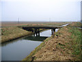

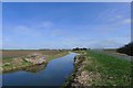
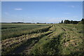
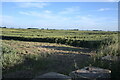
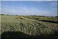
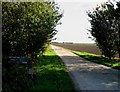
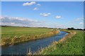
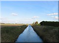
32 photos from this area
Area Information
Key information about the PE11 3JJ including its size, population, and administrative classification.
- Area Type
- Postcode
- Area Size
- 2.2 km²
- Population
- 1974
- Population Density
- 30 people/km²
House Prices in PE11 3JJ
36
Properties
£184,263
Average Sold Price
£66,000
Lowest Price
£440,000
Highest Price
Showing 36 properties
| Address | Type | Beds | Baths | Last Sale Price | Last Sale Date | |
|---|---|---|---|---|---|---|
| Wilsmead, Counter Drain Drove, Tongue End, Spalding, PE11 3JJ | Retail | 5 | 2 | £440,000 | Dec 2022 | |
| 20 Counter Drain Drove, Tongue End, Spalding, PE11 3JJ | Semi-detached | 3 | 1 | £146,000 | Oct 2018 | |
| 15 Counter Drain Drove, Tongue End, Spalding, PE11 3JJ | Semi-detached | 4 | 2 | £230,000 | Aug 2018 | |
| 10 Counter Drain Drove, Tongue End, Spalding, PE11 3JJ | house | - | - | £150,000 | Jun 2016 | |
| 14 Counter Drain Drove, Tongue End, Spalding, PE11 3JJ | Detached | 3 | 2 | £110,000 | Dec 2015 | |
| Kingfisher Lodge, 18 Counter Drain Drove, Tongue End, Spalding, PE11 3JJ | Semi-detached | 4 | - | £157,000 | Jun 2015 | |
| Glen View, Counter Drain Drove, Tongue End, Spalding, PE11 3JJ | Detached | 5 | 2 | £272,950 | Jan 2015 | |
| Masters House, Counter Drain Drove, Tongue End, Spalding, PE11 3JJ | Detached | - | - | £200,000 | Jul 2014 | |
| 13 Counter Drain Drove, Tongue End, Spalding, PE11 3JJ | Semi-detached | 3 | - | £166,000 | Dec 2012 | |
| 2 Counter Drain Drove, Tongue End, Spalding, PE11 3JJ | house | - | - | £96,000 | Nov 2010 |
Page 1 of 4
Energy Efficiency in PE11 3JJ
Amenities
Schools
| Rank | School | Type | Entry gender | Ages |
|---|
Explore more schools in this area
Go to Schools tabDemographics
Household Size
Family (3-5 people)
most common
Accommodation Type
Houses
most common
Tenure
71
majority
Ethnic Group
White
most common
Religion
N/A
most common
Household Composition
N/A
most common
Age
47
median
Adults (30-64 years)
most common
Household Deprivation
N/A
with no deprivation
NS-SEC
30
in Lower managerial occupations
Explore more demographic insights in this area
Go to Demographics tabPlanning
Planning Constraints
- Flood RiskPremium
- Ramsar Wetland SitesPremium
- Area of Outstanding Natural BeautyPremium
- Protected Nature ReservePremium
- Protected WoodlandPremium