Area Overview for PE11 3BD
Photos of PE11 3BD
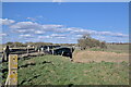

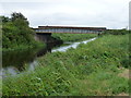
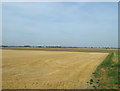
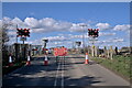


17 photos from this area
Area Information
Key information about the PE11 3BD including its size, population, and administrative classification.
- Area Type
- Postcode
- Area Size
- 1.2 km²
- Population
- 1464
- Population Density
- 312 people/km²
House Prices in PE11 3BD
17
Properties
£185,000
Average Sold Price
£55,000
Lowest Price
£410,000
Highest Price
Showing 17 properties
| Address | Type | Beds | Baths | Last Sale Price | Last Sale Date | |
|---|---|---|---|---|---|---|
| The Lodge, 11 South Drove, Pode Hole, Spalding, PE11 3BD | house | - | - | £410,000 | Jan 2021 | |
| Charinton Farm Bungalow, 9 South Drove, Pode Hole, Spalding, PE11 3BD | Bungalow | - | - | £90,000 | Dec 2016 | |
| Lakefield, South Drove, Pode Hole, Spalding, PE11 3BD | Bungalow | 3 | 1 | £226,000 | Sep 2016 | |
| 10 South Drove, Pode Hole, Spalding, PE11 3BD | Bungalow | 3 | - | £99,000 | May 2016 | |
| Danem, South Drove, Pode Hole, Spalding, PE11 3BD | Detached | - | - | £230,000 | Mar 2008 | |
| Royal Oak House, South Drove, Pode Hole, Spalding, PE11 3BD | house | - | - | £55,000 | Mar 2001 | |
| Former 3, South Drove, Pode Hole, Spalding, PE11 3BD | undefined | - | - | - | - | |
| Former 4, South Drove, Pode Hole, Spalding, PE11 3BD | undefined | - | - | - | - | |
| Hexham, South Drove, Pode Hole, Spalding, PE11 3BD | Detached | - | - | - | - | |
| Potts Plants, South Drove, Pode Hole, Spalding, PE11 3BD | Detached | - | - | - | - |
Page 1 of 2
Energy Efficiency in PE11 3BD
Amenities
Schools
| Rank | School | Type | Entry gender | Ages |
|---|
Explore more schools in this area
Go to Schools tabDemographics
Household Size
Two person
most common
Accommodation Type
Houses
most common
Tenure
83
majority
Ethnic Group
White
most common
Religion
N/A
most common
Household Composition
N/A
most common
Age
47
median
Adults (30-64 years)
most common
Household Deprivation
N/A
with no deprivation
NS-SEC
26
in Lower managerial occupations
Explore more demographic insights in this area
Go to Demographics tabPlanning
Planning Constraints
- Flood RiskPremium
- Ramsar Wetland SitesPremium
- Area of Outstanding Natural BeautyPremium
- Protected Nature ReservePremium
- Protected WoodlandPremium