Area Overview for PE11 2RD
Photos of PE11 2RD


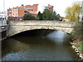


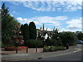

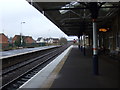

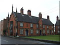
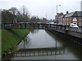
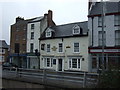
100 photos from this area
Area Information
Key information about the PE11 2RD including its size, population, and administrative classification.
- Area Type
- Postcode
- Area Size
- 2.6 hectares
- Population
- 2125
- Population Density
- 1607 people/km²
House Prices in PE11 2RD
28
Properties
£122,583
Average Sold Price
£27,500
Lowest Price
£465,000
Highest Price
Showing 28 properties
| Address | Type | Beds | Baths | Last Sale Price | Last Sale Date | |
|---|---|---|---|---|---|---|
| 18 Cowbit Road, Spalding, PE11 2RD | house | - | - | £87,500 | Mar 2024 | |
| 32 Cowbit Road, Spalding, PE11 2RD | house | - | - | £110,000 | Mar 2021 | |
| 30 Cowbit Road, Spalding, PE11 2RD | Terraced | 2 | 1 | £106,500 | Jun 2019 | |
| Westbourne House, 3A Cowbit Road, Spalding, PE11 2RD | Semi-detached | 4 | 3 | £465,000 | May 2019 | |
| 26 Cowbit Road, Spalding, PE11 2RD | house | - | - | £108,000 | Mar 2019 | |
| The Sleepy Hollow, 1A Cowbit Road, Spalding, PE11 2RD | Bungalow | 2 | 1 | £207,000 | Dec 2016 | |
| 31 Cowbit Road, Spalding, PE11 2RD | Terraced | 3 | 1 | £65,000 | Sep 2014 | |
| 24 Cowbit Road, Spalding, PE11 2RD | Terraced | 2 | 1 | £100,000 | Sep 2012 | |
| 29 Cowbit Road, Spalding, PE11 2RD | Terraced | - | - | £73,500 | Aug 2003 | |
| 27 Cowbit Road, Spalding, PE11 2RD | house | - | - | £75,000 | Mar 2003 |
Page 1 of 3
Energy Efficiency in PE11 2RD
Amenities
Schools
| Rank | School | Type | Entry gender | Ages |
|---|
Explore more schools in this area
Go to Schools tabDemographics
Household Size
Two person
most common
Accommodation Type
Houses
most common
Tenure
80
majority
Ethnic Group
White
most common
Religion
N/A
most common
Household Composition
N/A
most common
Age
47
median
Adults (30-64 years)
most common
Household Deprivation
N/A
with no deprivation
NS-SEC
30
in Lower managerial occupations
Explore more demographic insights in this area
Go to Demographics tabPlanning
Planning Constraints
- Flood RiskPremium
- Ramsar Wetland SitesPremium
- Area of Outstanding Natural BeautyPremium
- Protected Nature ReservePremium
- Protected WoodlandPremium