Area Overview for PE11 2LG
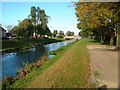
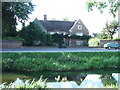
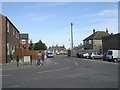
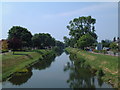
Photos of PE11 2LG


Area Information
Living in PE11 2LG means residing in a compact, highly concentrated cluster of residential properties in England. This specific postcode covers just 3,212 square metres, creating a very dense environment where 1,381 people call this small space home. With a population density of 429,998 people per square kilometre, the area represents an intense residential focus rather than a sprawling neighbourhood. You will experience daily life within a tightly built community where neighbours are often metres apart. The high occupancy rate means every square millimetre of land serves a household purpose. This small footprint defines the character of PE11 2LG. It is not a large town or a wide village but a specific residential node anchored by its immediate surroundings. The sheer number of residents per unit of area suggests a neighbourhood where streets are likely full and public spaces are shared intensively. Prospective buyers seeking character must look closely at the immediate streets defining this postcode. While the area itself is tiny, its location connects to the wider Spalding region. You gain access to regional transport links and shops from this concentrated cluster. The high density ensures that basic services are walking distance for many residents, yet the small size restricts the variety of local amenities found within the immediate boundaries of PE11 2LG. Understanding this specific spatial constraint is key to deciding if homes in this postcode suit your family's needs.
- Area Type
- Postcode
- Area Size
- 3212 m²
- Population
- 1381
- Population Density
- 4071 people/km²
The property market in PE11 2LG is defined by its exclusive focus on houses. Accommodation types in this postcode are almost entirely residential houses, distinguishing it from suburban areas where flats or terraced blocks dominate. This structure appeals to buyers seeking standalone living spaces rather than shared apartment environments. The high volume of owner occupancy, sitting at 63%, reinforces that the market is driven by those purchasing to live in, not investors flipping units rapidly. For those looking at homes in PE11 2LG, the limited physical size of the area—just 3,212 square metres—means selection outside these specific boundaries depends on adjacent streets. The concentration of households creates a consistent demand for similar housing styles. This uniformity reduces variety but offers predictability. Buyers know exactly what they are getting: solid, likely older properties suited to families or downsizers. The density of residents means that properties in this postcode achieve a high turnover of daily life activity. You will see more parked cars and foot traffic than in wider postcodes. The market here operates on a utility basis rather than prestige. Value is tied to the functional quality of the house and its proximity to the railway station. If you require specific modern features, you may look beyond this specific cluster to wider Spalding.
House Prices in PE11 2LG
Showing 7 properties
| Address | Type | Beds | Baths | Last Sale Price | Last Sale Date | |
|---|---|---|---|---|---|---|
| 44 Acacia Avenue, Spalding, PE11 2LG | Semi-detached | - | - | £160,000 | Mar 2022 | |
| 40 Acacia Avenue, Spalding, PE11 2LG | house | - | - | £143,500 | Dec 2010 | |
| 45 Acacia Avenue, Spalding, PE11 2LG | Semi-detached | - | - | £155,000 | Oct 2007 | |
| 46 Acacia Avenue, Spalding, PE11 2LG | Semi-detached | - | - | £139,000 | Jun 2007 | |
| 42 Acacia Avenue, Spalding, PE11 2LG | Retail | 2 | 1 | - | - | |
| 47 Acacia Avenue, Spalding, PE11 2LG | house | - | - | - | - | |
| 43 Acacia Avenue, Spalding, PE11 2LG | house | - | - | - | - |
Energy Efficiency in PE11 2LG
Your daily lifestyle in PE11 2LG revolves around easy access to key retail and rail hubs just a short distance away. Within practical reach, you will find five major retail locations, anchored by significant supermarkets like Lidl Spalding, Iceland Spalding, and Tesco Spalding. These stores are situated closer to the residential cluster than within the tiny 3,212 square metre boundary itself, yet they remain integral to daily life. Shopping trips require a short walk or drive to the main town centre where these stores operate. You benefit from one-stop shopping for groceries and household essentials without needing to travel off-site for essentials. The presence of Lidl, Iceland, and Tesco ensures that fresh food, light goods, and home essentials are always available. For most residents, this arrangement provides a full suite of weekly retail needs. Transport facilities include one railway station, Spalding Railway Station. This station sits near the extremity of the local catchment area, allowing PE11 2LG residents to commute easily. You do not need a car for every journey, as the rail link handles regional travel. The combination of accessible supermarkets and a functional railway strip defines the rhythm of life here. You spend your days in a dense residential setting and travel just minutes to broader commercial and transport centres.
Amenities
Schools
| Rank | School | Type | Entry gender | Ages |
|---|
Explore more schools in this area
Go to Schools tabDemographics
The community in PE11 2LG reflects a mature demographic profile. The median age is 47 years, indicating that the residents are primarily adults between the ages of 30 and 64. This age range dominates the population, suggesting the area attracts families with school-age children or retiring professionals who have already raised their young families. The average resident is well-established in their life stage, contributing to a stable neighbourhood atmosphere. Home ownership stands at 63% of households, a figure that signals security and long-term residence in PE11 2LG. Nearly two-thirds of the residents own their homes outright or through mortgage, while the remainder likely represent owner-occupiers with remaining loans or rental tenants. This balance supports a quiet, settled environment where most people have deep roots in the area. Houses form the predominant accommodation type, meaning terraced, semi-detached, or detached family homes make up the bulk of the housing stock. You will find fewer purpose-built flats compared to other urban postcodes. The population is predominantly White, aligning with the wider county trends in Lincolnshire. With 1,381 people living in such a small area, you reside in a close-knit group where local news travels quickly. This density creates a strong sense of place, although it means public facilities within the exact boundaries are limited compared to larger districts.
Household Size
Accommodation Type
Tenure
Ethnic Group
Religion
Household Composition
Age
Household Deprivation
NS-SEC
Explore more demographic insights in this area
Go to Demographics tabPlanning
Planning Constraints
- Flood RiskPremium
- Ramsar Wetland SitesPremium
- Area of Outstanding Natural BeautyPremium
- Protected Nature ReservePremium
- Protected WoodlandPremium